Posts

Showing posts from June, 2019

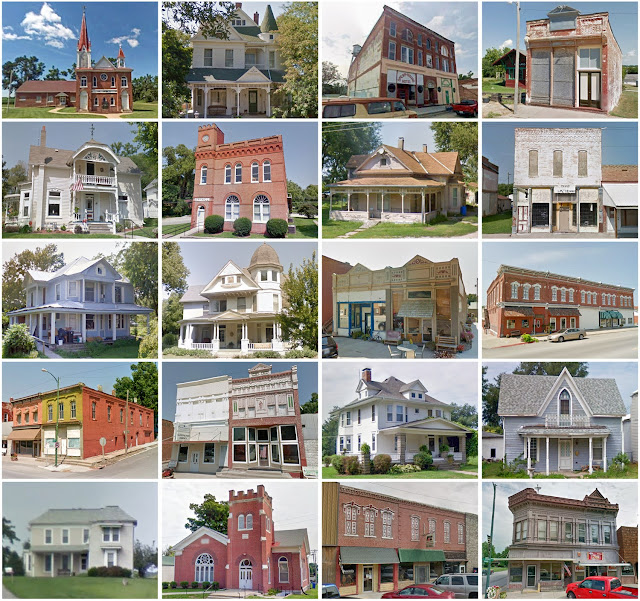
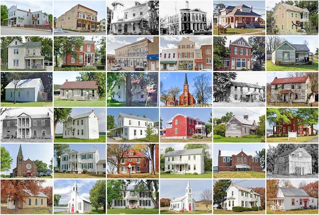
Clark County, Missouri

Image
Founding:  1836 Parent county:  Unorganized territory Namesake:  William Clark, American explorer Seat:   Waterloo (1837–1847, 1855–1872); Alexandria (1847–1855); Kahoka (1872–) Land area:  505 square miles Population (2020):  6,634 Population (historic):  2,846 (1840); 11,684 (1860); 15,031 (1880); 15,383 (1900); 10,254 (1930) Periods of population growth:  pre-1840–1900; 1970s Subdivisions:  Four cities; two villages; one CDP; 13 townships National Register listings:   Five Pre-1940 residences (estimated):  699 (20%) Pre-1940 housing survival rate:  29.5% Pre-1860 housing survival rate (1940):  6.2% Farm housing in disrepair (1950):  12.4% Nonfarm housing in disrepair (1950):  11.9% Average farmhouse value (1930):  $1,172 Average outbuilding value (1930):  $881 Average farmhouse size (1940):  5.5 rooms Number of farms (1920):  1,908 Average farm size (1920):  113.5 acres Sources of settlement:  Ohio, Iowa, Illinois, Kentucky, Indiana, and Pennsylvania _____

Chase County, Kansas

Image
Founding:  1859 Parent counties:  Butler and Wise Namesake:  Salmon Chase, Supreme Court justice Seat:  Cottonwood Falls (1859–) Land area:  773 square miles Population (2020):  2,572 Population (historic):  1,046 (1860); 6,081 (1880); 8,246 (1900); 6,952 (1930) Periods of population growth:  pre-1860–1890 Subdivisions:  Five cities; nine townships National Register listings:   19 Pre-1940 residences (estimated):  531 (35.4%) Pre-1940 housing survival rate:  35% Pre-1860 housing survival rate (1940):  2.9% Farm housing in disrepair (1950):  8.2% Nonfarm housing in disrepair (1950):  12% Average farmhouse value (1930):  $1,567 Average outbuilding value (1930):  $1,168 Average farmhouse size (1940):  5.7 rooms Number of farms (1920):  873 Average farm size (1920):  121 acres Sources of settlement:  Ohio, Indiana, Illinois, Pennsylvania, and New York _________________________________________________________________________________ Cottonwood Falls Namesa

Ashland County, Wisconsin

Image
Founding:  March 27, 1860 Parent county:  La Pointe Namesake:  Ashland, Henry Clay's estate Seat:  La Pointe (1860s–1873); Ashland (1860s, 1873–) Land area:  1,045 square miles Population (2020):  16,027 Population (historic):  515 (1860); 1,559 (1880); 20,176 (1900); 21,054 (1930) Periods of population growth:  1870–1920; 1930s; 1990s Subdivisions:  Two cities; one village; eight CDPs; 13 towns National Register listings:   41 Pre-1940 residences (estimated):  2,608 (27%) Pre-1940 housing survival rate:  49.4% Farm housing in disrepair (1950):  14.5% Nonfarm housing in disrepair (1950):  11% Average farmhouse value (1930):  $996 Average outbuilding value (1930):  $973 Average farmhouse size (1940):  4.8 rooms Number of farms (1920):  1,131 Average farm size (1920):  32 acres Sources of settlement:  Germany, Canada, Michigan, Sweden, and Norway ___________________________________________________________________________________ Ashland Namesake:  As

Richland County, Wisconsin

Image
Founding:  1850 (declared in 1842) Parent counties:  Crawford and Sauk Namesake:  A descriptive name Seat:  Richland Center (1852–) Land area:  586 square miles Population (2020):  17,304 Population (historic):  903 (1850); 15,731 (1870); 19,483 (1900); 19,525 (1930) Periods of population growth:  1850–1900; 1910s; 1930s; 1970–2010 Subdivisions:  One city; five villages; two CDPs; 16 towns National Register listings:   15 Pre-1940 residences (estimated):  2,824 (31.6%) Pre-1940 housing survival rate:  56.5% Pre-1860 housing survival rate (1940):  4% Farm housing in disrepair (1950):  9.3% Average farmhouse value (1930):  $1,591 Average outbuilding value (1930):  $1,901 Average farmhouse size (1940):  6.5 rooms Number of farms (1920):  2,533 Average farm size (1920):  73.8 acres Sources of settlement:  Ohio, Indiana, New York, Germany, Pennsylvania, Norway, and Ireland _________________________________________________________________________________ Ric

Holt County, Missouri

Image
Founding:  1841 Parent county:  Unorganized territory Namesake:  David Holt, Missouri politician Seat:  Oregon (1841–) Land area:  463 square miles Population (2020):  4,223 Population (historic):  3,957 (1850); 11,652 (1870); 17,083 (1900); 12,720 (1930) Periods of population growth:  pre-1850–1880; 1890s; 1970s Subdivisions:  Five cities; four villages; 12 townships National Register listings:   Five Pre-1940 residences (estimated):  891 (31.9%) Pre-1940 housing survival rate:  28% Pre-1860 housing survival rate (1940):  8.5% Farm housing in disrepair (1950):  16.7% Nonfarm housing in disrepair (1950):  9% Average farmhouse value (1930):  $1,525 Average outbuilding value (1930):  $1,372 Average farmhouse size (1940):  5.4 rooms Number of farms (1920):  1,814 Average farm size (1920):  125.1 acres Sources of settlement:  Ohio, Indiana, Kentucky, Virginia, Germany, and Pennsylvania ______________________________________________________________________________

Gasconade County, Missouri

Image
Founding:  1821 Parent county:  Franklin Namesake:  The Gasconade River Seat:  Gasconade (1821–1829); Mount Sterling (1829–1843); Hermann (1843–) Land area:  518 square miles Population (2020):  14,794 Population (historic):  1,545 (1830); 8,727 (1860); 11,153 (1880); 12,298 (1900); 12,172 (1930) Periods of population growth:  pre-1830–1840; 1850–1910; 1930s; 1970–2000 Subdivisions:  Six cities; nine townships National Register listings:   Nine Pre-1940 residences (estimated):  1,751 (21.3%) Pre-1940 housing survival rate:  50.9% Pre-1860 housing survival rate (1940):  12.3% Farm housing in disrepair (1950):  21.5% Nonfarm housing in disrepair (1950):  5.7% Average farmhouse value (1930):  $1,030 Average outbuilding value (1930):  $850 Average farmhouse size (1940):  4.6 rooms Number of farms (1920):  1,768 Average farm size (1920):  73.3 acres Sources of settlement:  Germany, Switzerland, and Tennessee _____________________________________________________

Warren County, Missouri

Image
Founding:  1833 Parent county:  Montgomery Namesake:  Joseph Warren, Boston revolutionary leader Seat:  Warrenton (1835–) Land area:  429 square miles Population (2020):  35,532 Population (historic):  4,253 (1840); 8,839 (1860); 10,806 (1880); 9,919 (1900); 8,082 (1930) Periods of population growth:  pre-1840–1880; 1890s; 1950–2020 Subdivisions:  Five cities; three villages; seven townships National Register listings:   10 Pre-1940 residences (estimated):  864 (5.7%) Pre-1940 housing survival rate:  38.8% Pre-1860 housing survival rate (1940):  6.9% Farm housing in disrepair (1950):  12.4% Nonfarm housing in disrepair (1950):  9.8% Average farmhouse value (1930):  $1,418 Average outbuilding value (1930):  $992 Average farmhouse size (1940):  5.2 rooms Number of farms (1920):  1,425 Average farm size (1920):  88.9 acres Sources of settlement:  Germany, Virginia, and Kentucky ___________________________________________________________________________________

Jefferson County, Missouri

Image
Founding:  1819 Parent counties:  St. Louis and Ste. Genevieve Namesake:  Thomas Jefferson, U.S. president Seat:  Herculaneum (1818–1839); Hillsboro (1839–) Land area:  657 square miles Population (2020):  226,739 Population (historic):  1,835 (1820); 6,928 (1850); 15,380 (1870); 25,712 (1900); 27,563 (1930) Periods of population growth:  pre-1820–1910; 1920–2020 Subdivisions:  Ten cities; four villages; seven CDPs; 12 townships National Register listings:   15 Pre-1940 residences (estimated):  4,518 (5%) Pre-1940 housing survival rate:  42.5% Pre-1860 housing survival rate (1940):  12.1% Farm housing in disrepair (1950):  15.2% Nonfarm housing in disrepair (1950):  9.6% Average farmhouse value (1930):  $1,391 Average outbuilding value (1930):  $860 Average farmhouse size (1940):  4.5 rooms Number of farms (1920):  2,218 Average farm size (1920):  70.6 acres Sources of settlement:  Germany, Illinois, Ireland, Tennessee, Virginia, and Kentucky ______________

Jersey County, Illinois

Image
Founding:  1839 Parent county:  Greene Namesake:  The state of New Jersey Seat:  Jerseyville (1839–) Land area:  369 square miles Population (2020):  21,512 Population (historic):  4,535 (1840); 12,051 (1860); 15,542 (1880); 14,612 (1900); 12,556 (1930) Periods of population growth:  pre-1840–1880; 1930–2010 Subdivisions:  Two cities; four villages; one town; 11 townships National Register listings:   21 Pre-1940 residences (estimated):  1,982 (19.6%) Pre-1940 housing survival rate:  49.2% Pre-1860 housing survival rate (1940):  11.6% Farm housing in disrepair (1950):  12.4% Nonfarm housing in disrepair (1950):  12.5% Average farmhouse value (1930):  $1,493 Average outbuilding value (1930):  $1,073 Average farmhouse size (1940):  5.6 rooms Number of farms (1920):  1,368 Average farm size (1920):  111.1 acres Sources of settlement:  Germany, Missouri, Ireland, Ohio, and New Jersey _______________________________________________________________________________

Greenup County, Kentucky

Image
Founding:  December 12, 1803 Parent county:  Mason Namesake:  Christopher Greenup (c. 1750–1818), Kentucky politician Seat:  Greenup (1803–) Land area:  344 square miles Population (2010):  36,910 Population (historic):  2,369 (1810); 6,297 (1840); 11,463 (1870); 15,432 (1900); 24,554 (1930) Periods of population growth:  pre-1810–1830; 1840s; 1860–1880; 1890–1910; 1920s; 1950–1980 Subdivisions:  Eight cities National Register listings:   20 Pre-1940 residences (estimated):  1,517 (9.3%) Pre-1940 housing survival rate:  29.2% Pre-1860 housing survival rate (1940):  8.2% Average farmhouse value (1930):  $532 Average outbuilding value (1930):  $258 Average farmhouse size (1940):  4.5 rooms Number of farms (1920):  2,023 Average farm size (1920):  43.1 acres _________________________________________________________________________________ Greenup Namesake:  Christopher Greenup (c. 1750–1818), Kentucky politician Founding:  1803 (platting); 1811 (post

Estill County, Kentucky

Image
Founding:  1808 Parent counties:  Clark and Madison Namesake:  James Estill, Kentucky soldier Seat:  Irvine (1813–) Land area:  253 square miles Population (2010):  14,672 Population (historic):  2,082 (1810); 5,535 (1840); 9,198 (1870); 11,669 (1900); 17,079 (1930) Periods of population growth:  pre-1810–1840; 1850–1870; 1910s; 1970s Subdivisions:  Two cities National Register listings:   Eight Pre-1940 residences (estimated):  930 (13.5%) Pre-1940 housing survival rate:  26.7% Pre-1860 housing survival rate (1940):  6.6% Average farmhouse value (1930):  $418 Average outbuilding value (1930):  $168 Average farmhouse size (1940):  4.3 rooms Number of farms (1920):  1,832 Average farm size (1920):  33.3 acres _________________________________________________________________________________ Irvine Namesake:  William Irvine, an early resident of Madison County Founding:  1812 (platting); 1813 (post office); 1849 (incorporation) Population (2010):  2

Tippecanoe County, Indiana

Image
Founding:  March 1, 1826 Parent county:  Unorganized territory Namesake:  The Battle of Tippecanoe Seat:  Lafayette (1826–) Land area:  500 square miles Population (2010):  172,780 Population (historic):  7,187 (1830); 19,377 (1850); 33,515 (1870); 38,659 (1900); 47,535 (1930) Periods of population growth:  pre-1830–1870; 1890s; 1920s; 1940–1970; 1990–2010 Subdivisions:  Two cities; five towns; six CDPs; 13 townships National Register listings:   48 Pre-1940 residences (estimated):  9,368 (12.5%) Pre-1940 housing survival rate:  61.1% Pre-1860 housing survival rate (1940):  11.9% Average farmhouse value (1930):  $1,785 Average outbuilding value (1930):  $1,638 Average farmhouse size (1940):  6.6 rooms Number of farms (1920):  2,401 Average farm size (1920):  109.3 acres Sources of settlement:  Ohio, Germany, Ireland, Pennsylvania, and New York ___________________________________________________________________________________ Lafayette Namesake:  Th