Posts

Showing posts with the label johnson county

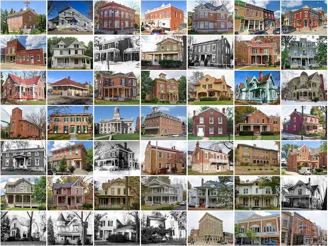
Johnson County, Iowa
Image
Founding:  1838 (declared in 1837) Parent counties:  Cook, Dubuque, Muscatine, and unorganized territory Namesake:  Richard Johnson, U.S. vice president Seat:   Napoleon (1838–1839); Iowa City (1839–) Land area:  614 square miles Population (2020):  152,854 Population (historic):  4,472 (1850); 24,898 (1870); 23,082 (1890); 25,914 (1910); 30,276 (1930) Periods of population growth:  pre-1850–1880; 1890–2020 Subdivisions:  11 cities; one CDP; 20 townships Pre-1940 residences (estimated):  7,349 (11.1%) Pre-1940 housing survival rate:  69.1% Pre-1860 housing survival rate (1940):  5.3% Farm housing in disrepair (1950):  2.9% Nonfarm housing in disrepair (1950):  2.7% Average farmhouse value (1930):  $2,561 Average outbuilding value (1930):  $3,078 Average farmhouse size (1940):  6.7 rooms Number of farms (1920):  2,625 Average farm size (1920):  122.1 acres Sources of settlement:  Czechosl...

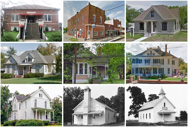
Johnson County, Missouri

Image
  Founding:  1834 Parent counties:  Cass and Lafayette Namesake:  Richard Johnson, Kentucky politician Seat:   Columbus (1834–1836); Warrensburg (1836–) Land area:  829 square miles Population (2020):  54,013 Population (historic):  4,471 (1840); 14,614 (1860); 28,172 (1880); 27,843 (1900); 22,413 (1930) Periods of population growth:  pre-1840–1880; 1950–2020 Subdivisions:  Five cities; two villages; two CDPs; 15 townships Pre-1940 residences (estimated):  1,937 (8.7%) Pre-1940 housing survival rate:  32.2% Pre-1860 housing survival rate (1940):  4.2% Farm housing in disrepair (1950):  9.1% Nonfarm housing in disrepair (1950):  8.1% Average farmhouse value (1930):  $1,337 Average outbuilding value (1930):  $1,099 Average farmhouse size (1940):  5.2 rooms Number of farms (1920):  3,590 Average farm size (1920):  121.9 acres Sources of settlement:  Kentucky, Virginia, Ohio, Pennsylvani...

Johnson County, Illinois

Image
Founding:  1812 Parent county:  Randolph Namesake:  Richard Johnson, Kentucky politician Seat:   Elvira (1814–1818); Vienna (1818–) Land area:  344 square miles Population (2020):  13,308 Population (historic):  843 (1820); 4,114 (1850); 11,248 (1870); 15,667 (1900); 10,203 (1930) Periods of population growth:  pre-1820–1900; 1930s; 1960–2000; 2010s Subdivisions:  One city; six villages Pre-1940 residences (estimated):  695 (12.3%) Pre-1940 housing survival rate:  27.7% Pre-1860 housing survival rate (1940):  1.4% Farm housing in disrepair (1950):  23.1% Nonfarm housing in disrepair (1950):  16.8% Average farmhouse value (1930):  $649 Average outbuilding value (1930):  $481 Average farmhouse size (1940):  4.4 rooms Number of farms (1920):  1,742 Average farm size (1920):  79.5 acres Sources of settlement:  Tennessee and Kentucky __________________________________...

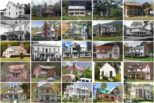
Johnson County, Tennessee

Image
Founding:  1836 Parent county:  Carter Namesake:  Thomas Johnson, local resident Seat:  Mountain City (1836–) Land area:  298 square miles Population (2020):  17,948 Population (historic):  2,658 (1840); 5,018 (1860); 7,766 (1880); 10,589 (1900); 12,209 (1930) Periods of population growth:  pre-1840–1910; 1930s; 1960–2010 Subdivisions:  One town Pre-1940 residences (estimated):  670 (7.4%) Pre-1940 housing survival rate:  30.9% Pre-1860 housing survival rate (1940):  6.1% Farm housing in disrepair (1950):  21.8% Nonfarm housing in disrepair (1950):  29.7% Average farmhouse value (1930):  $958 Average outbuilding value (1930):  $322 Average farmhouse size (1940):  4.7 rooms Number of farms (1920):  1,672 Average farm size (1920):  40 acres _________________________________________________________________________________ Mountain City Namesake:  The locale's ...

Johnson County, Kentucky

Image
Founding:  1843 Parent counties:  Floyd, Lawrence, and Morgan Namesake:  Richard Johnson, U.S. vice president Seat:  Paintsville (1843–) Land area:  262 square miles Population (2020):  22,680 Population (historic):  3,873 (1850); 7,494 (1870); 13,730 (1900); 22,968 (1930) Periods of population growth:  pre-1850–1940; 1970s; 1990s Subdivisions:  One city Pre-1940 residences (estimated):  813 (7.6%) Pre-1940 housing survival rate:  21.9% Pre-1860 housing survival rate (1940):  6.1% Farm housing in disrepair (1950): 17.5% Nonfarm housing in disrepair (1950): 15.8% Average farmhouse value (1930):  $426 Average outbuilding value (1930):  $143 Average farmhouse size (1940):  4.4 rooms Number of farms (1920):  2,185 Average farm size (1920):  42.4 acres _________________________________________________________________________________ Paintsville Namesake:  Paint Creek Fo...

Johnson County, Indiana

Image
  Founding:  1823 Parent county:  Unorganized territory Namesake:  John Johnson, Indiana supreme court justice Seat:  Franklin (1823–) Land area:  320 square miles Population (2020):  161,765 Population (historic):  4,019 (1830); 14,854 (1860); 19,537 (1880); 20,223 (1900); 21,706 (1930) Periods of population growth:  pre-1830–2020 Subdivisions:  Two cities; six towns; nine townships Pre-1940 residences (estimated):  4,400 (7.4%) Pre-1940 housing survival rate:  64.1% Pre-1860 housing survival rate (1940):  8.7% Farm housing in disrepair (1950): 5.3% Nonfarm housing in disrepair (1950): 6.3% Average farmhouse value (1930):  $1,824 Average outbuilding value (1930):  $1,308 Average farmhouse size (1940):  5.8 rooms Number of farms (1920):  2,051 Average farm size (1920):  80.2 acres Sources of settlement:  Kentucky, Ohio, Virginia, and North Carolina ______________________...