Posts

Showing posts with the label iron county

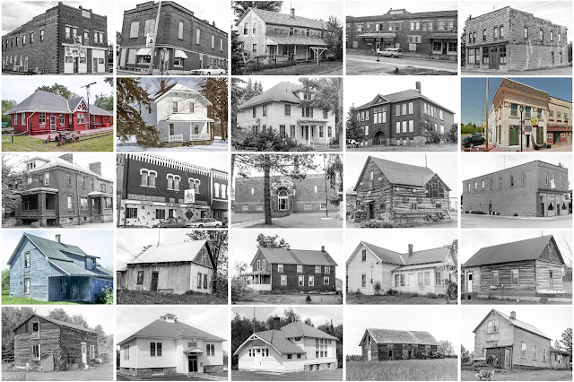
Iron County, Michigan

Image
Founding:  1885 Parent counties:  Marquette and Menominee Namesake:  Iron deposits within the county Seat:  Iron River (1885–1888); Crystal Falls (1888–) Land area:  1,166 square miles Population (2020):  11,631 Population (historic):  4,432 (1890); 15,164 (1910); 20,805 (1930) Periods of population growth:  pre-1890–1920 Subdivisions:  Five cities; two villages; one CDP; seven townships Pre-1940 residences (estimated):  2,738 (29.4%) Pre-1940 housing survival rate:  52.2% Farm housing in disrepair (1950):  13.1% Nonfarm housing in disrepair (1950):  11.3% Average farmhouse value (1930):  $1,092 Average outbuilding value (1930):  $871 Average farmhouse size (1940):  5.1 rooms Number of farms (1920):  621 Average farm size (1920):  22.7 acres Sources of settlement:  Michigan, Sweden, Finland, and Wisconsin ______________________________________________________________________________...
Iron County, Wisconsin

Image
Founding:  1893 Parent counties:  Ashland and Oneida Namesake:  Iron deposits within the county Seat:  Hurley (1893–) Land area:  758 square miles Population (2020):  6,137 Population (historic):  6,616 (1900); 8,306 (1910); 10,261 (1920); 9,933 (1930) Periods of population growth:  pre-1900–1920; 1930s; 1970s; 1990s; 2010s Subdivisions:  Two cities; four CDPs; ten towns Pre-1940 residences (estimated):  1,071 (17.8%) Pre-1940 housing survival rate:  52.1% Farm housing in disrepair (1950):  7% Nonfarm housing in disrepair (1950):  6.7% Average farmhouse value (1930):  $921 Average outbuilding value (1930):  $715 Average farmhouse size (1940):  4.1 rooms Number of farms (1920):  381 Average farm size (1920):  26.3 acres Sources of settlement:  Wisconsin, Sweden, Finland, Michigan, and Italy _______________________________________________________________________________...

Iron County, Missouri

Image
Founding:  1857 Parent counties:  Madison, Reynolds, St. Francois, Washington, and Wayne Namesake:  Iron deposits in the region Seat:  Ironton (1857–) Land area:  550 square miles Population (2020):  9,537 Population (historic):  5,842 (1860); 8,183 (1880); 8,716 (1900); 9,642 (1930) Periods of population growth:  pre-1860; 1870–1890; 1910s; 1960–1980 Subdivisions:  Five cities; one village; six townships Pre-1940 residences (estimated):  745 (14%) Pre-1940 housing survival rate:  25.1% Pre-1860 housing survival rate (1940):  3.3% Farm housing in disrepair (1950):  23% Nonfarm housing in disrepair (1950):  19.4% Average farmhouse value (1930):  $672 Average outbuilding value (1930):  $357 Average farmhouse size (1940):  4.1 rooms Number of farms (1920):  929 Average farm size (1920):  51.2 acres Sources of settlement:  Missouri, Tennessee, Germany, Illinois, and K...