Posts

Showing posts from October, 2019

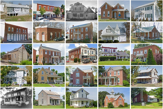
McDonald County, Missouri

Image
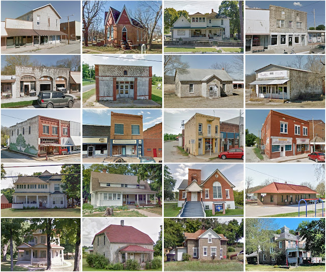
Founding:  1849 (declared in 1847) Parent county:  Newton Namesake:  Alexander McDonald, Continental Army soldier Seat:  Pineville (1849–) Land area:  539 square miles Population (2020):  23,303 Population (historic):  2,236 (1850); 3,756 (1870); 11,283 (1890); 13,539 (1910); 13,936 (1930) Periods of population growth:  pre-1850–1860; 1870–1900; 1930s; 1970–2000 Subdivisions:  Six cities; two villages; 19 townships National Register listings:   Four Pre-1940 residences (estimated):  694 (7%) Pre-1940 housing survival rate:  29.4% Pre-1860 housing survival rate (1940):  3.4% Farm housing in disrepair (1950):  16.9% Nonfarm housing in disrepair (1950):  10.3% Average farmhouse value (1930):  $557 Average outbuilding value (1930):  $368 Number of farms (1920):  2,143 Average farm size (1920):  53.5 acres Sources of settlement:  Missouri, Arkansas, Tennessee, Illinois, Kansas, Kentucky, and Indiana ________________________________________________________________

Iron County, Missouri

Image
Founding:  1857 Parent counties:  Madison, Reynolds, St. Francois, Washington, and Wayne Namesake:  Iron deposits in the region Seat:  Ironton (1857–) Land area:  550 square miles Population (2020):  9,537 Population (historic):  5,842 (1860); 8,183 (1880); 8,716 (1900); 9,642 (1930) Periods of population growth:  pre-1860; 1870–1890; 1910s; 1960–1980 Subdivisions:  Five cities; one village; six townships National Register listings:   Six Pre-1940 residences (estimated):  745 (14%) Pre-1940 housing survival rate:  25.1% Pre-1860 housing survival rate (1940):  3.3% Farm housing in disrepair (1950):  23% Nonfarm housing in disrepair (1950):  19.4% Average farmhouse value (1930):  $672 Average outbuilding value (1930):  $357 Average farmhouse size (1940):  4.1 rooms Number of farms (1920):  929 Average farm size (1920):  51.2 acres Sources of settlement:  Missouri, Tennessee, Germany, Illinois, and Kentucky _______________________________________________________

Reynolds County, Missouri

Image
Founding:  1845 Parent counties:  Shannon and Wayne Namesake:  Thomas Reynolds, Missouri governor Seat:  Centerville (1845–) Land area:  808 square miles Population (2020):  6,096 Population (historic):  1,849 (1850); 3,756 (1870); 6,803 (1890); 9,592 (1910); 8,923 (1930) Periods of population growth:  pre-1850–1920; 1930s; 1960–1980; 1990–2010 Subdivisions:  Three cities; six townships National Register listings:   Two Pre-1940 residences (estimated):  331 (8.2%) Pre-1940 housing survival rate:  16.1% Pre-1860 housing survival rate (1940):  0.9% Farm housing in disrepair (1950):  24.5% Nonfarm housing in disrepair (1950):  28.6% Average farmhouse value (1930):  $399 Average outbuilding value (1930):  $286 Average farmhouse size (1940):  3.9 rooms Number of farms (1920):  1,073 Average farm size (1920):  54.5 acres Sources of settlement:  Tennessee, Arkansas, Illinois, and Kentucky ______________________________________________________________________________

Cumberland County, New Jersey

Image
Founding:  1748 Parent county:  Salem Namesake:  Prince William, Duke of Cumberland Seat:  Bridgeton (1748–) Land area:  484 square miles Population (2020):  154,152 Population (historic):  8,248 (1790); 14,374 (1840); 34,665 (1870); 51,193 (1900); 69,895 (1930) Periods of population growth:  pre-1790–1810; 1820–2010 Subdivisions:  Three cities; one borough; seven CDPs; 10 townships National Register listings:   30 Pre-1940 residences (estimated):  10,043 (17.8%) Pre-1940 housing survival rate:  53.1% Pre-1860 housing survival rate (1940):  31.2% Farm housing in disrepair (1950):  9.6% Nonfarm housing in disrepair (1950):  7.1% Average farmhouse value (1930):  $2,455 Average outbuilding value (1930):  $1,952 Average farmhouse size (1940):  6.5 rooms Number of farms (1920):  3,094 Average farm size (1920):  29.3 acres _________________________________________________________________________________ Bridgeton Namesake:  Unclear—likely a bridge spanning t

Gratiot County, Michigan

Image
Founding:  1856 (declared in 1831) Parent counties:  Unorganized territory Namesake:  Charles Gratiot, U.S. army engineer Seat:  Ithaca (1856–) Land area:  568 square miles Population (2020):  41,761 Population (historic):  4,042 (1860); 21,936 (1880); 29,889 (1900); 30,252 (1930) Periods of population growth:  pre-1860–1900; 1910s; 1930–1980; 1990–2010 Subdivisions:  Three cities; three villages; 16 townships National Register listings:   Ten Pre-1940 residences (estimated):  4,062 (24.9%) Pre-1940 housing survival rate:  52.4% Pre-1860 housing survival rate (1940):  6.5% Farm housing in disrepair (1950):  9.2% Nonfarm housing in disrepair (1950):  9.1% Average farmhouse value (1930):  $1,570 Average outbuilding value (1930):  $1,703 Number of farms (1920):  3,859 Average farm size (1920):  65.1 acres Sources of settlement:  Michigan, Ohio, New York, and Canada _________________________________________________________________________________ Ithaca Na

Macomb County, Michigan

Image
Founding:  1818 Parent county:  Wayne Namesake:  Alexander Macomb, U.S. army general Seat:  Mount Clemens (1818–) Land area:  479 square miles Population (2020):  881,217 Population (historic):  2,413 (1830); 22,843 (1860); 31,627 (1880); 33,244 (1900); 77,146 (1930) Periods of population growth:  1820–1900; 1910–2020 Subdivisions:  12 cities; three villages; 11 townships National Register listings:   16 Pre-1940 residences (estimated):  16,811 (4.6%) Pre-1940 housing survival rate:  54.4% Pre-1860 housing survival rate (1940):  16.8% Farm housing in disrepair (1950):  5% Nonfarm housing in disrepair (1950):  3.6% Average farmhouse value (1930):  $2,536 Average outbuilding value (1930):  $2,153 Average farmhouse size (1940):  6.5 rooms Number of farms (1920):  3,570 Average farm size (1920):  62 acres Sources of settlement:  New York, Germany, and Canada __________________________________________________________________________________ Mount Clemens Nam

Perry County, Missouri

Image
Founding:  1821 Parent county:  Ste. Genevieve Namesake:  Oliver Hazard Perry, U.S. naval commander Seat:  Perryville (1821–) Land area:  474 square miles Population (2020):  18,956 Population (historic):  3,349 (1830); 9,128 (1860); 11,895 (1880); 15,134 (1900); 13,707 (1930) Periods of population growth:  pre-1830–1900; 1930s; 1970s; 1990–2010 Subdivisions:  Three cities; two villages; one CDPs; eight townships National Register listings:   Nine Pre-1940 residences (estimated):  866 (10%) Pre-1940 housing survival rate:  36.5% Pre-1860 housing survival rate (1940):  8% Farm housing in disrepair (1950):  17.5% Nonfarm housing in disrepair (1950):  6.1% Average farmhouse value (1930):  $1,041 Average outbuilding value (1930):  $862 Average farmhouse size (1940):  4.9 rooms Number of farms (1920):  2,955 Average farm size (1920):  83.1 acres Sources of settlement:  Germany and Illinois ___________________________________________________________________________

Porter County, Indiana

Image
Founding:  1836 Parent county:  LaPorte Namesake:  David Porter (1780–1843), U.S. naval captain Seat:  Valparaiso (1836–) Land area:  418 square miles Population (2010):  164,343 Population (historic):  2,162 (1840); 10,313 (1860); 17,227 (1880); 19,175 (1900); 22,821 (1930) Periods of population growth:  pre-1840–1880; 1920–1980; 1990–2010 Subdivisions:  Two cities; nine towns; six CDPs; 12 townships National Register listings:   35 Pre-1940 residences (estimated):  5,490 (8.1%) Pre-1940 housing survival rate:  62.2% Pre-1860 housing survival rate (1940):  9.3% Average farmhouse value (1930):  $2,093 Average outbuilding value (1930):  $1,901 Average farmhouse size (1940):  6.2 rooms Number of farms (1920):  1,791 Average farm size (1920):  104.4 acres Sources of settlement:  Ohio, Germany, New York, Sweden, Illinois, and Pennsylvania _________________________________________________________________________________ Valparaiso Namesake:  Valparaíso, Chil

Kalamazoo County, Michigan

Image
Founding:  1830 (declared in 1829) Parent county:  Unorganized territory Namesake:  The Kalamazoo River Seat:   Prairie Ronde (1830–1831); Kalamazoo (1831–) Land area:  562 square miles Population (2020):  261,670 Population (historic):  7,380 (1840); 24,646 (1860); 34,342 (1880); 44,310 (1900); 91,368 (1930) Periods of population growth:  pre-1840–2020 Subdivisions:  Four cities; five villages; five CDPs; 16 townships National Register listings:   58 Pre-1940 residences (estimated):  16,111 (14.5%) Pre-1940 housing survival rate:  55% Pre-1860 housing survival rate (1940):  16.9% Farm housing in disrepair (1950):  8.2% Nonfarm housing in disrepair (1950):  4.4% Average farmhouse value (1930):  $1,957 Average outbuilding value (1930):  $1,556 Average farmhouse size (1940):  6.7 rooms Number of farms (1920):  3,161 Average farm size (1920):  78.4 acres Sources of settlement:  New York, Ohio, England, and Ireland ______________________________________________

Uvalde County, Texas

Image
Founding:  1856 (declared in 1850) Parent county:  Bexar Namesake:  Juan de Ugalde, Spanish soldier Seat:  Uvalde (1856–) Land area:  1,552 square miles Population (2020):  24,564 Population (historic):  506 (1860); 2,541 (1880); 4,647 (1900); 12,945 (1930) Periods of population growth:  pre-1860–1910; 1920–2010 Subdivisions:  Two cities; three CDPs National Register listings:   11 Pre-1940 residences (estimated):  811 (7.3%) Pre-1940 housing survival rate:  30.2% Farm housing in disrepair (1950):  19% Nonfarm housing in disrepair (1950):  18.4% Average farmhouse value (1930):  $1,190 Average outbuilding value (1930):  $832 Average farmhouse size (1940):  4 rooms Number of farms (1920):  706 Average farm size (1920):  144.5 acres _________________________________________________________________________________ Uvalde Namesake:  Juan de Ugalde, Spanish soldier Founding:  1853 (platting as Encina ); 1857 (post office) Population (2020):  15,217 Popu

Montgomery County, Indiana

Image
Founding:  1823 Parent county:  Unorganized territory Namesake:  Richard Montgomery, Continental Army general Seat:  Crawfordsville (1823–) Land area:  505 square miles Population (2010):  38,124 Population (historic):  7,317 (1830); 18,085 (1850); 23,765 (1870); 29,388 (1900); 26,980 (1930) Periods of population growth:  pre-1830–1880; 1950s Subdivisions:  One city; ten towns; one CDP; 11 townships National Register listings:   21 Pre-1940 residences (estimated):  4,922 (29.6%) Pre-1940 housing survival rate:  55.8% Pre-1860 housing survival rate (1940):  12.1% Farm housing in disrepair (1950): 6.5% Nonfarm housing in disrepair (1950): 6% Average farmhouse value (1930):  $1,684 Average outbuilding value (1930):  $1,363 Average farmhouse size (1940):  6.3 rooms Number of farms (1920):  2,564 Average farm size (1920):  96.6 acres Sources of settlement:  Ohio, Kentucky, and Virginia _______________________________________________________________________________

Craig County, Virginia

Image
Founding:  1851 Parent counties:  Botetourt, Giles, Monroe, and Roanoke Namesake:  Robert Craig, Virginia politician Seat:  New Castle (1851–) Land area:  330 square miles Population (2020):  4,892 Population (historic):  3,553 (1860); 3,794 (1880); 4,293 (1900); 3,562 (1930) Periods of population growth:  pre-1860; 1870–1910; 1930s; 1960–2010 Subdivisions:  One town National Register listings:   Six Pre-1940 residences (estimated):  396 (13.6%) Pre-1940 housing survival rate:  46.4% Pre-1860 housing survival rate (1940):  15.6% Farm housing in disrepair (1950):  16.8% Nonfarm housing in disrepair (1950):  11.9% Average farmhouse value (1930):  $1,034 Average outbuilding value (1930):  $606 Average farmhouse size (1940):  5.5 rooms Number of farms (1920):  541 Average farm size (1920):  75.2 acres _________________________________________________________________________________ New Castle Namesake:  Unknown Founding:  pre-1851 (founding as New Fincas

Bradford County, Pennsylvania

Image
Founding:  1812 (declared in 1810) Parent counties:  Luzerne and Lycoming Namesake:  William Bradford, U.S. attorney general Seat:  Towanda (1812–) Land area:  1,147 square miles Population (2020):  59,967 Population (historic):  11,554 (1820); 42,831 (1850); 53,204 (1870); 59,403 (1900); 49,039 (1930) Periods of population growth:  pre-1820–1900; 1930–1980; 1990s Subdivisions:  14 boroughs; one CDP; 37 townships National Register listings:   14 Pre-1940 residences (estimated):  10,191 (33.4%) Pre-1940 housing survival rate:  71.1% Pre-1860 housing survival rate (1940):  24.5% Farm housing in disrepair (1950):  11.3% Nonfarm housing in disrepair (1950):  8.5% Average farmhouse value (1930):  $1,336 Average outbuilding value (1930):  $1,260 Average farmhouse size (1940):  7.7 rooms Number of farms (1920):  5,290 Average farm size (1920):  83.2 acres _________________________________________________________________________________ Towanda Namesake:  Towa