Posts

Showing posts from October, 2020

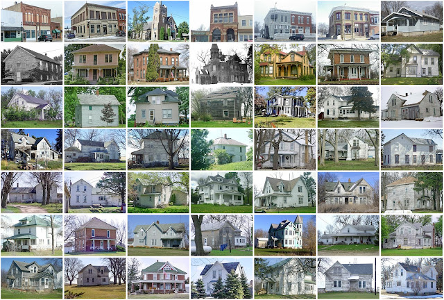
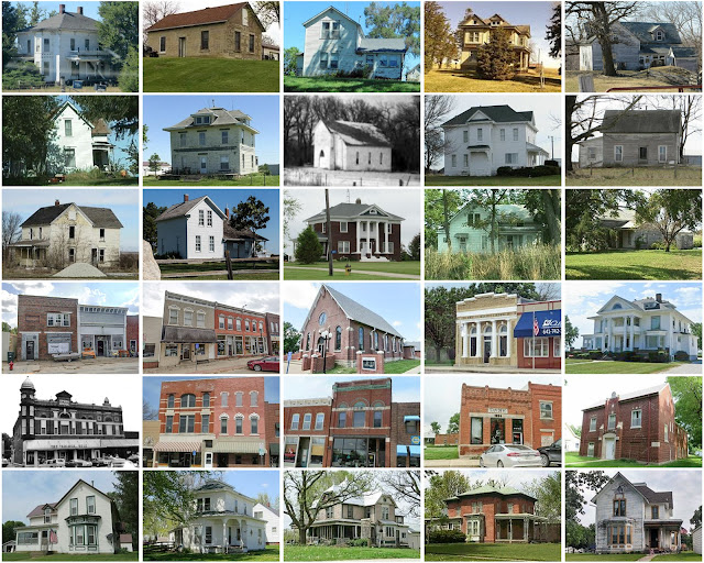
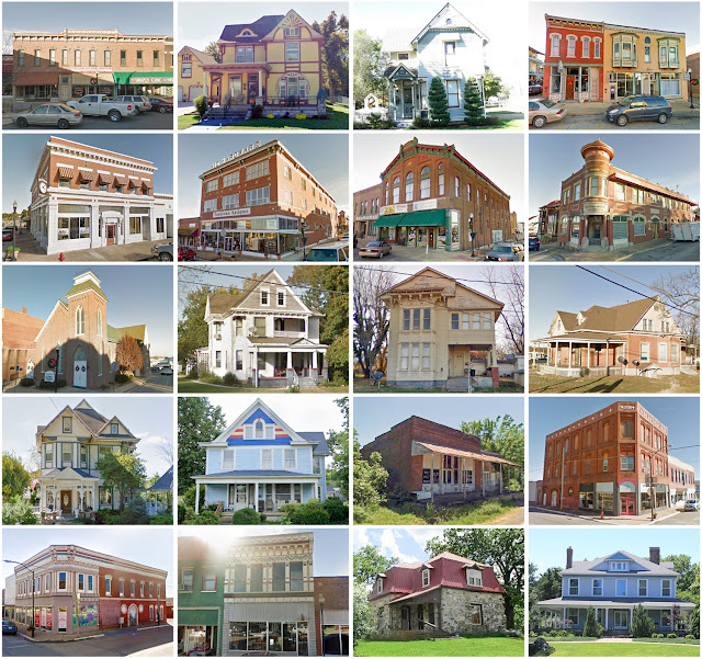
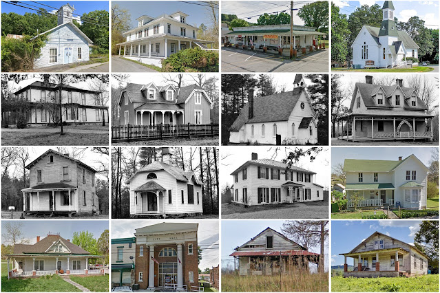
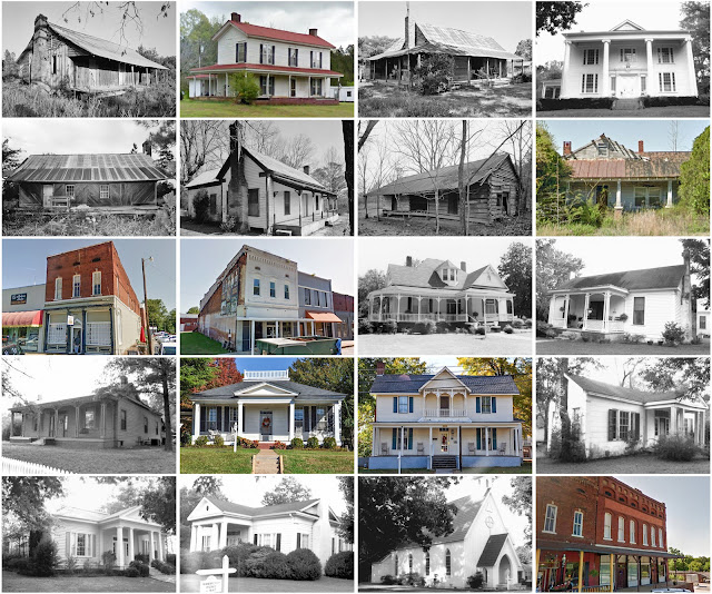
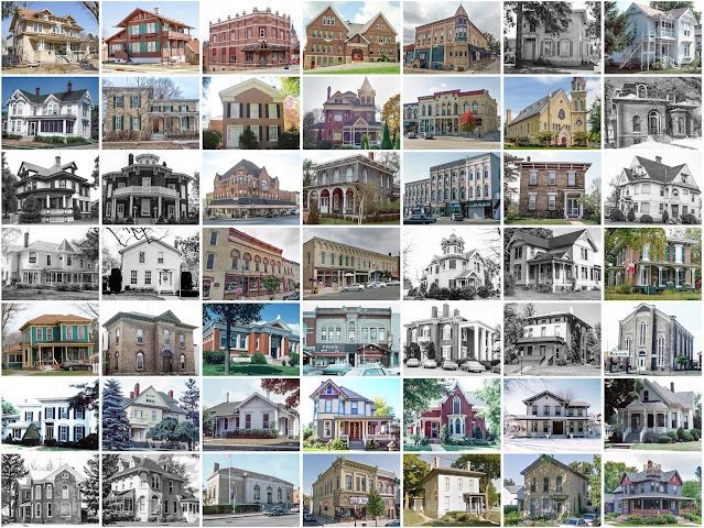
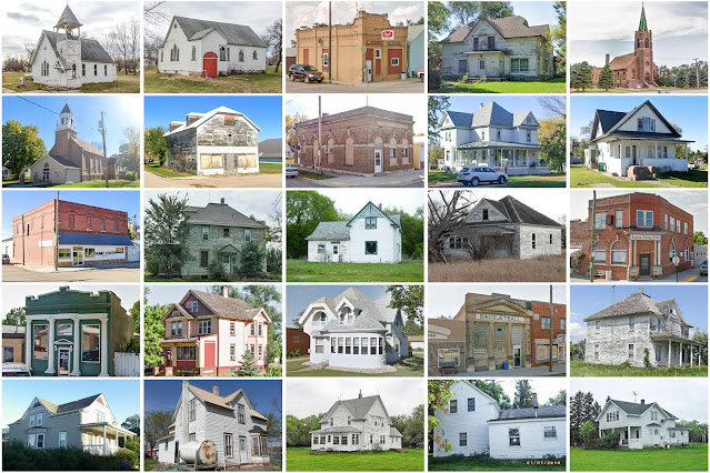
Buchanan County, Iowa

Image
  Founding:  1847 (declared in 1837) Parent county:  Dubuque Namesake:  James Buchanan, U.S. president Seat:  Independence (1847–) Land area:  571 square miles Population (2020):  20,565 Population (historic):  517 (1850); 17,034 (1870); 18,997 (1890); 19,748 (1910); 19,550 (1930) Periods of population growth:  pre-1850–1900; 1910s; 1930–1960; 1970s; 1990s Subdivisions:  11 cities; 16 townships National Register listings:   22 Pre-1940 residences (estimated):  2,459 (27.1%) Pre-1940 housing survival rate:  55.1% Pre-1860 housing survival rate (1940):  5.9% Farm housing in disrepair (1950):  4.2% Nonfarm housing in disrepair (1950):  3.7% Average farmhouse value (1930):  $1,812 Average outbuilding value (1930):  $2,459 Average farmhouse size (1940):  6.9 rooms Number of farms (1920):  2,232 Average farm size (1920):  125.7 acres Sources of settlement:  New York, Ohio, Illinois, Pennsylvania, Ireland, Germany, and Wisconsin ________________________________________________________________

Butler County, Iowa

Image
  Founding:  1854 (declared in 1851) Parent county:  Unorganized territory Namesake:  William Butler, Kentucky politician Seat:  Clarksville (1854–1860); Butler Center (1860–1881); Allison (1881–) Land area:  580 square miles Population (2020):  14,334 Population (historic):  3,724 (1860); 14,293 (1880); 17,955 (1900); 17,617 (1930) Periods of population growth:  pre-1860–1900; 1910s; 1930s; 1970s Subdivisions:  Ten cities; 16 townships National Register listings:   Seven Pre-1940 residences (estimated):  2,786 (41.1%) Pre-1940 housing survival rate:  59.9% Farm housing in disrepair (1950):  2.5% Nonfarm housing in disrepair (1950):  5.2% Average farmhouse value (1930):  $1,817 Average outbuilding value (1930):  $2,469 Average farmhouse size (1940):  6.8 rooms Number of farms (1920):  2,244 Average farm size (1920):  137 acres Sources of settlement:  New York, Illinois, Wisconsin, Germany, Ohio, Pennsylvania, and Ireland ________________________________________________________________

Adair County, Iowa

Image
  Founding:  1854 (declared in 1851) Parent counties:  Pottawattamie and unorganized territory Namesake:  John Adair, Kentucky governor Seat:  Fontanelle (1855–1875); Greenfield (1875–) Land area:  569 square miles Population (2020):  7,496 Population (historic):  984 (1860); 11,667 (1880); 16,192 (1900); 13,891 (1930) Periods of population growth:  pre-1860–1900 Subdivisions:  Seven cities; 17 townships National Register listings:   Nine Pre-1940 residences (estimated):  1,375 (37.2%) Pre-1940 housing survival rate:  41.5% Farm housing in disrepair (1950):  7.1% Nonfarm housing in disrepair (1950):  6.7% Average farmhouse value (1930):  $1,925 Average outbuilding value (1930):  $2,255 Average farmhouse size (1940):  6.4 rooms Number of farms (1920):  2,113 Average farm size (1920):  151.9 acres Sources of settlement:  Illinois, Ohio, Indiana, Pennsylvania, and New York _________________________________________________________________________________ Greenfield Namesake:  A traditional

Rockwall County, Texas

Image
  Founding:  1873 Parent county:  Kaufman Namesake:  The city of Rockwall Seat:  Rockwall (1873–) Land area:  127 square miles Population (2020):  107,819 Population (historic):  2,984 (1880); 8,531 (1900); 7,658 (1930) Periods of population growth:  pre-1880–1900; 1910s; 1960–2020 Subdivisions:  Five cities National Register listings:   Two Pre-1940 residences (estimated):  274 (0.8%) Pre-1940 housing survival rate:  12.8% Farm housing in disrepair (1950):  42.2% Nonfarm housing in disrepair (1950):  19.2% Average farmhouse value (1930):  $782 Average outbuilding value (1930):  $401 Average farmhouse size (1940):  3.7 rooms Number of farms (1920):  1,075 Average farm size (1920):  71.9 acres _________________________________________________________________________________ Rockwall Namesake:  Subterranean rock formations near the city Founding:  1854 (platting); 1854 (post office) Population (2020):  47,251 Population (historic):  215 (1880); 1,245 (1900); 1,074 (1930) Periods of popul

Somervell County, Texas

Image
  Founding:  1875 Parent county:  Hood Namesake:  Alexander Somervell, Texas politician Seat:  Glen Rose (1875–) Land area:  186 square miles Population (2020):  9,205 Population (historic):  2,649 (1880); 3,498 (1900); 3,016 (1930) Periods of population growth:  pre-1880–1910; 1930s; 1950–2020 Subdivisions:  One city National Register listings:   Four Pre-1940 residences (estimated):  125 (3.3%) Pre-1940 housing survival rate:  27.5% Farm housing in disrepair (1950):  27.9% Nonfarm housing in disrepair (1950):  14.1% Average farmhouse value (1930):  $557 Average outbuilding value (1930):  $261 Average farmhouse size (1940):  3.8 rooms Number of farms (1920):  530 Average farm size (1920):  76.3 acres _________________________________________________________________________________ Glen Rose Namesake:  A descriptive name Founding:  circa 1870 (founding as Barnard's Mill ); 1874 (post office) Population (2020):  2,659 Population (historic):  132 (1880); 400 (1890); 983 (1930) Pre-19

Randolph County, Missouri

Image
  Founding:  1829 Parent counties:  Ralls and unorganized territory Namesake:  John Randolph, Virginia politician Seat:  Huntsville (1831–) Land area:  482 square miles Population (2020):  24,716 Population (historic):  2,942 (1830); 9,439 (1850); 15,908 (1870); 24,442 (1900); 26,431 (1930) Periods of population growth:  pre-1830–1890; 1900–1920; 1960–1980; 1990–2010 Subdivisions:  Five cities; three villages; 12 townships National Register listings:   Six Pre-1940 residences (estimated):  2,620 (24.4%) Pre-1940 housing survival rate:  34.3% Pre-1860 housing survival rate (1940):  12.1% Farm housing in disrepair (1950):  19.5% Nonfarm housing in disrepair (1950):  10% Average farmhouse value (1930):  $1,310 Average outbuilding value (1930):  $855 Average farmhouse size (1940):  4.9 rooms Number of farms (1920):  2,380 Average farm size (1920):  97.5 acres Sources of settlement:  Missouri, Kentucky, Virginia, Illinois, and Pennsylvania ___________________________________________________

Miller County, Missouri

Image
  Founding:  1837 Parent counties:  Cole, Pulaski, and unorganized territory Namesake:  John Miller, Missouri governor Seat:  Tuscumbia (1837–) Land area:  593 square miles Population (2020):  24,722 Population (historic):  2,282 (1840); 6,812 (1860); 9,805 (1880); 15,187 (1900); 16,728 (1930) Periods of population growth:  pre-1840–1860; 1870–1910; 1920s; 1950–2010 Subdivisions:  Four cities; four villages; seven townships National Register listings:   Eight Pre-1940 residences (estimated):  1,243 (9.6%) Pre-1940 housing survival rate:  29.2% Pre-1860 housing survival rate (1940):  1.7% Farm housing in disrepair (1950):  14.6% Nonfarm housing in disrepair (1950):  9.5% Average farmhouse value (1930):  $780 Average outbuilding value (1930):  $541 Average farmhouse size (1940):  4.2 rooms Number of farms (1920):  2,194 Average farm size (1920):  74.9 acres Sources of settlement:  Missouri, Kentucky, Ohio, Illinois, Virginia, Tennessee, Indiana, and Germany ______________________________

Crawford County, Missouri

Image
  Founding:  1829 Parent county:  Unorganized territory Namesake:  William Crawford, Georgia politician Seat:   Jerome (1829–1835); Steelville (1835–) Land area:  743 square miles Population (2020):  23,056 Population (historic):  1,712 (1830); 6,397 (1850); 7,982 (1870); 12,959 (1900); 11,287 (1930) Periods of population growth:  pre-1830–1850; 1860–1910; 1930s; 1950–2010 Subdivisions:  Three cities; three villages; nine townships National Register listings:   14 Pre-1940 residences (estimated):  794 (6.6%) Pre-1940 housing survival rate:  39.8% Pre-1860 housing survival rate (1940):  5.3% Farm housing in disrepair (1950):  23.6% Nonfarm housing in disrepair (1950):  15.3% Average farmhouse value (1930):  $794 Average outbuilding value (1930):  $562 Average farmhouse size (1940):  4.4 rooms Number of farms (1920):  1,856 Average farm size (1920):  63 acres Sources of settlement:  Missouri, Tennessee, Kentucky, Illinois, and Germany _____________________________________________________

Howell County, Missouri

Image
  Founding:  1857 Parent county:  Oregon Namesake:  Josiah Howell, early resident Seat:  West Plains (1858–) Land area:  927 square miles Population (2020):  39,750 Population (historic):  3,169 (1860); 8,814 (1880); 21,834 (1900); 19,672 (1930) Periods of population growth:  pre-1860–1900; 1910s; 1930–1950; 1960–2010 Subdivisions:  Four cities; two CDPs; 12 townships National Register listings:   Six Pre-1940 residences (estimated):  1,464 (8%) Pre-1940 housing survival rate:  32.1% Pre-1860 housing survival rate (1940):  2.8% Farm housing in disrepair (1950):  26.2% Nonfarm housing in disrepair (1950):  12% Average farmhouse value (1930):  $598 Average outbuilding value (1930):  $378 Average farmhouse size (1940):  4.1 rooms Number of farms (1920):  3,076 Average farm size (1920):  63.2 acres Sources of settlement:  Tennessee, Illinois, Kentucky, and Arkansas _________________________________________________________________________________ West Plains Namesake:  Prairies near the cit

Pulaski County, Missouri

Image
  Founding:  1833 Parent counties:  Crawford and Morgan Namesake:  Casimir Pulaski, Polish soldier Seat:  Waynesville (1833–) Land area:  547 square miles Population (2020):  53,955 Population (historic):  6,529 (1840); 3,835 (1860); 7,250 (1880); 10,394 (1900); 10,755 (1930) Periods of population growth:  pre-1840; 1860–1910; 1920–1940; 1950–1970; 2000–2020 Subdivisions:  Five cities; one CDP; six townships National Register listings:   Seven Pre-1940 residences (estimated):  750 (3.9%) Pre-1940 housing survival rate:  32.7% Pre-1860 housing survival rate (1940):  1.3% Farm housing in disrepair (1950):  11% Nonfarm housing in disrepair (1950):  8.2% Average farmhouse value (1930):  $698 Average outbuilding value (1930):  $491 Average farmhouse size (1940):  3.8 rooms Number of farms (1920):  1,454 Average farm size (1920):  64.9 acres Sources of settlement:  Missouri, Tennessee, Kentucky, Illinois, and Indiana ___________________________________________________________________________

Morgan County, Tennessee

Image
  Founding:  1818 Parent counties:  Anderson, Overton, and Roane Namesake:  Daniel Morgan, Virginia politician Seat:   Montgomery (1817–1870); Wartburg (1870–) Land area:  522 square miles Population (2020):  21,035 Population (historic):  1,676 (1820); 3,430 (1850); 2,969 (1870); 9,587 (1900); 13,603 (1930) Periods of population growth:  pre-1820–1850; 1870–1950; 1970–2010 Subdivisions:  Two cities; one town; two CDPs National Register listings:   Five Pre-1940 residences (estimated):  499 (5.6%) Pre-1940 housing survival rate:  20.2% Pre-1860 housing survival rate (1940):  3.9% Farm housing in disrepair (1950):  32.7% Nonfarm housing in disrepair (1950):  29% Average farmhouse value (1930):  $382 Average outbuilding value (1930):  $195 Average farmhouse size (1940):  4.6 rooms Number of farms (1920):  1,251 Average farm size (1920):  24.1 acres _________________________________________________________________________________ Wartburg Namesake:  Wartburg Castle (in Thuringia, Germany)

Tishomingo County, Mississippi

Image
  Founding:  1836 Parent county:  Unorganized territory Namesake:  Tishomingo, Chickasaw chief Seat:   Jacinto (1836–1870); Iuka (1870–) Land area:  424 square miles Population (2020):  18,850 Population (historic):  6,681 (1840); 24,149 (1860); 8,774 (1880); 10,124 (1900); 16,411 (1930) Periods of population growth:  pre-1840–1860; 1870–1940; 1960–1980; 1990–2010 Subdivisions:  One city; three towns; two villages National Register listings:   18 Pre-1940 residences (estimated):  462 (4.4%) Pre-1940 housing survival rate:  15.4% Pre-1860 housing survival rate (1940):  0.8% Farm housing in disrepair (1950):  46.2% Nonfarm housing in disrepair (1950):  35.7% Average farmhouse value (1930):  $283 Average outbuilding value (1930):  $107 Average farmhouse size (1940):  3.7 rooms Number of farms (1920):  2,250 Average farm size (1920):  29 acres Sources of settlement:  Alabama, Tennessee, South Carolina, and Georgia ____________________________________________________________________________

Colbert County, Alabama

Image
  Founding:  1870 Parent county:  Franklin Namesake:  Levi Colbert, Chickasaw chief Seat:  Tuscumbia (1870–) Land area:  593 square miles Population (2020):  57,227 Population (historic):  12,537 (1870); 20,189 (1890); 24,802 (1910); 29,860 (1930) Periods of population growth:  pre-1870–1920; 1930–1960 Subdivisions:  Three cities; three towns National Register listings:   30 Pre-1940 residences (estimated):  1,911 (7.2%) Pre-1940 housing survival rate:  23.7% Farm housing in disrepair (1950):  29.5% Nonfarm housing in disrepair (1950):  20.5% Average farmhouse value (1930):  $392 Average outbuilding value (1930):  $150 Average farmhouse size (1940):  3.7 rooms Number of farms (1920):  3,018 Average farm size (1920):  40.6 acres _________________________________________________________________________________ Tuscumbia Namesake:  Tuscumbia, Chickasaw leader Founding:  circa 1816 (founding as  Big Spring ); 1820 (incorporation) Population (2020):  9,054 Population (historic):  1,214 (187

Green County, Wisconsin

Image
  Founding:  1837 Parent county:  Iowa Namesake:  Nathanael Greene, Continental Army general Seat:   New Mexico (1837–1839); Monroe (1839–) Land area:  584 square miles Population (2020):  37,093 Population (historic):  8,566 (1850); 23,611 (1870); 22,732 (1890); 21,641 (1910); 21,870 (1930) Periods of population growth:  1840–1870; 1880s; 1920–2020 Subdivisions:  Two cities; four villages; one CDP; 16 townships National Register listings:   30 Pre-1940 residences (estimated):  4,354 (27.3%) Pre-1940 housing survival rate:  74.5% Pre-1860 housing survival rate (1940):  9.2% Farm housing in disrepair (1950):  2.2% Nonfarm housing in disrepair (1950):  5.3% Average farmhouse value (1930):  $2,495 Average outbuilding value (1930):  $3,374 Average farmhouse size (1940):  7.1 rooms Number of farms (1920):  2,330 Average farm size (1920):  116.2 acres Sources of settlement:  New York, Pennsylvania, Switzerland, Germany, Norway, Ohio, and Ireland _____________________________________________

Sargent County, North Dakota

Image
  Founding:  1883 Parent county:  Ransom Namesake:  H.E. Sargent, railroad official Seat:  Milnor (1883–1886); Forman (1886–) Land area:  859 square miles Population (2020):  3,862 Population (historic):  5,076 (1890); 9,202 (1910); 9,298 (1930) Periods of population growth:  pre-1890–1910 Subdivisions:  Seven cities; one CDP; 32 townships National Register listings:   One Pre-1940 residences (estimated):  481 (22.8%) Pre-1940 housing survival rate:  33% Farm housing in disrepair (1950):  5.7% Nonfarm housing in disrepair (1950):  4.3% Average farmhouse value (1930):  $1,786 Average outbuilding value (1930):  $1,892 Average farmhouse size (1940):  6 rooms Number of farms (1920):  1,321 Average farm size (1920):  326.1 acres Sources of settlement:  Minnesota, Norway, Iowa, and Sweden _________________________________________________________________________________ Forman Namesake:  Cornelius Forman, platter Founding:  1883 (platting); 1883 (post office) Population (2020):  509 Populatio