Posts

Showing posts with the label carter county

Carter County, Montana
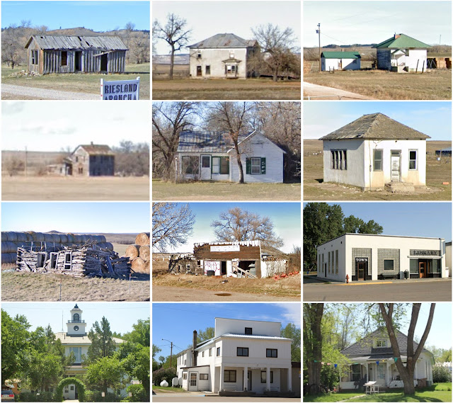
Image
Founding:  1917 Parent county:  Fallon Namesake:  Thomas Carter, Montana politician Seat:  Ekalaka (1917–) Land area:  3,341 square miles Population (2020):  1,415 Population (historic):  3,972 (1920); 4,136 (1930); 3,280 (1940) Periods of population growth:  pre-1920–1930; 2010s Subdivisions:  One town; one CDP Pre-1940 residences (estimated):  124 (15.2%) Pre-1940 housing survival rate:  20.8% Farm housing in disrepair (1950):  19.6% Nonfarm housing in disrepair (1950):  17.4% Average farmhouse value (1930):  $593 Average outbuilding value (1930):  $610 Average farmhouse size (1940):  3.6 rooms Number of farms (1920):  855 Average farm size (1920):  98 acres Sources of settlement:  South Dakota, Iowa, Nebraska, and Missouri _________________________________________________________________________________   Ekalaka   Namesake:  Ijkalaka, wife of David Russell, founder...
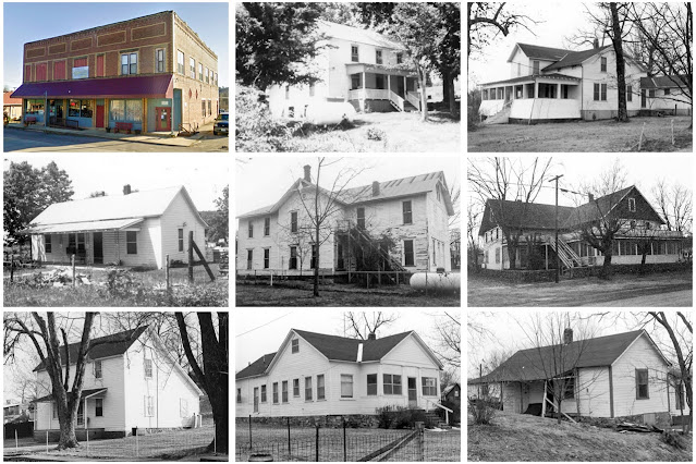
Carter County, Missouri

Image
Founding:  1859 Parent counties:  Ripley and Shannon Namesake:  Zimri Carter, local settler Seat:  Van Buren (1859–) Land area:  507 square miles Population (2020):  5,202 Population (historic):  1,235 (1860); 2,168 (1880); 6,706 (1900); 7,482 (1920); 5,503 (1930) Periods of population growth:  pre-1860–1900; 1910s; 1930s; 1970–2010 Subdivisions:  Three cities; two CDPs; five townships Pre-1940 residences (estimated):  170 (5.2%) Pre-1940 housing survival rate:  14.8% Pre-1860 housing survival rate (1940):  0.5% Farm housing in disrepair (1950):  16.1% Nonfarm housing in disrepair (1950):  18.4% Average farmhouse value (1930):  $414 Average outbuilding value (1930):  $300 Average farmhouse size (1940):  3.9 rooms Number of farms (1920):  608 Average farm size (1920):  49.1 acres Sources of settlement:  Missouri, Illinois, Tennessee, Indiana, Kentucky, and Arkansas...

Carter County, Kentucky

Image
Founding:  1838 Parent counties:  Greenup and Lawrence Namesake:  William Carter, Kentucky politician Seat:  Grayson (1838–) Land area:  409 square miles Population (2020):  26,627 Population (historic):  2,905 (1840); 8,516 (1860); 12,345 (1880); 20,228 (1900); 23,839 (1930) Periods of population growth:  pre-1840–1860; 1870–1940; 1970s; 1990–2010 Subdivisions:  Two cities Pre-1940 residences (estimated):  767 (6.2%) Pre-1940 housing survival rate:  20.1% Pre-1860 housing survival rate (1940):  7.9% Farm housing in disrepair (1950):  32.3% Nonfarm housing in disrepair (1950):  27.1% Average farmhouse value (1930):  $407 Average outbuilding value (1930):  $200 Average farmhouse size (1940):  4.6 rooms Number of farms (1920):  2,644 Average farm size (1920):  45.2 acres _________________________________________________________________________________ Grayson Name...