Posts

Showing posts with the label crawford county

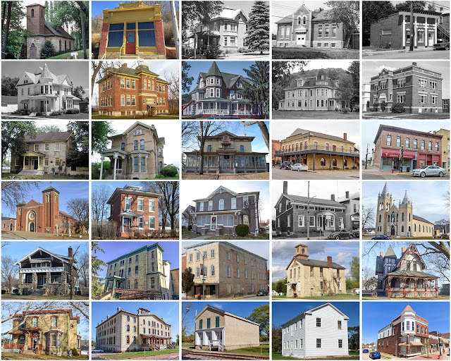
Crawford County, Iowa

Image
Founding:  1855 (declared in 1851) Parent counties:  Pottawattamie and unorganized territory Namesake:  William Crawford, Georgia politician Seat:  Denison (1856–) Land area:  714 square miles Population (2020):  16,525 Population (historic):  383 (1860); 12,413 (1880); 21,685 (1900); 21,028 (1930) Periods of population growth:  1860–1900; 1910 –1930; 1960s; 1990 –2010 Subdivisions:  13 cities; 20 townships Pre-1940 residences (estimated):  2,434 (34.5%) Pre-1940 housing survival rate:  52.4% Farm housing in disrepair (1950):  5.3% Nonfarm housing in disrepair (1950):  6.6% Average farmhouse value (1930):  $2,467 Average outbuilding value (1930):  $3,489 Average farmhouse size (1940):  6.8 rooms Number of farms (1920):  2,444 Average farm size (1920):  166.5 acres Sources of settlement:  Iowa, Germany, Illinois, Ireland, and Sweden ______________________________________________________________...
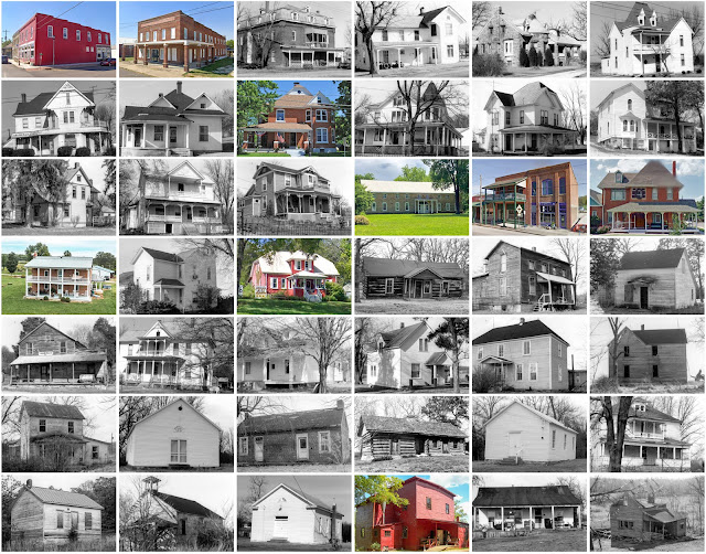
Crawford County, Missouri

Image
  Founding:  1829 Parent county:  Unorganized territory Namesake:  William Crawford, Georgia politician Seat:   Jerome (1829–1835); Steelville (1835–) Land area:  743 square miles Population (2020):  23,056 Population (historic):  1,712 (1830); 6,397 (1850); 7,982 (1870); 12,959 (1900); 11,287 (1930) Periods of population growth:  pre-1830–1850; 1860–1910; 1930s; 1950–2010 Subdivisions:  Three cities; three villages; nine townships Pre-1940 residences (estimated):  794 (6.6%) Pre-1940 housing survival rate:  39.8% Pre-1860 housing survival rate (1940):  5.3% Farm housing in disrepair (1950):  23.6% Nonfarm housing in disrepair (1950):  15.3% Average farmhouse value (1930):  $794 Average outbuilding value (1930):  $562 Average farmhouse size (1940):  4.4 rooms Number of farms (1920):  1,856 Average farm size (1920):  63 acres Sources of settlement:  Missouri, Tennessee, Kentucky, Illi...

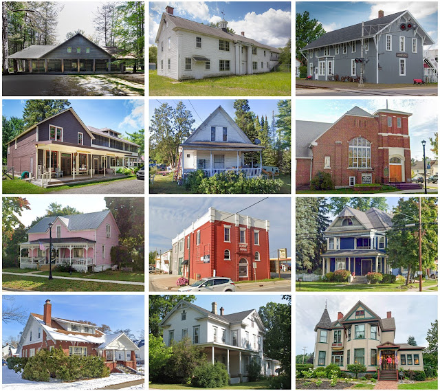
Crawford County, Michigan

Image
Founding:  1879 (declared in 1840) Parent county:  Unorganized territory Namesake:  William Crawford, American soldier Seat:  Grayling (1879–) Land area:  556 square miles Population (2020):  12,988 Population (historic):  1,159 (1880); 2,943 (1900); 3,097 (1930) Periods of population growth:  pre-1880–1890; 1900–1920; 1930–2000 Subdivisions:  One city; six townships Pre-1940 residences (estimated):  634 (5.7%) Pre-1940 housing survival rate:  89.9% Farm housing in disrepair (1950):  3.6% Nonfarm housing in disrepair (1950):  6.4% Average farmhouse value (1930):  $936 Average outbuilding value (1930):  $761 Number of farms (1920):  212 Average farm size (1920):  52.1 acres Sources of settlement:  Michigan, Canada, Denmark, New York, and Ohio _________________________________________________________________________________ Grayling Namesake:  The Arctic grayling,...

Crawford County, Illinois

Image
Founding:  1816 Parent county:  Edwards Namesake:  William Crawford, Georgia politician Seat:  Palestine (1818–1843); Robinson (1843–) Land area:  444 square miles Population (2020):  18,679 Population (historic):  3,022 (1820); 7,135 (1850); 13,889 (1870); 19,240 (1900); 21,085 (1930) Periods of population growth:  pre-1820–1910; 1930s; 1970s; 1990s Subdivisions:  One city; five villages; two CDPs; ten townships Pre-1940 residences (estimated):  1,872 (21.6%) Pre-1940 housing survival rate:  39.4% Pre-1860 housing survival rate (1940):  4.8% Farm housing in disrepair (1950):  18.7% Nonfarm housing in disrepair (1950):  11.2% Average farmhouse value (1930):  $1,135 Average outbuilding value (1930):  $757 Average farmhouse size (1940):  5.6 rooms Number of farms (1920):  2,248 Average farm size (1920):  98 acres Sources of settlement:  Ohio, Indiana, and Kentucky ...

Crawford County, Wisconsin

Image
Founding:  1818 Parent counties:  Unorganized territory Namesake:  William Crawford, Georgia politician Seat:  Prairie du Chien (1818–) Land area:  571 square miles Population (2020):  16,113 Population (historic):  1,502 (1840); 8,068 (1860); 15,644 (1880); 17,286 (1900); 16,781 (1930) Periods of population growth:  pre-1840–1900; 1910–1940; 1970s; 1990s Subdivisions:  One city; nine villages; 11 towns Pre-1940 residences (estimated):  2,118 (23.6%) Pre-1940 housing survival rate:  49.4% Pre-1860 housing survival rate (1940):  10.5% Farm housing in disrepair (1950):  11.2% Nonfarm housing in disrepair (1950):  7% Average farmhouse value (1930):  $1,547 Average outbuilding value (1930):  $1,807 Average farmhouse size (1940):  6.1 rooms Number of farms (1920):  1,911 Average farm size (1920):  77.1 acres Sources of settlement:  Norway, Germany, New York, Ireland, ...

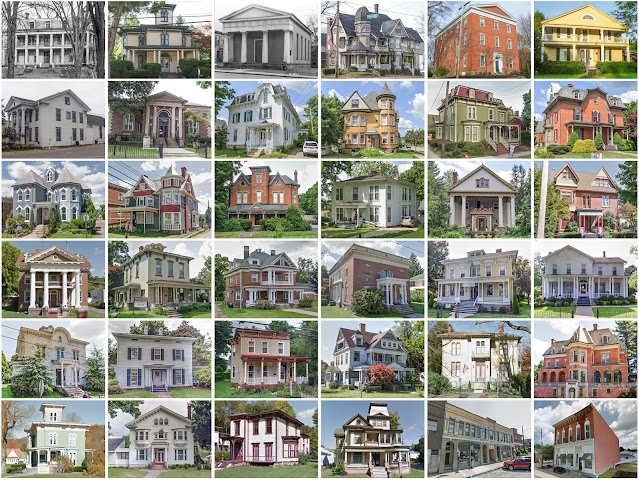
Crawford County, Pennsylvania

Image
Founding:  1800 Parent county:  Allegheny Namesake:  William Crawford, American soldier Seat:  Meadville (1800–) Land area:  1,012 square miles Population (2020):  83,938 Population (historic):  2,346 (1800); 31,724 (1840); 63,832 (1870); 63,643 (1900); 62,980 (1930) Periods of population growth:  pre-1800–1880; 1920–1950; 1960–1980; 1990s Subdivisions:  Two cities; 14 boroughs; 15 CDPs; 35 townships Pre-1940 residences (estimated):  12,406 (27.7%) Pre-1940 housing survival rate:  61.6% Pre-1860 housing survival rate (1940):  21% Farm housing in disrepair (1950):  11% Nonfarm housing in disrepair (1950):  6% Average farmhouse value (1930):  $1,565 Average outbuilding value (1930):  $1,257 Average farmhouse size (1940):  7.2 rooms Number of farms (1920):  6,521 Average farm size (1920):  52.3 acres _______________________________________________________________________...

Crawford County, Indiana

Image
Founding:  1818 Parent counties:  Harrison, Orange, and Perry Namesake:  William Crawford, Continental Army colonel Seat:  Fredonia (1822–1843); Leavenworth (1843–1893); English (1893–) Land area:  306 square miles Population (2020):  10,526 Population (historic):  2,583 (1820); 6,524 (1850); 12,356 (1880); 13,476 (1900); 10,160 (1930) Periods of population growth:  pre-1820–1890; 1970–2000 Subdivisions:  Five towns; nine townships Pre-1940 residences (estimated):  846 (15.3%) Pre-1940 housing survival rate:  31.8% Pre-1860 housing survival rate (1940):  7.9% Farm housing in disrepair (1950): 18.3% Nonfarm housing in disrepair (1950): 17.7% Average farmhouse value (1930):  $552 Average outbuilding value (1930):  $358 Average farmhouse size (1940):  4.6 rooms Number of farms (1920):  1,810 Average farm size (1920):  52 acres Sources of settlement:  Kentucky and Ohio ________...

Crawford County, Ohio

Image
Founding:  1826 (declared in 1820) Parent county:  Unorganized territory Namesake:  William Crawford, American explorer Seat:  Bucyrus (1826–)  Land area:  402 square miles Population (2020):  42,025 Population (historic):  4,791 (1830); 23,881 (1860); 30,583 (1880); 33,915 (1900); 35,345 (1930) Periods of population growth:  pre-1830–1920; 1930–1970 Subdivisions:  Two cities; five villages; two CDPs; 16 townships Pre-1940 residences (estimated):  6,788 (33.8%) Pre-1940 housing survival rate:  67.8% Pre-1860 housing survival rate (1940):  17.3% Farm housing in disrepair (1950):  3.4% Nonfarm housing in disrepair (1950):  5.3% Average farmhouse value (1930):  $1,723 Average outbuilding value (1930):  $1,729 Average farmhouse size (1940):  7.6 rooms Number of farms (1920):  2,415 Average farm size (1920):  83.5 acres Sources of settlement:  Pennsylvania, Germ...