Posts

Showing posts with the label arkansas

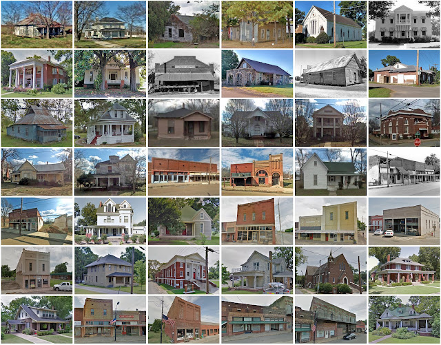
Monroe County, Arkansas
Image
Founding:  1830 Parent counties:  Arkansas, Phillips, and Pulaski Namesake:  James Monroe, U.S. president Seat:   Lawrenceville (1830–1857); Clarendon (1857–) Land area:  607 square miles Population (2020):  6,799 Population (historic):  461 (1830); 2,049 (1850); 8,336 (1870); 16,816 (1900); 20,651 (1930) Periods of population growth:  pre-1830–1920; 1930s Subdivisions:  Three cities; two towns; two CDPs Pre-1940 residences (estimated):  169 (4.3%) Pre-1940 housing survival rate:  8.1% Pre-1860 housing survival rate (1940):  2.8% Farm housing in disrepair (1950):  48.9% Nonfarm housing in disrepair (1950):  38.7% Average farmhouse value (1930):  $334 Average outbuilding value (1930):  $129 Average farmhouse size (1940):  3.5 rooms Number of farms (1920):  3,305 Average farm size (1920):  30.6 acres Sources of settlement:  Tennessee, Mississippi, and Alabama _______________________________...
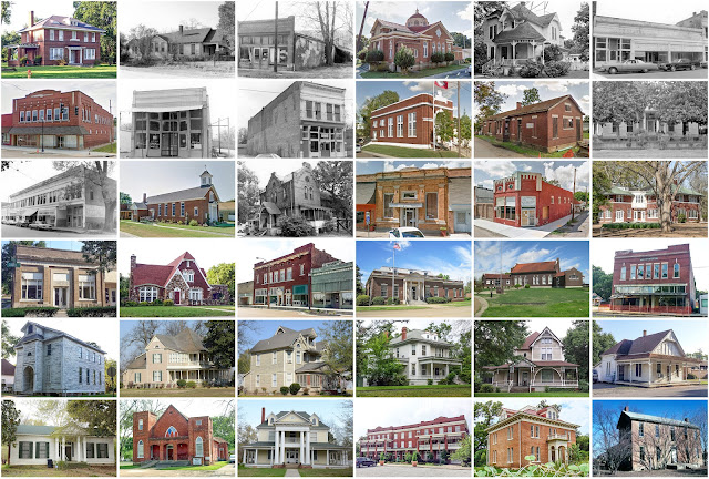
Izard County, Arkansas

Image
Founding:  1826 Parent county:  Independence Namesake:  George Izard, Arkansas governor Seat:  Norfork (1826–1830); Athens (1830–1836); Mount Olive (1836–1875); Melbourne (1875–) Land area:  581 square miles Population (2020):  13,577 Population (historic):  1,266 (1830); 7,215 (1860); 10,857 (1880); 13,506 (1900); 12,872 (1930) Periods of population growth:  pre-1830–1860; 1870–1910; 1960–2010 Subdivisions:  Four cities; four towns; two CDPs Pre-1940 residences (estimated):  336 (4.9%) Pre-1940 housing survival rate:  14.7% Pre-1860 housing survival rate (1940):  4.9% Farm housing in disrepair (1950):  40.1% Average farmhouse value (1930):  $358 Average outbuilding value (1930):  $158 Average farmhouse size (1940):  3.6 rooms Number of farms (1920):  2,549 Average farm size (1920):  47.1 acres Sources of settlement:  Tennessee, Missouri, and Georgia __________________________________________...

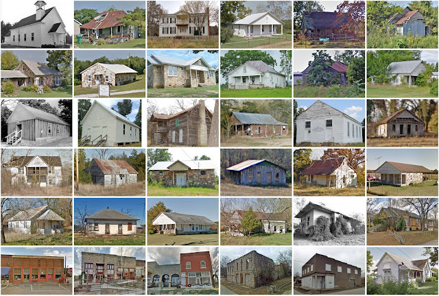
Yell County, Arkansas

Image
Founding:  1840 Parent counties:  Pope and Scott Namesake:  Archibald Yell, Arkansas governor Seats:  Danville (1841–) and Dardanelle (1875–) Land area:  930 square miles Population (2020):  20,263 Population (historic):  3,341 (1850); 8,048 (1870); 18,015 (1890); 26,323 (1910); 21,313 (1930) Periods of population growth:  pre-1850–1910; 1960–2010 Subdivisions:  Six cities; one town; two CDPs Pre-1940 residences (estimated):  559 (5.7%) Pre-1940 housing survival rate:  16.2% Pre-1860 housing survival rate (1940):  2.2% Farm housing in disrepair (1950):  27.8% Nonfarm housing in disrepair (1950):  24.2% Average farmhouse value (1930):  $359 Average outbuilding value (1930):  $211 Average farmhouse size (1940):  3.9 rooms Number of farms (1920):  3,817 Average farm size (1920):  40.3 acres Sources of settlement:  Tennessee, Georgia, Mississippi, Alabama, and North Carolina _________________...

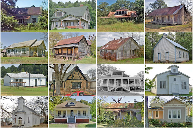
Stone County, Arkansas

Image
Founding:  1873 Parent counties:  Independence, Izard, Searcy, and Van Buren Namesake:  The county's rocky terrain Seat:  Mountain View (1873–) Land area:  607 square miles Population (2020):  12,481 Population (historic):  5,089 (1880); 8,100 (1900); 7,993 (1930) Periods of population growth:  pre-1880–1910; 1930s; 1960–2020 Subdivisions:  Two cities; 24 townships Pre-1940 residences (estimated):  142 (2.1%) Pre-1940 housing survival rate:  16.6% Farm housing in disrepair (1950):  25.5% Nonfarm housing in disrepair (1950):  33.6% Average farmhouse value (1930):  $255 Average outbuilding value (1930):  $128 Average farmhouse size (1940):  3.3 rooms Number of farms (1920):  1,426 Average farm size (1920):  38.7 acres Sources of settlement:  Arkansas and Tennessee _________________________________________________________________________________   Mountain View   Namesake: ...

Nevada County, Arkansas

Image
Founding:  1871 Parent counties:  Columbia, Hempstead, and Ouachita Namesake:  The state of Nevada Seat:   Mount Moriah (1871–1872); Rosston (1872–1877); Prescott (1877–) Land area:  618 square miles Population (2020):  8,187 Population (historic):  12,959 (1880); 16,609 (1900); 20,407 (1930) Periods of population growth:  pre-1880–1920; 1970s Subdivisions:  Two cities; six towns; one CDP Pre-1940 residences (estimated):  287 (6.2%) Pre-1940 housing survival rate:  7.3% Farm housing in disrepair (1950):  15.2% Nonfarm housing in disrepair (1950):  41.6% Average farmhouse value (1930):  $360 Average outbuilding value (1930):  $117 Average farmhouse size (1940):  4.2 rooms Number of farms (1920):  3,682 Average farm size (1920):  39.8 acres Sources of settlement:  Georgia, Alabama, Tennessee, Mississippi, and South Carolina _____________________________________________________________...

Woodruff County, Arkansas

Image
Founding:  1862 Parent counties:  Jackson and St. Francis Namesake:  William Woodruff, Arkansas politician Seat:  Augusta (1862–) Land area:  587 square miles Population (2020):  6,269 Population (historic):  6,891 (1870); 14,009 (1890); 20,049 (1910); 22,682 (1930) Periods of population growth:  pre-1870–1930 Subdivisions:  Four cities; one town Pre-1940 residences (estimated):  190 (4.9%) Pre-1940 housing survival rate:  6.7% Farm housing in disrepair (1950):  48.7% Nonfarm housing in disrepair (1950):  38.2% Average farmhouse value (1930):  $339 Average outbuilding value (1930):  $136 Average farmhouse size (1940):  3.7 rooms Number of farms (1920):  2,853 Average farm size (1920):  36.6 acres Sources of settlement:  Arkansas, Mississippi, Tennessee, Alabama, Georgia, and North Carolina _________________________________________________________________________________   Augusta   N...

Newton County, Arkansas

Image
Founding:  1842 Parent counties:  Carroll and Johnson Namesake:  Thomas Newton, Arkansas senator Seat:  Jasper (1843–) Land area:  821 square miles Population (2020):  7,225 Population (historic):  1,758 (1850); 4,374 (1870); 9,950 (1890); 10,612 (1910); 10,564 (1930) Periods of population growth:  pre-1850–1900; 1970s; 1990s Subdivisions:  One city; one town Pre-1940 residences (estimated):  575 (12.3%) Pre-1940 housing survival rate:  16.4% Pre-1860 housing survival rate (1940):  2% Farm housing in disrepair (1950):  21.4% Nonfarm housing in disrepair (1950):  25.7% Average farmhouse value (1930):  $256 Average outbuilding value (1930):  $160 Average farmhouse size (1940):  3.3 rooms Number of farms (1920):  2,028 Average farm size (1920):  30.7 acres Sources of settlement:  Tennessee and Missouri _________________________________________________________________________________   J...

Searcy County, Arkansas

Image
Founding:  1839 Parent county:  Marion Namesake:  Richard Searcy, Arkansas judge Seat:   Lebanon (1840–1856); Marshall (1856–) Land area:  666 square miles Population (2020):  7,828 Population (historic):  936 (1840); 5,271 (1860); 7,278 (1880); 11,988 (1900); 11,056 (1930) Periods of population growth:  pre-1840–1860; 1870–1910; 1970s Subdivisions:  Two cities; three towns Pre-1940 residences (estimated):  450 (9.1%) Pre-1940 housing survival rate:  20.9% Pre-1860 housing survival rate (1940):  2.1% Farm housing in disrepair (1950): 34.9% Nonfarm housing in disrepair (1950): 20.3% Average farmhouse value (1930):  $270 Average outbuilding value (1930):  $142 Average farmhouse size (1940):  3.4 rooms Number of farms (1920):  2,175 Average farm size (1920):  36.3 acres Sources of settlement:  Tennessee and Missouri ________________________________________________________...
Perry County, Arkansas

Image
  Founding:  1840 Parent county:  Conway Namesake:  Oliver Hazard Perry, U.S. naval officer Seat:  Perryville (1841–) Land area:  551 square miles Population (2020):  10,019 Population (historic):  978 (1850); 2,685 (1870); 5,538 (1890); 9,402 (1910); 7,695 (1930) Periods of population growth:  pre-1850–1920; 1930s; 1960–2010 Subdivisions:  Two cities; five towns; 17 townships Pre-1940 residences (estimated):  300 (6%) Pre-1940 housing survival rate:  14.8% Pre-1860 housing survival rate (1940):  2.1% Farm housing in disrepair (1950):  43.1% Nonfarm housing in disrepair (1950):  27.8% Average farmhouse value (1930):  $313 Average outbuilding value (1930):  $134 Average farmhouse size (1940):  3.5 rooms Number of farms (1920):  1,265 Average farm size (1920):  35.3 acres Sources of settlement:  Tennessee, Mississippi, Alabama, and Georgia ______________________________________________...

Calhoun County, Arkansas

Image
Founding:  1850 Parent counties:  Bradley, Dallas, Ouachita, and Union Namesake:  John Calhoun, South Carolina politician Seat:  Hampton (1851–) Land area:  629 square miles Population (2020):  4,739 Population (historic):  4,103 (1860); 5,671 (1880); 8,539 (1900); 9,752 (1930) Periods of population growth:  pre-1860; 1870–1920; 1970s Subdivisions:  Two cities; two towns Pre-1940 residences (estimated):  143 (4.9%) Pre-1940 housing survival rate:  9.5% Pre-1860 housing survival rate (1940):  1.1% Farm housing in disrepair (1950):  31.9% Nonfarm housing in disrepair (1950):  33.6% Average farmhouse value (1930):  $377 Average outbuilding value (1930):  $137 Average farmhouse size (1940):  4.1 rooms Number of farms (1920):  1,684 Average farm size (1920):  37.1 acres Sources of settlement:  Alabama, Georgia, Tennessee, and Mississippi ___________________________...

Randolph County, Arkansas

Image
Founding:  1835 Parent county:  Lawrence Namesake:  John Randolph, Virginia politician Seat:  Pocahontas (1835–) Land area:  652 square miles Population (2020):  18,571 Population (historic):  2,196 (1840); 6,261 (1860); 11,724 (1880); 17,156 (1900); 16,871 (1930) Periods of population growth:  pre-1840–1910; 1930s; 1970s; 1990s; 2010s Subdivisions:  Two cities; four towns; 26 townships Pre-1940 residences (estimated):  481 (5.6%) Pre-1940 housing survival rate:  12.8% Pre-1860 housing survival rate (1940):  4.2% Farm housing in disrepair (1950):  23.1% Nonfarm housing in disrepair (1950):  17.9% Average farmhouse value (1930):  $396 Average outbuilding value (1930):  $238 Average farmhouse size (1940):  3.6 rooms Number of farms (1920):  2,838 Average farm size (1920):  51.2 acres Sources of settlement:  Tennessee, Missouri, Kentucky, and Illinois ___________...