Posts

Showing posts with the label mississippi

Holmes County, Mississippi
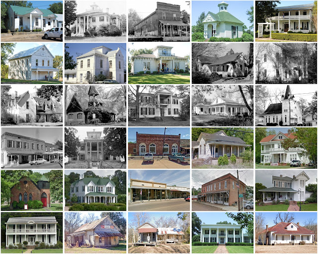
Image
Founding:  1833 Parent county:  Yazoo Namesake:  David Holmes, Mississippi politician Seat:  Lexington (1833–) Land area:  757 square miles Population (2020):  17,000 Population (historic):  9,452 (1840); 19,370 (1870); 36,828 (1900); 38,534 (1930) Periods of population growth:  pre-1840–1910; 1920–1940 Subdivisions:  Two cities; five towns Pre-1940 residences (estimated):  493 (6.5%) Pre-1940 housing survival rate:  8.8% Pre-1860 housing survival rate (1940):  7.2% Farm housing in disrepair (1950):  41.3% Nonfarm housing in disrepair (1950):  28.6% Average farmhouse value (1930):  $304 Average outbuilding value (1930):  $112 Average farmhouse size (1940):  3.6 rooms Number of farms (1920):  6,240 Average farm size (1920):  34 acres _________________________________________________________________________________   Lexington   Namesake:  Lexington, Massachusetts F...
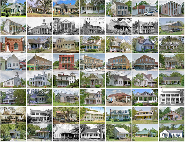
Wilkinson County, Mississippi

Image
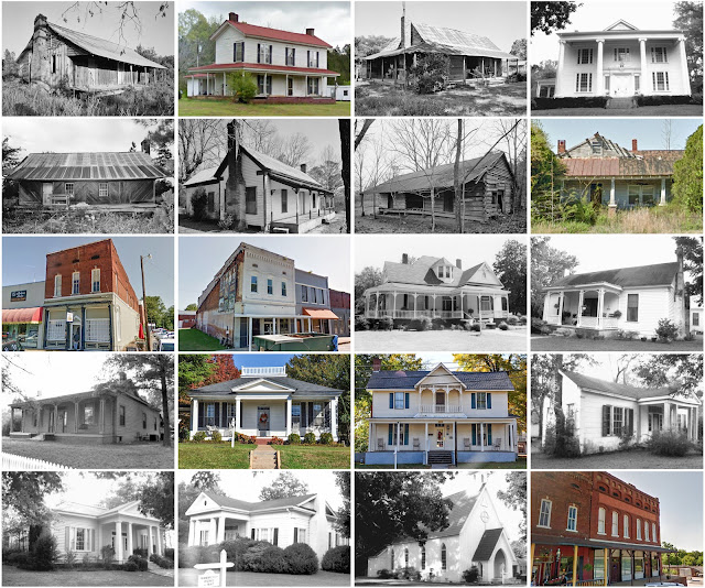
Founding:  1802 Parent county:  Adams Namesake:  James Wilkinson, Louisiana territorial governor Seat:   Pinckneyville (1806–1810s); Woodville (1810s–) Land area:  678 square miles Population (2020):  8,587 Population (historic):  5,068 (1810); 14,193 (1840); 12,705 (1870); 21,453 (1900); 13,957 (1930) Periods of population growth:  pre-1810–1850; 1870s; 1890s; 1930s; 1990s Subdivisions:  Three towns Pre-1940 residences (estimated):  160 (3.1%) Pre-1940 housing survival rate:  10% Pre-1860 housing survival rate (1940):  8.2% Farm housing in disrepair (1950):  48.5% Nonfarm housing in disrepair (1950):  26.8% Average farmhouse value (1930):  $305 Average outbuilding value (1930):  $129 Average farmhouse size (1940):  3.5 rooms Number of farms (1920):  2,436 Average farm size (1920):  44.2 acres ____________________________________________________________________________...

Carroll County, Mississippi

Image
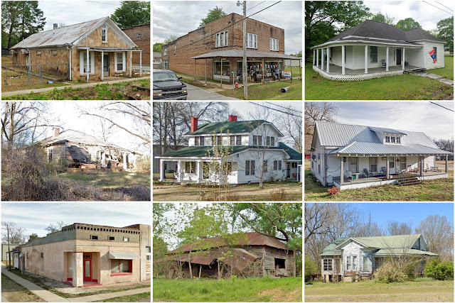
Founding:  1833 Parent counties:  Lowndes, Monroe, Washington, and Yazoo Namesake:  Charles Carroll, Maryland politician Seat:  Carrollton (1834–) and Vaiden Land area:  628 square miles Population (2020):  9,998 Population (historic):  10,481 (1840); 22,035 (1860); 17,795 (1880); 22,116 (1900); 19,765 (1930) Periods of population growth:  pre-1840–1860; 1880–1910; 1930s; 1970s; 1990s Subdivisions:  Three towns Pre-1940 residences (estimated):  211 (4.1%) Pre-1940 housing survival rate:  8% Pre-1860 housing survival rate (1940):  4.3% Farm housing in disrepair (1950):  46.8% Nonfarm housing in disrepair (1950):  34.5% Average farmhouse value (1930):  $214 Average outbuilding value (1930):  $79 Average farmhouse size (1940):  3.7 rooms Number of farms (1920):  3,963 Average farm size (1920):  42.6 acres _________________________________________________________________________________   Car...

Claiborne County, Mississippi

Image
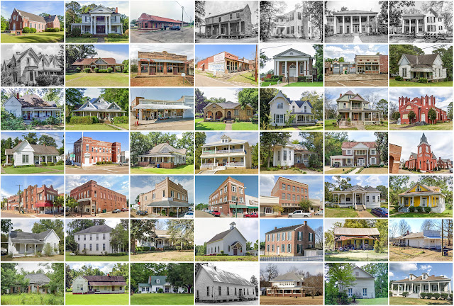
Founding:  1802 Parent county:  Jefferson Namesake:  William Claiborne, Louisiana governor Seat:  Port Gibson (1802–) Land area:  487 square miles Population (2020):  9,135 Population (historic):  3,102 (1810); 13,078 (1840); 13,386 (1870); 20,787 (1900); 12,152 (1930) Periods of population growth:  pre-1810–1860; 1870s; 1890s; 1930s; 1970s; 1990s Subdivisions:  One city; one CDP Pre-1940 residences (estimated):  216 (5%) Pre-1940 housing survival rate:  8.1% Pre-1860 housing survival rate (1940):  7.1% Farm housing in disrepair (1950):  38.2% Nonfarm housing in disrepair (1950):  34.9% Average farmhouse value (1930):  $401 Average outbuilding value (1930):  $123 Average farmhouse size (1940):  3.6 rooms Number of farms (1920):  2,154 Average farm size (1920):  52.7 acres _________________________________________________________________________________ Port Gibson Namesake:  Samuel Gibson...

Tishomingo County, Mississippi

Image
  Founding:  1836 Parent county:  Unorganized territory Namesake:  Tishomingo, Chickasaw chief Seat:   Jacinto (1836–1870); Iuka (1870–) Land area:  424 square miles Population (2020):  18,850 Population (historic):  6,681 (1840); 24,149 (1860); 8,774 (1880); 10,124 (1900); 16,411 (1930) Periods of population growth:  pre-1840–1860; 1870–1940; 1960–1980; 1990–2010 Subdivisions:  One city; three towns; two villages Pre-1940 residences (estimated):  462 (4.4%) Pre-1940 housing survival rate:  15.4% Pre-1860 housing survival rate (1940):  0.8% Farm housing in disrepair (1950):  46.2% Nonfarm housing in disrepair (1950):  35.7% Average farmhouse value (1930):  $283 Average outbuilding value (1930):  $107 Average farmhouse size (1940):  3.7 rooms Number of farms (1920):  2,250 Average farm size (1920):  29 acres Sources of settlement:  Alabama, Tennessee, South Carolina, and Georgia _____...

Humphreys County, Mississippi

Image
Founding:  1918 Parent counties:  Holmes, Sunflower, Washington, and Yazoo Namesake:  Benjamin Humphreys, Mississippi governor Seat:  Belzoni (1918–) Land area:  418 square miles Population (2020):  7,785 Population (historic):  19,192 (1920); 24,729 (1930); 26,257 (1940) Periods of population growth:  pre-1920–1940 Subdivisions:  One city; three towns Pre-1940 residences (estimated):  281 (7.3%) Pre-1940 housing survival rate:  5.5% Farm housing in disrepair (1950):  48.8% Nonfarm housing in disrepair (1950):  43.8% Average farmhouse value (1930):  $343 Average outbuilding value (1930):  $40 Average farmhouse size (1940):  3.3 rooms Number of farms (1920):  3,695 Average farm size (1920):  26.4 acres _________________________________________________________________________________ Belzoni Namesake:  Giovanni Belzoni, Italian explorer Founding:  1895 (pla...

Franklin County, Mississippi

Image
Founding:  1809 Parent county:  Adams Namesake:  Benjamin Franklin, Founding Father Seat:   Franklin (1809–1820); Meadville (1820–) Land area:  564 square miles Population (2020):  7,675 Population (historic):  2,016 (1810); 5,904 (1850); 7,498 (1870); 13,678 (1900); 12,268 (1930) Periods of population growth:  pre-1810–1860; 1870–1910; 1930s; 1970–2000 Subdivisions:  Three towns Pre-1940 residences (estimated):  155 (3.7%) Pre-1940 housing survival rate:  14.7% Pre-1860 housing survival rate (1940):  6.1% Farm housing in disrepair (1950):  21.2% Nonfarm housing in disrepair (1950):  24.6% Average farmhouse value (1930):  $303 Average outbuilding value (1930):  $102 Average farmhouse size (1940):  4.1 rooms Number of farms (1920):  2,210 Average farm size (1920):  38 acres _________________________________________________________________________________ Meadville ...

Benton County, Mississippi

Image
Founding:  1870 Parent counties:  Marshall and Tippah Namesake:  Uncertain—likely Thomas Benton, Missouri politician Seat:  Ashland (1871–) Land area:  407 square miles Population (2020):  7,646 Population (historic):  11,023 (1880); 10,510 (1900); 9,813 (1930) Periods of population growth:  pre-1880; 1930s; 1970s; 2000s Subdivisions:  Three towns Pre-1940 residences (estimated):  154 (3.6%) Pre-1940 housing survival rate:  9.9% Farm housing in disrepair (1950):  45.9% Nonfarm housing in disrepair (1950):  36.3% Average farmhouse value (1930):  $254 Average outbuilding value (1930):  $97 Average farmhouse size (1940):  3.4 rooms Number of farms (1920):  1,904 Average farm size (1920):  36.9 acres Sources of settlement:  Mississippi, Tennessee, Alabama, and North Carolina _________________________________________________________________________________ Ashland N...

Sharkey County, Mississippi

Image
Founding:  1876 Parent county:  Issaquena Namesake:  William Sharkey, Mississippi governor Seat:  Rolling Fork (1876–) Land area:  432 square miles Population (2020):  3,800 Population (historic):  6,306 (1880); 12,178 (1900); 13,877 (1930) Periods of population growth:  pre-1880–1910; 1930s Subdivisions:  One city; two towns Pre-1940 residences (estimated):  110 (5.2%) Pre-1940 housing survival rate:  5.8% Farm housing in disrepair (1950):  53% Nonfarm housing in disrepair (1950):  39.9% Average farmhouse value (1930):  $422 Average outbuilding value (1930):  $142 Average farmhouse size (1940):  3.3 rooms Number of farms (1920):  3,142 Average farm size (1920):  21.9 acres _________________________________________________________________________________ Rolling Fork Namesake:  Rapids along Deer Creek Founding:  1848 (post office) Population (2020): ...

Jefferson County, Mississippi

Image
Founding:  1802 (declared in 1799) Parent county:  Unorganized territory Namesake:  Thomas Jefferson, U.S. president Seat:   Greenville (1803–1825); Fayette (1825–) Land area:  520 square miles Population (2020):  7,260 Population (historic):  2,940 (1800); 11,650 (1840); 13,848 (1870); 21,292 (1900); 14,291 (1930) Periods of population growth:  pre-1800–1860; 1870–1900; 1990s Subdivisions:  One city Pre-1940 residences (estimated):  245 (6.6%) Pre-1940 housing survival rate:  5.8% Pre-1860 housing survival rate (1940):  10.1% Farm housing in disrepair (1950):  42.8% Nonfarm housing in disrepair (1950):  35.4% Average farmhouse value (1930):  $348 Average outbuilding value (1930):  $120 Average farmhouse size (1940):  3.6 rooms Number of farms (1920):  2,942 Average farm size (1920):  39.7 acres _________________________________________________________________________...

Issaquena County, Mississippi

Image
Founding:  1844 Parent county:  Washington Namesake:  The Choctaw name for Deer Creek, which flows through the county Seat:   Duncansby  (1844–1848); Tallula (1848–1871); Mayersville (1871–) Land area:  413 square miles Population (2020):  1,338 Population (historic):  4,478 (1850); 6,887 (1870); 12,318 (1890); 10,560 (1910); 5,734 (1930) Periods of population growth:  pre-1850–1860; 1870–1890; 1900s; 1930s; 1990s Subdivisions:  One town Pre-1940 residences (estimated):  29 (5.4%) Pre-1940 housing survival rate:  3% Pre-1860 housing survival rate (1940):  3.3% Farm housing in disrepair (1950):  34.2% Nonfarm housing in disrepair (1950):  21.9% Average farmhouse value (1930):  $411 Average outbuilding value (1930):  $150 Average farmhouse value (1940):  3.1 rooms Number of farms (1920):  1,914 Average farm size (1920):  28.6 acres _________________________________...