Posts

Showing posts with the label virginia

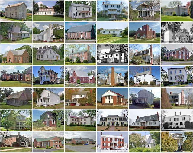
Charles City County, Virginia

Image
Founding:  1634 Parent county:  Unorganized territory Namesake:  Charles I, King of England Seat:   City Point (1634–1639); Westover (1639–1730); Charles City (1730–) Land area:  183 square miles Population (2020):  6,773 Population (historic):  5,588 (1790); 4,774 (1840); 4,975 (1870); 5,040 (1900); 4,881 (1930) Periods of population growth:  pre-1790; 1810–1830; 1840–1860; 1870s; 1900s; 1920s; 1940–1980; 1990–2010 Subdivisions:  One CDP Pre-1940 residences (estimated):  217 (6.7%) Pre-1940 housing survival rate:  28.9% Pre-1860 housing survival rate (1940):  20.4% Farm housing in disrepair (1950):  15.7% Nonfarm housing in disrepair (1950):  24.5% Average farmhouse value (1930):  $880 Average outbuilding value (1930):  $541 Average farmhouse size (1940):  5.7 rooms Number of farms (1920):  614 Average farm size (1920):  46.6 acres ____________________________________________________________...
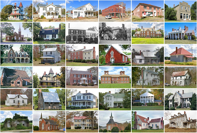
Westmoreland County, Virginia

Image
Founding:  1653 Parent county:  Northumberland Namesake:  Westmorland, England Seat:   Currioman Bay (1653–1680s); Montross (1680s–) Land area:  229 square miles Population (2020):  18,477 Population (historic):  6,901 (1820); 8,080 (1850); 7,682 (1870); 9,243 (1900); 8,497 (1930) Periods of population growth:  pre-1790–1810; 1820s; 1840–1860; 1870s; 1890–1920; 1930–2020 Subdivisions:  Two towns Pre-1940 residences (estimated):  974 (8.8%) Pre-1940 housing survival rate:  40.5% Pre-1860 housing survival rate (1940):  9.8% Farm housing in disrepair (1950):  10.3% Nonfarm housing in disrepair (1950):  13.6% Average farmhouse value (1930):  $1,275 Average outbuilding value (1930):  $559 Average farmhouse size (1940):  5.1 rooms Number of farms (1920):  1,455 Average farm size (1920):  41.5 acres _________________________________________________________________________________...
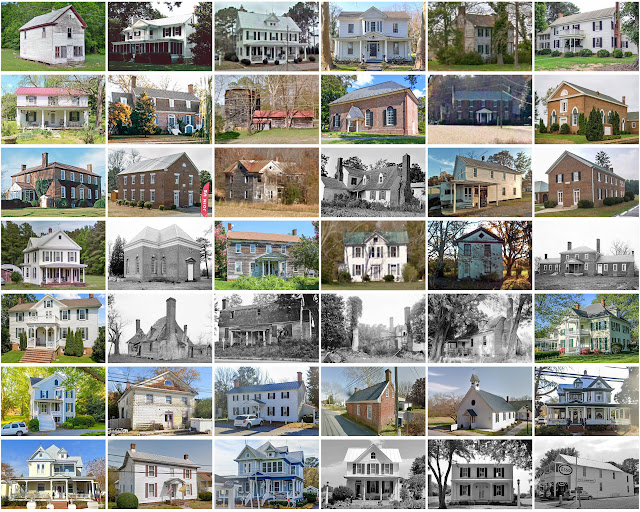
Lancaster County, Virginia

Image
Founding:  1651 Parent counties:  Northumberland and York Namesake:  Lancaster, England Seat:  Lancaster (1740–) Land area:  133 square miles Population (2020):  10,919 Population (historic):  5,638 (1790); 4,628 (1840); 5,355 (1870); 8,949 (1900); 8,896 (1930) Periods of population growth:  pre-1790; 1800s; 1840–1910; 1950s; 1970–2000 Subdivisions:  Three towns; two CDPs Pre-1940 residences (estimated):  940 (12.6%) Pre-1940 housing survival rate:  45.2% Pre-1860 housing survival rate (1940):  15.4% Farm housing in disrepair (1950):  13.3% Nonfarm housing in disrepair (1950):  13.4% Average farmhouse value (1930):  $944 Average outbuilding value (1930):  $313 Average farmhouse size (1940):  6.1 rooms Number of farms (1920):  1,256 Average farm size (1920):  22.2 acres _____________________________________________...

King George County, Virginia

Image
Founding:  1721 Parent county:  Richmond Namesake:  George I of Great Britain Seat:  King George (1720–) Land area:  180 square miles Population (2020):  26,723 Population (historic):  7,366 (1790); 5,927 (1840); 5,742 (1870); 6,918 (1900); 5,297 (1930) Periods of population growth:  pre-1790; 1820s; 1840–1860; 1870–1900; 1930–2020 Subdivisions:  Five CDPs Pre-1940 residences (estimated):  391 (3.8%) Pre-1940 housing survival rate:  33.7% Pre-1860 housing survival rate (1940):  19.4% Farm housing in disrepair (1950):  16.9% Nonfarm housing in disrepair (1950):  14% Average farmhouse value (1930):  $1,320 Average outbuilding value (1930):  $506 Average farmhouse size (1940):  5.4 rooms Number of farms (1920):  1,008 Average farm size (19...

King and Queen County, Virginia

Image
Founding:  1691 Parent county:  New Kent Namesake:  King William III and Queen Mary II of England Seat:  King and Queen Court House (1691–) Land area:  315 square miles Population (2020):  6,608 Population (historic):  9,377 (1790); 10,862 (1840); 9,709 (1870); 9,265 (1900); 7,618 (1930) Periods of population growth:  pre-1790–1820; 1870s; 1900s; 1970–2010 Subdivisions:  One CDP Pre-1940 residences (estimated):  363 (10.5%) Pre-1940 housing survival rate:  25.2% Pre-1860 housing survival rate (1940):  20.3% Farm housing in disrepair (1950):  35.6% Nonfarm housing in disrepair (1950):  34.6% Average farmhouse value (1930):  $899 Average outbuilding value (1930):  $281 Average farmhouse size (1940):  5.7 rooms Number of farms (1920):  1,534 Average farm size (1920):  36.5 acres _________________________________________________________________________________   King and Q...

New Kent County, Virginia

Image
Founding:  1654 Parent county:  York Namesake:  Kent, England Seat:  New Kent (1654–) Land area:  210 square miles Population (2020):  22,945 Population (historic):  6,239 (1790); 6,230 (1840); 4,381 (1870); 4,865 (1900); 4,300 (1930) Periods of population growth:  pre-1790–1820; 1870s; 1950–2020 Subdivisions:  One CDP Pre-1940 residences (estimated):  534 (6.1%) Pre-1940 housing survival rate:  23.1% Pre-1860 housing survival rate (1940):  22.8% Farm housing in disrepair (1950):  29.6% Nonfarm housing in disrepair (1950):  35.5% Average farmhouse value (1930):  $1,141 Average outbuilding value (1930):  $470 Average farmhouse size (1940):  5.2 rooms Number of farms (1920):  679 Average farm size (1920):  36.6 acres _________________________________________________________________________________   New Kent   Namesake:  Kent, England Founding:  circa 1654...

Powhatan County, Virginia

Image
Founding:  1777 Parent county:  Cumberland Namesake:  Powhatan, Powhatan chief Seat:  Powhatan (1777–) Land area:  260 square miles Population (2020):  30,033 Population (historic):  6,822 (1790); 7,924 (1840); 7,667 (1870); 6,824 (1900); 6,143 (1930) Periods of population growth:  pre-1790–1830; 1840–1860; 1870s; 1910s; 1950–2020 Subdivisions:  One CDP Pre-1940 residences (estimated):  415 (3.7%) Pre-1940 housing survival rate:  38.7% Pre-1860 housing survival rate (1940):  22.5% Farm housing in disrepair (1950):  27.1% Nonfarm housing in disrepair (1950):  30.3% Average farmhouse value (1930):  $1,351 Average outbuilding value (1930):  $671 Average farmhouse size (1940):   Number of farms (1920):  1,048 Average farm size (1920):  45 acres _________________________________________________________________________________   Powhatan   Namesake:  Powhatan,...

Greensville County, Virginia

Image
Founding:  1781 Parent county:  Brunswick Namesake:  Uncertain—perhaps Richard Grenville, English explorer Seat:  Emporia (1781–) Land area:  295 square miles Population (2020):  11,391 Population (historic):  6,362 (1790); 6,366 (1840); 6,362 (1870); 9,758 (1900); 13,388 (1930) Periods of population growth:  pre-1790–1830; 1850s; 1870s; 1890–1910; 1920–1950; 1970s; 1990s Subdivisions:  One city; one town Pre-1940 residences (estimated):  407 (9.7%) Pre-1940 housing survival rate:  11.1% Pre-1860 housing survival rate (1940):  17.2% Farm housing in disrepair (1950):  31.2% Nonfarm housing in disrepair (1950):  24.1% Average farmhouse value (1930):  $716 Average outbuilding value (1930):  $317 Average farmhouse size (1940):  4.3 rooms Number of farms (1920):  1,328 Average farm size (1920):  33.7 acres _________________________________________________________________________________  ...

Northampton County, Virginia

Image
Founding:  1634 Parent county:  Unorganized territory Namesake:  Northamptonshire, England Seat:  Eastville (1690–) Land area:  212 square miles Population (2020):  12,282 Population (historic):  6,889 (1790); 7,715 (1840); 8,046 (1870); 13,770 (1900); 18,565 (1930) Periods of population growth:  pre-1790; 1800–1830; 1850–1930; 1970s Subdivisions:  Five town; two CDPs Pre-1940 residences (estimated):  1,489 (20%) Pre-1940 housing survival rate:  38.8% Pre-1860 housing survival rate (1940):  17.8% Farm housing in disrepair (1950):  24.9% Nonfarm housing in disrepair (1950):  18.4% Average farmhouse value (1930):  $2,249 Average outbuilding value (1930):  $964 Average farmhouse size (1940):  5 rooms Number of farms (1920):  1,259 Average farm size (1920):  38.1 acres _________________________________________________________________________________   Eastville   Namesake:  Perhaps ...

Montgomery County, Virginia

Image
Founding:  1776 Parent county:  Fincastle Namesake:  Richard Montgomery, Continental Army general Seat:  Christiansburg (1777–) Land area:  387 square miles Population (2020):  99,721 Population (historic):  13,228 (1790); 7,405 (1840); 12,556 (1870); 15,852 (1900); 19,605 (1930) Periods of population growth:  pre-1790; 1810–1830; 1840–1890; 1900–2020 Subdivisions:  Two towns; eight CDPs Pre-1940 residences (estimated):  2,439 (5.7%) Pre-1940 housing survival rate:  41.9% Pre-1860 housing survival rate (1940):  22.1% Farm housing in disrepair (1950):  11.2% Nonfarm housing in disrepair (1950):  10.2% Average farmhouse value (1930):  $1,353 Average outbuilding value (1930):  $716 Average farmhouse size (1940):  5.4 rooms Number of farms (1920):  1,860 Average farm size (1920):  64.7 acres _________________________________________________________________________________   Christiansburg ...