Posts

Showing posts with the label west virginia

Kanawha County, West Virginia
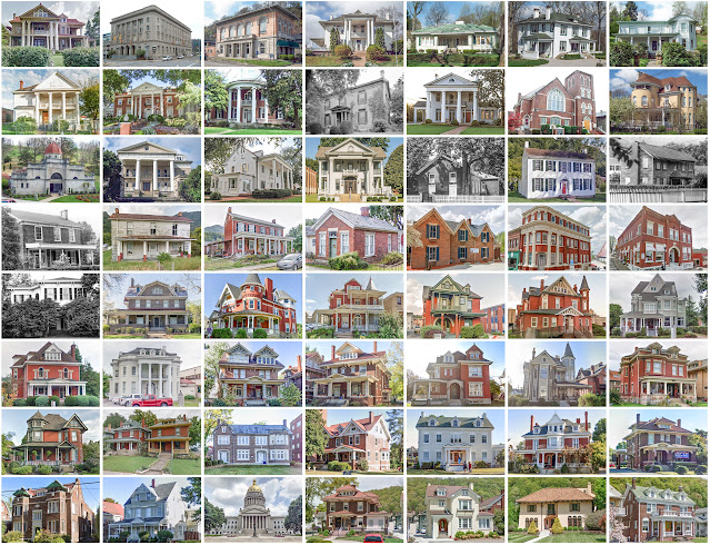
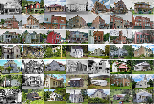
Image
Founding:  1789 Parent counties:  Greenbrier and Montgomery Namesake:  The Kanawha River Seat:  Charleston (1789–) Land area:  902 square miles Population (2020):  180,745 Population (historic):  3,239 (1800); 13,567 (1840); 22,349 (1870); 54,696 (1900); 157,667 (1930) Periods of population growth:  pre-1800–1960 Subdivisions:  Six cities; eight towns; 12 CDPs Pre-1940 residences (estimated):  11,631 (12.6%) Pre-1940 housing survival rate:  30.1% Pre-1860 housing survival rate (1940):  12.1% Farm housing in disrepair (1950):  17.6% Nonfarm housing in disrepair (1950):  11% Average farmhouse value (1930):  $897 Average outbuilding value (1930):  $430 Average farmhouse size (1940):  4.4 rooms Number of farms (1920):  2,952 Average farm size (1920):  40.8 acres _________________________________________________________________________________ Charleston Namesake:  Unknown Founding:  1788...
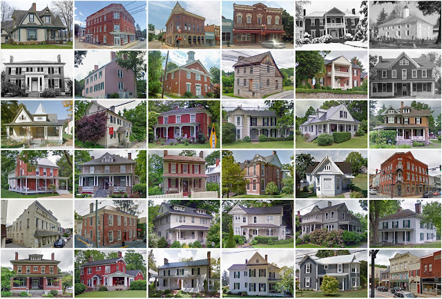
Greenbrier County, West Virginia

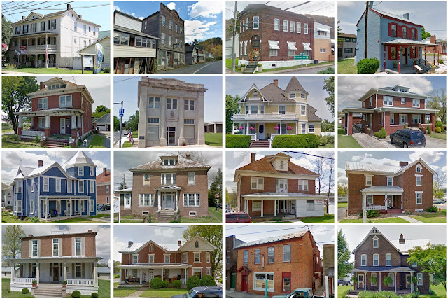
Image
Founding:  1778 Parent counties:  Botetourt and Montgomery Namesake:  The Greenbrier River Seat:  Lewisburg (1780–) Land area:  1,020 square miles Population (2020):  32,608 Population (historic):  6,015 (1790); 8,695 (1840); 11,417 (1870); 20,683 (1900); 35,878 (1930) Periods of population growth:  pre-1790; 1800–1830; 1840–1860; 1870–1950; 1970s; 2000s Subdivisions:  Three cities; four towns; one CDP Pre-1940 residences (estimated):  3,665 (19%) Pre-1940 housing survival rate:  37.2% Pre-1860 housing survival rate (1940):  15% Farm housing in disrepair (1950): 20% Nonfarm housing in disrepair (1950):  17.9% Average farmhouse value (1930):  $1,207 Average outbuilding value (1930):  $616 Average farmhouse size (1940):  5.6 rooms Number of farms (1920):  2,439 Average farm size (1920):  61.1 acres _________________________________________________________________________________ Lewisburg Namesake: ...

Nicholas County, West Virginia

Image
Founding:  1818 Parent counties:  Greenbrier, Kanawha, and Randolph Namesake:  Wilson Nicholas, Virginia politician Seat:  Summersville (1820–) Land area:  647 square miles Population (2020):  24,604 Population (historic):  1,853 (1820); 3,963 (1850); 4,458 (1870); 11,403 (1900); 20,686 (1930) Periods of population growth:  pre-1820–1830; 1840–1860; 1870–1920; 1930–1950; 1970s Subdivisions:  Two cities; seven CDPs Pre-1940 residences (estimated):  1,636 (12.4%) Pre-1940 housing survival rate:  30.4% Pre-1860 housing survival rate (1940):  4.3% Farm housing in disrepair (1950):  18% Nonfarm housing in disrepair (1950):  14% Average farmhouse value (1930):  $835 Average outbuilding value (1930):  $287 Average farmhouse size (1940):  4.9 rooms Number of farms (1920):  1,670 Average farm size (1920):  50.2 acres _________________________________________________________________________________ Summ...

Pocahontas County, West Virginia

Image
Founding:  1821 Parent counties:  Bath, Pendleton, and Randolph Namesake:  Pocahontas, daughter of Powhatan Seat:  Huntersville (1821–1891); Marlinton (1891–) Land area:  940 square miles Population (2020):  7,869 Population (historic):  2,542 (1830); 3,598 (1850); 4,069 (1870); 8,570 (1900); 14,555 (1930) Periods of population growth:  pre-1830–1920; 1970s; 1990s Subdivisions:  Three towns; six CDPs Pre-1940 residences (estimated):  1,279 (14.3%) Pre-1940 housing survival rate:  41.2% Pre-1860 housing survival rate (1940):  10.2% Farm housing in disrepair (1950):  22.8% Nonfarm housing in disrepair (1950):  24.3% Average farmhouse value (1930):  $1,008 Average outbuilding value (1930):  $550 Average farmhouse size (1940):  5.8 rooms Number of farms (1920):  1,283 Average farm size (1920):  71.8 acres _________________________________________________________________________________ Marlinton N...

Hampshire County, West Virginia

Image
  Founding:  1754 Parent counties:  Augusta and Frederick Namesake:  Hampshire, England Seat:   Fort Pleasant (1757–1762); Romney (1762–) Land area:  640 square miles Population (2020):  23,093 Population (historic):  7,346 (1790); 12,295 (1840); 7,643 (1870); 11,806 (1900); 11,836 (1930) Periods of population growth:  pre-1790–1850; 1870–1900; 1910–1940; 1970–2010 Subdivisions:  One city; one town; two CDPs Pre-1940 residences (estimated):  1,565 (11.2%) Pre-1940 housing survival rate:  40.8% Pre-1860 housing survival rate (1940):  23.2% Farm housing in disrepair (1950):  20.4% Nonfarm housing in disrepair (1950):  18.1% Average farmhouse value (1930):  $899 Average outbuilding value (1930):  $677 Average farmhouse size (1940):  5.9 rooms Number of farms (1920):  1,663 Average farm size (1920):  81 acres _________________________________________________________________________________ R...

Putnam County, West Virginia

Image
Founding:  1848 Parent counties:  Cabell, Kanawha, and Mason Namesake:  Israel Putnam, Continental Army officer Seat:  Winfield (1848–) Land area:  346 square miles Population (2020):  57,440 Population (historic):  5,335 (1850); 7,794 (1870); 14,342 (1890); 18,587 (1910); 16,737 (1930) Periods of population growth:  pre-1850–1910; 1930–2020 Subdivisions:  Two cities; five towns; two CDPs Pre-1940 residences (estimated):  1,234 (5.1%) Pre-1940 housing survival rate:  35.5% Pre-1860 housing survival rate (1940):  9% Farm housing in disrepair (1950):  27.6% Nonfarm housing in disrepair (1950):  14.2% Average farmhouse value (1930):  $753 Average outbuilding value (1930):  $435 Average farmhouse size (1940):  4.7 rooms Number of farms (1920):  1,956 Average farm size (1920):  60.2 acres _________________________________________________________________________________ ...

Berkeley County, West Virginia

Image
Founding:  1772 Parent county:  Frederick Namesake:  Unclear—either Norborne or William Berkeley, colonial Virginia governors Seat:  Martinsburg (1772–) Land area:  321 square miles Population (2020):  122,076 Population (historic):  19,713 (1790); 10,518 (1830); 14,900 (1870); 19,469 (1900); 28,030 (1930) Periods of population growth:  pre-1790–1800; 1830–2020 Subdivisions:  One city; one town; two CDPs Pre-1940 residences (estimated):  3,578 (7.2%) Pre-1940 housing survival rate:  62.9% Pre-1860 housing survival rate (1940):  32.3% Farm housing in disrepair (1950):  8.5% Nonfarm housing in disrepair (1950):  7.5% Average farmhouse value (1930):  $1,779 Average outbuilding value (1930):  $1,475 Average farmhouse size (1940):  6.5 rooms Number of farms (1920):  1,290 Average farm size (1920):  105.8 acres _______________________________________________________________...

Harrison County, West Virginia

Image
Founding:  1784 Parent county:  Monongalia Namesake:  Benjamin Harrison, Virginia politician Seat:  Clarksburg (1785–) Land area:  416 square miles Population (2020):  65,921 Population (historic):  2,080 (1790); 14,722 (1830); 16,714 (1870); 27,690 (1900); 78,567 (1830) Periods of population growth:  pre-1790–1840; 1850–1950; 1970s Subdivisions:  Five cities; five towns; six CDPs Pre-1940 residences (estimated):  7,620 (24%) Pre-1940 housing survival rate:  41.7% Pre-1860 housing survival rate (1940):  12.8% Farm housing in disrepair (1950):  25.5% Nonfarm housing in disrepair (1950):  15.5% Average farmhouse value (1930):  $1,408 Average outbuilding value (1930):  $613 Average farmhouse size (1940):  5.4 rooms Number of farms (1920):  2,271 Average farm size (1920):  88.5 acres _________________________________________________________________________________ Clar...

Gilmer County, West Virginia

Image
Founding:  1845 Parent counties:  Kanawha and Lewis Namesake:  Thomas Gilmer, Virginia governor Seat:  Glenville (1845–) Land area:  339 square miles Population (2020):  7,408 Population (historic):  3,475 (1850); 4,338 (1870); 9,746 (1890); 11,379 (1910); 10,641 (1930) Periods of population growth:  pre-1850–1900; 1930s; 1970s; 2000s Subdivisions:  Two towns Pre-1940 residences (estimated):  616 (17.5%) Pre-1940 housing survival rate:  29.1% Pre-1860 housing survival rate (1940):  7.5% Farm housing in disrepair (1950):  24% Nonfarm housing in disrepair (1950):  20.9% Average farmhouse value (1930):  $813 Average outbuilding value (1930):  $369 Average farmhouse size (1940):  4.8 rooms Number of farms (1920):  1,526 Average farm size (1920):  80.4 acres _________________________________________________________________________________ Glenville Namesake:  A ...

Pendleton County, West Virginia

Image
Founding:  1788 Parent counties:  Augusta, Hardy, and Rockingham Namesake:  Edmund Pendleton, Virginia politician Seat:   Ruddle (1788–1794); Franklin (1794–) Land area:  696 square miles Population (2020):  6,143 Population (historic):  2,452 (1790); 6,271 (1830); 6,455 (1870); 9,167 (1900); 9,660 (1930) Periods of population growth:  pre-1790–1840; 1850–1940; 1970–2000 Subdivisions:  One town; one CDP Pre-1940 residences (estimated):  1,065 (20.5%) Pre-1940 housing survival rate:  48.5% Pre-1860 housing survival rate (1940):  8% Farm housing in disrepair (1950):  23.9% Nonfarm housing in disrepair (1950):  26.8% Average farmhouse value (1930):  $983 Average outbuilding value (1930):  $644 Average farmhouse size (1940):  5.7 rooms Number of farms (1920):  1,342 Average farm size (1920):  82.7 acres _____________________________________________________________________...

Barbour County, West Virginia

Image
Founding:  1843 Parent counties:  Harrison, Lewis, and Randolph Namesake:  Philip Barbour, Virginia politician Seat:  Philippi (1843–) Land area:  341 square miles Population (2020):  15,465 Population (historic):  9,005 (1850); 10,312 (1870); 12,702 (1890); 15,858 (1910); 18,628 (1930) Periods of population growth:  pre-1850; 1860–1940; 1970s; 2000s Subdivisions:  One city; two towns; two CDPs Pre-1940 residences (estimated):  1,942 (24.6%) Pre-1940 housing survival rate:  33% Pre-1860 housing survival rate (1940):  10.2% Farm housing in disrepair (1950):  26.1% Nonfarm housing in disrepair (1950):  24.3% Average farmhouse value (1930):  $877 Average outbuilding value (1930):  $399 Average farmhouse size (1940):  5.2 rooms Number of farms (1920):  1,837 Average farm size (1920):  71.2 acres _____________________________________________________________________________...

Roane County, West Virginia

Image
Founding:  1856 Parent counties:  Gilmer, Jackson, and Kanawha Namesake:  Spencer Roane, Virginia politician Seat:  Spencer (1856–) Land area:  484 square miles Population (2020):  14,028 Population (historic):  5,381 (1860); 12,184 (1880); 19,852 (1900); 19,478 (1930) Periods of population growth:  pre-1860–1910; 1930s; 1970s; 1990s Subdivisions:  One city; one town Pre-1940 residences (estimated):  1,473 (19.8%) Pre-1940 housing survival rate:  34.8% Pre-1860 housing survival rate (1940):  3.2% Farm housing in disrepair (1950):  21.9% Nonfarm housing in disrepair (1950):  17.7% Average farmhouse value (1930):  $969 Average outbuilding value (1930):  $438 Average farmhouse size (1940):  5.5 rooms Number of farms (1920):  2,448 Average farm size (1920):  78.4 acres _________________________________________________________________________________ Spencer Namesake...

Grant County, West Virginia

Image
Founding:  1866 Parent county:  Hardy Namesake:  Ulysses S. Grant, U.S. president Seat:   Laurelton (1866); Maysville (1866–1872); Petersburg (1872–) Land area:  477 square miles Population (2020):  10,976 Population (historic):  4,467 (1870); 6,802 (1890); 7,838 (1910); 8,441 (1930) Periods of population growth:  pre-1870–1920; 1930s; 1960–2010 Subdivisions:  One city; one town Pre-1940 residences (estimated):  1,133 (17.3%) Pre-1940 housing survival rate:  37.8% Farm housing in disrepair (1950):  17.9% Nonfarm housing in disrepair (1950):  16.1% Average farmhouse value (1930):  $856 Average outbuilding value (1930):  $539 Average farmhouse size (1940):  5.5 rooms Number of farms (1920):  793 Average farm size (1920):  121.4 acres _________________________________________________________________________________ Petersburg Namesake:  Jacob Peterson, local residen...

Preston County, West Virginia

Image
Founding:  1818 Parent county:  Monongalia Namesake:  James Preston, Virginia governor Seat:  Kingwood (1818–) Land area:  649 square miles Population ( 2020 ):  34,216 Population (historic):  3,422 (1820); 11,708 (1850); 14,555 (1870); 22,727 (1900); 29,043 (1930) Periods of population growth:  pre-1820–1950; 1970s; 1990–2020 Subdivisions:  One city; nine towns; one CDP Pre-1940 residences (estimated):  3,295 (21.8%) Pre-1940 housing survival rate:  40.6% Pre-1860 housing survival rate (1940):  10.7% Farm housing in disrepair (1950):  21.2% Nonfarm housing in disrepair (1950): 16% Average farmhouse value (1930):  $909 Average outbuilding value (1930):  $641 Average farmhouse size (1940):  5.7 rooms Number of farms (1920):  2,406 Average farm size (1920):  63.1 acres _________________________________________________________________________________ Kingwood Namesake: ...

Fayette County, West Virginia

Image
Founding:  1831 Parent counties:  Greenbrier, Kanawha, Logan, and Nicholas Namesake:  The Marquis de Lafayette, Continental Army general Seat:   New Haven (1831–1837); Fayetteville (1837–) Land area:  662 square miles Population (2020):  40,488 Population (historic):  3,924 (1840); 5,997 (1860); 11,560 (1880); 31,987 (1900); 72,050 (1930) Periods of population growth:  pre-1840–1950; 1970s Subdivisions:  Four cities; six towns; 18 CDPs Pre-1940 residences (estimated):  4,664 (21.6%) Pre-1940 housing survival rate:  27% Pre-1860 housing survival rate (1940):  7% Farm housing in disrepair (1950):  22.2% Nonfarm housing in disrepair (1950):  16.7% Average farmhouse value (1930):  $988 Average outbuilding value (1930):  $438 Average farmhouse size (1940):  5 rooms Number of farms (1920):  1,461 Average farm size (1920):  32.5 acres _______________________________________...