Posts

Showing posts from June, 2020

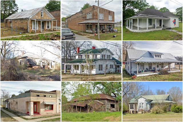
Franklin County, Mississippi

Image
Founding:  1809 Parent county:  Adams Namesake:  Benjamin Franklin, Founding Father Seat:   Franklin (1809–1820); Meadville (1820–) Land area:  564 square miles Population (2020):  7,675 Population (historic):  2,016 (1810); 5,904 (1850); 7,498 (1870); 13,678 (1900); 12,268 (1930) Periods of population growth:  pre-1810–1860; 1870–1910; 1930s; 1970–2000 Subdivisions:  Three towns National Register listings:   Five Pre-1940 residences (estimated):  155 (3.7%) Pre-1940 housing survival rate:  14.7% Pre-1860 housing survival rate (1940):  6.1% Farm housing in disrepair (1950):  21.2% Nonfarm housing in disrepair (1950):  24.6% Average farmhouse value (1930):  $303 Average outbuilding value (1930):  $102 Average farmhouse size (1940):  4.1 rooms Number of farms (1920):  2,210 Average farm size (1920):  38 acres _________________________________________________________________________________ Meadville Namesake:  Cowles Mead, Mississippi politician Found

Tazewell County, Illinois

Image
Founding:  1827 Parent county:  Unorganized territory Namesake:  Littleton Tazewell, Virginia governor Seat:  Mackinaw (1827–1831); Pekin (1831–) Land area:  649 square miles Population (2020):  131,343 Population (historic):  4,716 (1830); 12,052 (1850); 27,903 (1870); 33,221 (1900); 46,082 (1930) Periods of population growth:  pre-1830–1880; 1890–1980; 1990–2010 Subdivisions:  Six cities; ten villages; one CDP; 19 townships National Register listings:   18 Pre-1940 residences (estimated):  9,375 (15.9%) Pre-1940 housing survival rate:  48% Pre-1860 housing survival rate (1940):  15.5% Farm housing in disrepair (1950):  5.8% Nonfarm housing in disrepair (1950):  8.6% Average farmhouse value (1930):  $2,561 Average outbuilding value (1930):  $2,426 Average farmhouse size (1940):  6.9 rooms Number of farms (1920):  2,536 Average farm size (1920):  131.6 acres Sources of settlement:  Germany, Ohio, Pennsylvania, New York, Ireland, Kentucky, and Virginia ______

Benton County, Mississippi

Image
Founding:  1870 Parent counties:  Marshall and Tippah Namesake:  Uncertain—likely Thomas Benton, Missouri politician Seat:  Ashland (1871–) Land area:  407 square miles Population (2020):  7,646 Population (historic):  11,023 (1880); 10,510 (1900); 9,813 (1930) Periods of population growth:  pre-1880; 1930s; 1970s; 2000s Subdivisions:  Three towns National Register listings:   One Pre-1940 residences (estimated):  154 (3.6%) Pre-1940 housing survival rate:  9.9% Farm housing in disrepair (1950):  45.9% Nonfarm housing in disrepair (1950):  36.3% Average farmhouse value (1930):  $254 Average outbuilding value (1930):  $97 Average farmhouse size (1940):  3.4 rooms Number of farms (1920):  1,904 Average farm size (1920):  36.9 acres Sources of settlement:  Mississippi, Tennessee, Alabama, and North Carolina _________________________________________________________________________________ Ashland Namesake:  Ashland, Henry Clay's estate Founding:  18

Sharkey County, Mississippi

Image
Founding:  1876 Parent county:  Issaquena Namesake:  William Sharkey, Mississippi governor Seat:  Rolling Fork (1876–) Land area:  432 square miles Population (2020):  3,800 Population (historic):  6,306 (1880); 12,178 (1900); 13,877 (1930) Periods of population growth:  pre-1880–1910; 1930s Subdivisions:  One city; two towns National Register listings:   Six Pre-1940 residences (estimated):  110 (5.2%) Pre-1940 housing survival rate:  5.8% Farm housing in disrepair (1950):  53% Nonfarm housing in disrepair (1950):  39.9% Average farmhouse value (1930):  $422 Average outbuilding value (1930):  $142 Average farmhouse size (1940):  3.3 rooms Number of farms (1920):  3,142 Average farm size (1920):  21.9 acres _________________________________________________________________________________ Rolling Fork Namesake:  Rapids along Deer Creek Founding:  1848 (post office) Population (2020):  1,883 Population (historic):  91 (1880); 703 (1920); 902 (1930)

Renville County, North Dakota

Image
Founding:  1910 Parent county:  Ward Namesake:  Joseph Renville, French Canadian trapper Seat:  Mohall (1910–) Land area:  877 square miles Population (2020):  2,282 Population (historic):  7,840 (1910); 7,776 (1920); 7,263 (1930) Periods of population growth:  pre-1910 Subdivisions:  Six cities; 24 townships National Register listings:   Two Pre-1940 residences (estimated):  339 (25.5%) Pre-1940 housing survival rate:  24.3% Farm housing in disrepair (1950):  10.5% Nonfarm housing in disrepair (1950):  10.7% Average farmhouse value (1930):  $1,363 Average outbuilding value (1930):  $1,430 Average farmhouse size (1940):  5.3 rooms Number of farms (1920):  1,174 Average farm size (1920):  356.8 acres Sources of settlement:  Minnesota, Iowa, Norway, Germany, Denmark, and Sweden _________________________________________________________________________________ Mohall Namesake:  M.O. Hall, owner of the city site Founding:  1901 (platting as Hall ); 1902

Oliver County, North Dakota

Image
Founding:  1885 Parent county:  Mercer Namesake:  Harry Oliver, North Dakota politician Seat:   Sanger (1885–1902); Center (1902–) Land area:  723 square miles Population (2020):  1,877 Population (historic):  464 (1890); 3,577 (1910); 4,262 (1930) Periods of population growth:  1880–1920 Subdivisions:  One city; two territories National Register listings:   One Pre-1940 residences (estimated):  138 (13.8%) Pre-1940 housing survival rate:  27.1% Farm housing in disrepair (1950):  10.1% Nonfarm housing in disrepair (1950):  5.6% Average farmhouse value (1930):  $1,102 Average outbuilding value (1930):  $1,294 Average farmhouse size (1940):  4.7 rooms Number of farms (1920):  766 Average farm size (1920):  241.7 acres Sources of settlement:  Minnesota, Russia, Germany, and Iowa _________________________________________________________________________________ Center Namesake:  The city's location within Oliver County Founding:  1902 (platting); 190

McHenry County, Illinois

Image
Founding:  1837 (declared in 1836) Parent county:  Cook Namesake:  William McHenry, Illinois politician Seat:  McHenry (1836–1843); Woodstock (1843–) Land area:  603 square miles Population (2020):  310,229 Population (historic):  2,578 (1840); 22,089 (1860); 24,908 (1880); 29,759 (1900); 35,079 (1930) Periods of population growth:  pre-1840–2020 Subdivisions:  Five cities; two CDPs; 17 townships National Register listings:   13 Pre-1940 residences (estimated):  9,246 (7.8%) Pre-1940 housing survival rate:  82.7% Pre-1860 housing survival rate (1940):  12.5% Farm housing in disrepair (1950):  4.5% Nonfarm housing in disrepair (1950):  2% Average farmhouse value (1930):  $2,483 Average outbuilding value (1930):  $3,560 Average farmhouse size (1940):  7.6 rooms Number of farms (1920):  2,874 Average farm size (1920):  92 acres Sources of settlement:  New York, Germany, Ireland, Wisconsin, and Vermont ____________________________________________________________

Vermilion County, Illinois

Image
Founding:  1826 Parent county:  Clark Namesake:  The Vermilion River Seat:  Danville (1827–) Land area:  898 square miles Population (2020):  74,188 Population (historic):  5,836 (1830); 11,492 (1850); 30,388 (1870); 65,635 (1900); 89,339 (1930) Periods of population growth:  pre-1830–1930; 1940–1970 Subdivisions:  Three cities; 18 villages; one CDP; 19 townships National Register listings:   15 Pre-1940 residences (estimated):  12,742 (35.3%) Pre-1940 housing survival rate:  45.1% Pre-1860 housing survival rate (1940):  6.7% Farm housing in disrepair (1950):  8.5% Nonfarm housing in disrepair (1950):  8.6% Average farmhouse value (1930):  $1,963 Average outbuilding value (1930):  $1,562 Average farmhouse size (1940):  6.1 rooms Number of farms (1920):  3,587 Average farm size (1920):  133.6 acres Sources of settlement:  Indiana, Ohio, Kentucky, Germany, and Pennsylvania _________________________________________________________________________________ Da

DuPage County, Illinois

Image
Founding:  1839 Parent county:  Cook Namesake:  The DuPage River Seat:  Naperville (1839–1867); Wheaton (1867–) Land area:  327 square miles Population (2020):  932,877 Population (historic):  3,535 (1840); 14,701 (1860); 19,161 (1880); 28,196 (1900); 91,998 (1930) Periods of population growth:  pre-1840–2020 Subdivisions:  Seven cities; 20 villages; nine townships National Register listings:   50 Pre-1940 residences (estimated):  19,432 (5.4%) Pre-1940 housing survival rate:  76.3% Pre-1860 housing survival rate (1940):  19.8% Farm housing in disrepair (1950):  4.8% Nonfarm housing in disrepair (1950):  2% Average farmhouse value (1930):  $3,520 Average outbuilding value (1930):  $3,537 Average farmhouse size (1940):  6.8 rooms Number of farms (1920):  1,756 Average farm size (1920):  88.6 acres Sources of settlement:  Germany, New York, Pennsylvania, and England _________________________________________________________________________________ Napervil

Ogle County, Illinois

Image
Founding:  1836 Parent counties:  Jo Daviess and unorganized territory Namesake:  Joseph Ogle, Illinois frontiersman Seat:  Oregon (1837–) Land area:  759 square miles Population (2020):  51,788 Population (historic):  3,479 (1840); 22,888 (1860); 29,937 (1880); 29,129 (1900); 28,118 (1930) Periods of population growth:  pre-1840–1880; 1890s; 1920–1980; 1990–2010 Subdivisions:  Four cities; nine villages; two CDPs; 24 townships National Register listings:   28 Pre-1940 residences (estimated):  5,944 (26.2%) Pre-1940 housing survival rate:  67.1% Pre-1860 housing survival rate (1940):  16.2% Farm housing in disrepair (1950):  4.5% Nonfarm housing in disrepair (1950):  4.7% Average farmhouse value (1930):  $2,301 Average outbuilding value (1930):  $3,268 Average farmhouse size (1940):  7.5 rooms Number of farms (1920):  2,784 Average farm size (1920):  137.4 acres Sources of settlement:  Pennsylvania, New York, Maryland, Germany, Ohio, Ireland, and Canada ___

Cape May County, New Jersey

Image
Founding:  1692 Parent county:  Unorganized territory Namesake:  Cape May Seat:  Cape May Court House (1745–) Land area:  251 square miles Population (2020):  95,263 Population (historic):  2,571 (1790); 5,324 (1840); 8,349 (1870); 13,201 (1900); 29,486 (1930) Periods of population growth:  pre-1790–1910; 1920s; 1940–2000 Subdivisions:  Five cities; seven boroughs; ten CDPs; four townships National Register listings:   53 Pre-1940 residences (estimated):  15,372 (15.5%) Pre-1940 housing survival rate:  52% Pre-1860 housing survival rate (1940):  28.4% Farm housing in disrepair (1950):  7.3% Nonfarm housing in disrepair (1950):  2.3% Average farmhouse value (1930):  $2,382 Average outbuilding value (1930):  $1,368 Average farmhouse size (1940):  6.7 rooms Number of farms (1920):  629 Average farm size (1920):  29.5 acres _________________________________________________________________________________ Cape May Court House Namesake:  Cape May County F

Lewis County, Idaho

Image
Founding:  1911 Parent county:  Nez Perce Namesake:  Meriwether Lewis, explorer Seat:  Nez Perce (1911–) Land area:  479 square miles Population (2020):  3,533 Population (historic):  5,851 (1920); 5,238 (1930) Periods of population growth:  pre-1920; 1950s; 1970s; 1990–2010 Subdivisions:  Five cities National Register listings:   Four Pre-1940 residences (estimated):  437 (22.8%) Pre-1940 housing survival rate:  32.2% Farm housing in disrepair (1950): 9.4% Nonfarm housing in disrepair (1950): 6.9% Average farmhouse value (1930):  $1,098 Average outbuilding value (1930):  $891 Number of farms (1920):  606 Average farm size (1920):  212.1 acres _________________________________________________________________________________ Nez Perce Namesake:  The Nez Perce tribe Founding:  1895 (platting); 1896 (post office); 1903 (incorporation) Population (2020):  458 Population (historic):  599 (1910); 677 (1920); 444 (1930) Periods of population growth:

Lapeer County, Michigan

Image
Founding:  1835 (declared in 1822) Parent county:  Unorganized territory Namesake:  The French word la pierre  ("stone"), likely a reference to the Flint River Seat:  Lapeer (1835–) Land area:  643 square miles Population (2020):  88,619 Population (historic):  4,265 (1840); 14,754 (1860); 30,138 (1880); 27,641 (1900); 28,348 (1930) Periods of population growth:  pre-1840–1880; 1920–2020 Subdivisions:  Two cities; seven villages; two CDPs; 18 townships National Register listings:   24 Pre-1940 residences (estimated):  4,504 (12.2%) Pre-1940 housing survival rate:  66.3% Pre-1860 housing survival rate (1940):  11.3% Farm housing in disrepair (1950):  14.3% Nonfarm housing in disrepair (1950):  7.8% Average farmhouse value (1930):  $1,569 Average outbuilding value (1930):  $1,668 Average farmhouse size (1940):  6.9 rooms Number of farms (1920):  3,614 Average farm size (1920):  80.7 acres Sources of settlement:  Canada, New York, Germany, and England _______________