Posts

Showing posts with the label missouri

Greene County, Missouri
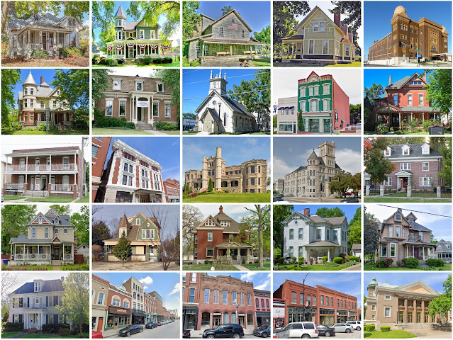
Image
Founding:  1833 Parent county:  Unorganized territory Namesake:  Nathanael Greene, Continental Army general Seat:  Springfield (1834–) Land area:  675 square miles Population (2020):  298,915 Population (historic):  5,372 (1840); 13,186 (1860); 28,801 (1880); 52,713 (1900); 82,929 (1930) Periods of population growth:  pre-1840–2020 Subdivisions:  Eight cities Pre-1940 residences (estimated):  11,746 (8.7%) Pre-1940 housing survival rate:  45% Pre-1860 housing survival rate (1940):  5.6% Farm housing in disrepair (1950):  7.6% Nonfarm housing in disrepair (1950):  5.8% Average farmhouse value (1930):  $1,375 Average outbuilding value (1930):  $925 Average farmhouse size (1940):  4.5 rooms Number of farms (1920):  4,252 Average farm size (1920):  71 acres Sources of settlement:  Missouri, Tennessee, Kentucky, Arkansas, North Carolina, Illinois, and Ohio _____________________________________...

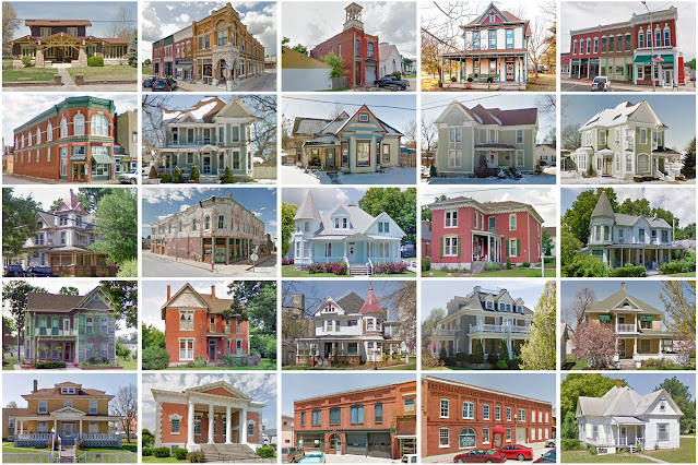
Christian County, Missouri

Image
Founding:  1859 Parent counties:  Greene, Taney, and Webster Namesake:  William Christian, Continental Army colonel Seat:  Ozark (1859–) Land area:  563 square miles Population (2020):  88,842 Population (historic):  5,491 (1860); 9,628 (1880); 16,939 (1900); 13,169 (1930) Periods of population growth:  pre-1860–1900; 1930s; 1960–2020 Subdivisions:  Seven cities; one village; one CDP; 19 townships Pre-1940 residences (estimated):  1,445 (4.2%) Pre-1940 housing survival rate:  37.6% Pre-1860 housing survival rate (1940):  6.7% Farm housing in disrepair (1950):  10.4% Nonfarm housing in disrepair (1950):  7.5% Average farmhouse value (1930):  $803 Average outbuilding value (1930):  $613 Average farmhouse size (1940):  4.1 rooms Number of farms (1920):  2,585 Average farm size (1920):  72.2 acres Sources of settlement:  Missouri, Tennessee, Kentucky, and Illinois ____________________________...

Lawrence County, Missouri

Image
Founding:  1845 (declared in 1843) Parent counties:  Barry and Dade Namesake:  James Lawrence, U.S. naval officer Seat:  Mount Vernon (1845–) Land area:  612 square miles Population (2020):  38,001 Population (historic):  4,859 (1850); 12,977 (1870); 26,228 (1890); 26,583 (1910); 23,774 (1930) Periods of population growth:  pre-1850–1900; 1930s; 1960–2010 Subdivisions:  Eight cities; three villages; one CDP; 14 townships Pre-1940 residences (estimated):  2,669 (16%) Pre-1940 housing survival rate:  44.6% Pre-1860 housing survival rate (1940):  1.8% Farm housing in disrepair (1950):  10.5% Nonfarm housing in disrepair (1950):  6.7% Average farmhouse value (1930):  $971 Average outbuilding value (1930):  $690 Average farmhouse size (1940):  4.9 rooms Number of farms (1920):  2,979 Average farm size (1920):  94.3 acres Sources of settlement:  Missouri, Tennessee, Illinois, Kentucky, and Indi...

Jasper County, Missouri

Image
Founding:  1841 Parent county:  Unorganized territory Namesake:  William Jasper, South Carolina soldier Seat:  Carthage (1842–) Land area:  638 square miles Population (2020):  122,761 Population (historic):  4,223 (1850); 14,928 (1870); 50,500 (1890); 89,673 (1910); 73,810 (1930) Periods of population growth:  pre-1850–1910; 1930–1950; 1960–2020 Subdivisions:  16 cities; six villages; 15 townships Pre-1940 residences (estimated):  8,327 (16.2%) Pre-1940 housing survival rate:  41.1% Pre-1860 housing survival rate (1940):  5.2% Farm housing in disrepair (1950):  16.2% Nonfarm housing in disrepair (1950):  11.5% Average farmhouse value (1930):  $1,155 Average outbuilding value (1930):  $758 Average farmhouse size (1940):  5.2 rooms Number of farms (1920):  2,786 Average farm size (1920):  93.5 acres Sources of settlement:  Illinois, Ohio, Indiana, Kentucky, and Tennessee __________________...

Webster County, Missouri

Image
Founding:  1855 Parent county:  Greene Namesake:  Daniel Webster, New Hampshire politician Seat:  Marshfield (1856–) Land area:  593 square miles Population (2020):  39,085 Population (historic):  7,099 (1860); 12,175 (1880); 16,640 (1900); 16,148 (1930) Periods of population growth:  pre-1860–1910; 1930s; 1960–2020 Subdivisions:  Six cities; one village; 16 townships Pre-1940 residences (estimated):  1,320 (8.9%) Pre-1940 housing survival rate:  33.5% Pre-1860 housing survival rate (1940):  1.8% Farm housing in disrepair (1950):  18.9% Nonfarm housing in disrepair (1950):  9.3% Average farmhouse value (1930):  $785 Average outbuilding value (1930):  $596 Average farmhouse size (1940):  4 rooms Number of farms (1920):  2,697 Average farm size (1920):  74.8 acres Sources of settlement:  Missouri, Tennessee, Illinois, and Kentucky ____________________________________________________________...
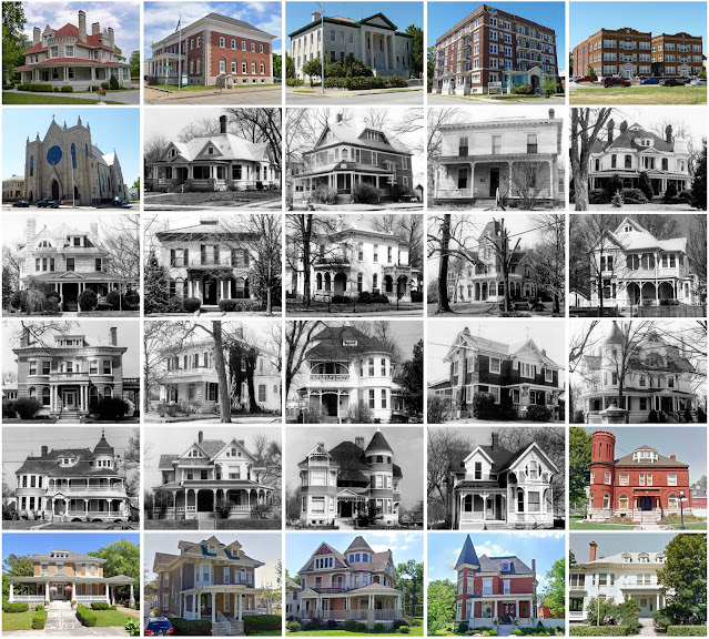
Newton County, Missouri

Image
Founding:  1838 Parent county:  Barry Namesake:  John Newton, South Carolina soldier Seat:  Neosho (1839–) Land area:  625 square miles Population (2020):  58,648 Population (historic):  8,790 (1840); 9,319 (1860); 18,947 (1880); 27,001 (1900); 26,959 (1930) Periods of population growth:  pre-1840–1910; 1920–1940; 1950–2020 Subdivisions:  Five cities; 15 villages; 14 townships Pre-1940 residences (estimated):  2,790 (11.3%) Pre-1940 housing survival rate:  37.7% Pre-1860 housing survival rate (1940):  1.9% Farm housing in disrepair (1950):  13.4% Nonfarm housing in disrepair (1950):  14.6% Average farmhouse value (1930):  $801 Average outbuilding value (1930):  $548 Average farmhouse size (1940):  4.4 rooms Number of farms (1920):  2,906 Average farm size (1920):  75 acres Sources of settlement:  Missouri, Illinois, Tennessee, Indiana, Kentucky, and Ohio __________________________________...

Jackson County, Missouri

Image
Founding:  1826 (declared in 1825) Parent county:  Lillard Namesake:  Andrew Jackson, U.S. president Seat:  Independence (1827–) and Kansas City Land area:  604 square miles Population (2020):  717,204 Population (historic):  2,823 (1830); 14,000 (1850); 65,011 (1870); 195,193 (1900); 470,454 (1930) Periods of population growth:  pre-1830–1970; 1980–2020 Subdivisions:  15 cities; three villages; one CDP; eight townships Pre-1940 residences (estimated):  64,544 (19.7%) Pre-1940 housing survival rate:  34.3% Pre-1860 housing survival rate (1940):  6.9% Farm housing in disrepair (1950):  5% Nonfarm housing in disrepair (1950):  6.1% Average farmhouse value (1930):  $2,203 Average outbuilding value (1930):  $1,649 Average farmhouse size (1940):  5.1 rooms Number of farms (1920):  3,345 Average farm size (1920):  76.9 acres Sources of settlement:  Missouri, Kentucky, Illinois, Ohio, New York, ...

Cape Girardeau County, Missouri

Image
Founding:  1812 Parent county:  Unorganized territory Namesake:  A promontory along the Mississippi River Seat:  Jackson (1814–) Land area:  579 square miles Population (2020):  81,710 Population (historic):  5,968 (1820); 13,912 (1850); 17,558 (1870); 24,315 (1900); 33,203 (1930) Periods of population growth:  pre-1820–2020 Subdivisions:  Three cities; seven villages; ten townships Pre-1940 residences (estimated):  3,635 (10.7%) Pre-1940 housing survival rate:  37.5% Pre-1860 housing survival rate (1940):  5.7% Farm housing in disrepair (1950):  11.1% Nonfarm housing in disrepair (1950):  8.2% Average farmhouse value (1930):  $1,111 Average outbuilding value (1930):  $854 Average farmhouse size (1940):  5.1 rooms Number of farms (1920):  2,661 Average farm size (1920):  86.5 acres Sources of settlement:  Germany, Tennessee, Illinois, and Kentucky _________________________________________...

Polk County, Missouri

Image
  Founding:  1835 Parent counties:  Greene, Pulaski, St. Clair, and unorganized territory Namesake:  James Polk, U.S. president Seat:  Bolivar (1835–) Land area:  636 square miles Population (2020):  31,519 Population (historic):  8,449 (1840); 9,995 (1860); 15,734 (1880); 23,255 (1900); 17,803 (1930) Periods of population growth:  pre-1840; 1850–1900; 1960–2020 Subdivisions:  Five cities; four villages; 22 townships Pre-1940 residences (estimated):  1,464 (10.8%) Pre-1940 housing survival rate:  33.8% Pre-1860 housing survival rate (1940):  2.1% Farm housing in disrepair (1950):  14.8% Nonfarm housing in disrepair (1950):  10% Average farmhouse value (1930):  $858 Average outbuilding value (1930):  $616 Average farmhouse size (1940):  4.5 rooms Number of farms (1920):  3,405 Average farm size (1920):  78.8 acres Sources of settlement:  Missouri, Tennessee, Kentucky, Illinois, and Oh...

Laclede County, Missouri

Image
Founding:  1849 Parent counties:  Camden, Pulaski, and unorganized territory Namesake:  Pierre Laclède, founder of St. Louis, Missouri Seat:  Lebanon (1849–) Land area:  765 square miles Population (2020):  35,571 Population (historic):  2,498 (1850); 9,380 (1870); 14,721 (1890); 17,363 (1910); 16,320 (1930) Periods of population growth:  pre-1850–1910; 1930–1950; 1960–2020 Subdivisions:  Two cities; two villages; one CDP; nine townships Pre-1940 residences (estimated):  1,149 (7.2%) Pre-1940 housing survival rate:  24.6% Pre-1860 housing survival rate (1940):  3.9% Farm housing in disrepair (1950):  20.2% Nonfarm housing in disrepair (1950):  12.5% Average farmhouse value (1930):  $736 Average outbuilding value (1930):  $472 Average farmhouse size (1940):  4.1 rooms Number of farms (1920):  2,599 Average farm size (1920):  72.2 acres Sources of settlement:  Missouri, Tennessee, Illinois,...

Knox County, Missouri

Image
  Founding:  1845 (declared in 1843) Parent county:  Scotland Namesake:   Henry Knox, Continental Amy general Seat:  Edina (1845–) Land area:  504 square miles Population (2020):  3,744 Population (historic):  2,894 (1850); 10,974 (1870); 13,501 (1890); 12,403 (1910); 9,658 (1930) Periods of population growth:  pre-1850–1890 Subdivisions:  Four cities; two villages; one CDP; 13 townships Pre-1940 residences (estimated):  803 (35.1%) Pre-1940 housing survival rate:  29.1% Pre-1860 housing survival rate (1940):  2.2% Farm housing in disrepair (1950):  6% Nonfarm housing in disrepair (1950):  4.9% Average farmhouse value (1930):  $1,306 Average outbuilding value (1930):  $1,125 Average farmhouse size (1940):  5 rooms Number of farms (1920):  1,880 Average farm size (1920):  139.5 acres Sources of settlement:  Missouri, Illinois, Ohio, Kentucky, Virginia, Indiana, and Pennsylvania ______...

Pettis County, Missouri

Image
  Founding:  1833 Parent counties:  Cooper, Morgan, St. Clair, Saline, and unorganized territory Namesake:  Spencer Pettis, Missouri politician Seat:   St. Helena (1833–1837); Georgetown (1837–1865); Sedalia (1865–) Land area:  682 square miles Population (2020):  42,980 Population (historic):  2,930 (1840); 9,392 (1860); 27,271 (1880); 32,438 (1900); 34,664 (1930) Periods of population growth:  pre-1840–1920; 1950s; 1970s; 1990–2020 Subdivisions:  Five cities; one village; 17 townships Pre-1940 residences (estimated):  3,870 (21.2%) Pre-1940 housing survival rate:  37.9% Pre-1860 housing survival rate (1940):  6.7% Farm housing in disrepair (1950):  9.7% Nonfarm housing in disrepair (1950):  13.5% Average farmhouse value (1930):  $1,612 Average outbuilding value (1930):  $1,116 Average farmhouse size (1940):  5.2 rooms Number of farms (1920):  2,797 Average farm size (1920):  123.7 acre...

Taney County, Missouri

Image
  Founding:  1837 (declared in 1835) Parent county:  Greene Namesake:  Roger Taney, Supreme Court chief justice Seat:  Forsyth (1838–) Land area:  632 square miles Population (2020):  56,066 Population (historic):  3,264 (1840); 3,576 (1860); 5,599 (1880); 10,812 (1900); 8,867 (1930) Periods of population growth:  pre-1840–1850; 1860–1900; 1930s; 1950–2020 Subdivisions:  Five cities; three villages; one CDP; eight townships Pre-1940 residences (estimated):  833 (2.7%) Pre-1940 housing survival rate:  20.7% Pre-1860 housing survival rate (1940):  1.9% Farm housing in disrepair (1950):  27.6% Nonfarm housing in disrepair (1950):  16.8% Average farmhouse value (1930):  $589 Average outbuilding value (1930):  $350 Average farmhouse size (1940):  3.4 rooms Number of farms (1920):  1,216 Average farm size (1920):  53.1 acres Sources of settlement:  Missouri, Arkansas, Kentucky, and Tenness...

Stone County, Missouri

Image
  Founding:  1851 Parent county:  Taney Namesake:  William Stone, early resident Seat:  Galena (1852–) Land area:  464 square miles Population (2020):  31,076 Population (historic):  2,400 (1860); 4,404 (1880); 9,892 (1900); 11,614 (1930) Periods of population growth:  pre-1860–1920; 1960–2010 Subdivisions:  Six cities; four villages; one CDP Pre-1940 residences (estimated):  907 (4.3%) Pre-1940 housing survival rate:  31.2% Pre-1860 housing survival rate (1940):  1.2% Farm housing in disrepair (1950):  28.4% Nonfarm housing in disrepair (1950):  19% Average farmhouse value (1930):  $568 Average outbuilding value (1930):  $400 Average farmhouse size (1940):  3.7 rooms Number of farms (1920):  1,741 Average farm size (1920):  64.3 acres Sources of settlement:  Missouri, Arkansas, and Tennessee _________________________________________________________________________________ Galena Nam...