Posts

Showing posts from September, 2019

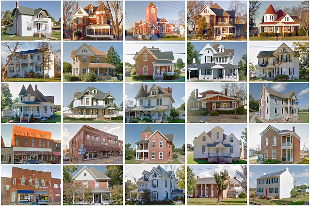
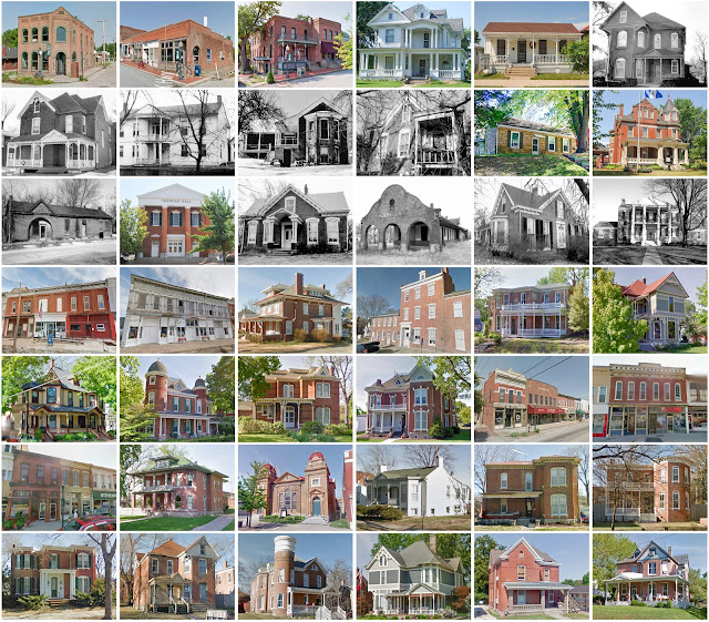
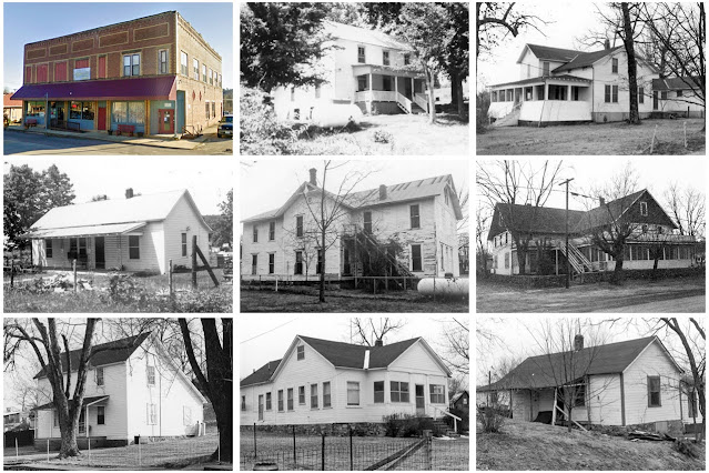
Montgomery County, Missouri

Image
Founding:  1819 Parent county:  St. Charles Namesake:  Richard Montgomery, Continental Army general Seat:   Pinckney (1818–1824); Lewiston (1824–1834); Danville (1834–1890); Montgomery City (1901–) Land area:  536 square miles Population (2020):  11,322 Population (historic):  3,074 (1820); 5,489 (1850); 10,405 (1870); 16,571 (1900); 13,011 (1930) Periods of population growth:  pre-1820–1890; 1970s; 1990–2010 Subdivisions:  Eight cities; one village; two CDPs; six townships National Register listings:   Nine Pre-1940 residences (estimated):  1,010 (16.2%) Pre-1940 housing survival rate:  36.3% Pre-1860 housing survival rate (1940):  7.4% Farm housing in disrepair (1950):  16.5% Nonfarm housing in disrepair (1950):  10.9% Average farmhouse value (1930):  $1,191 Average outbuilding value (1930):  $883 Average farmhouse size: 5.1 rooms Number of farms (1920):  2,261 Average farm size (1920):  96 acres Sources of settlement:  Virginia, Kentucky, Ohio, Germany, a

Scotland County, Missouri

Image
Founding:  1841 Parent county:  Unorganized territory Namesake:  The country of Scotland Seat:   Sand Hill (1841–1843); Memphis (1843–) Land area:  437 square miles Population (2020):  4,716 Population (historic):  3,782 (1850); 10,670 (1870); 12,674 (1890); 11,869 (1910); 8,853 (1930) Periods of population growth:  pre-1850–1900; 1990s Subdivisions:  Two cities; three villages; 10 townships National Register listings:   Three Pre-1940 residences (estimated):  773 (32.7%) Pre-1940 housing survival rate:  31.7% Pre-1860 housing survival rate (1940):  1.2% Farm housing in disrepair (1950):  14.8% Nonfarm housing in disrepair (1950):  7.8% Average farmhouse value (1930):  $1,459 Average outbuilding value (1930):  $1,155 Average farmhouse size (1940):  5.7 rooms Number of farms (1920):  1,800 Average farm size (1920):  128.4 acres Sources of settlement:  Kentucky, Ohio, Iowa, Illinois, Virginia, and Indiana _______________________________________________________

Moniteau County, Missouri

Image
Founding:  1845 Parent counties:  Cole and Morgan Namesake:  Moniteau Creek Seat:  California (1845–) Land area:  415 square miles Population (2020):  15,473 Population (historic):  6,004 (1850); 11,375 (1870); 15,630 (1890); 14,375 (1910); 12,173 (1930) Periods of population growth:  pre-1850–1900; 1960–2010 Subdivisions:  Four cities; one village; seven townships National Register listings:   11 Pre-1940 residences (estimated):  1,279 (20.7%) Pre-1940 housing survival rate:  36.9% Pre-1860 housing survival rate (1940):  4.9% Farm housing in disrepair (1950):  7.1% Nonfarm housing in disrepair (1950):  8.4% Average farmhouse value (1930):  $1,237 Average outbuilding value (1930):  $1,021 Average farmhouse size (1940):  5.1 rooms Number of farms (1920):  1,932 Average farm size (1920):  99.4 acres Sources of settlement:  Germany, Ohio, Kentucky, Tennessee, and Virginia ___________________________________________________________________________________ Cali

Callaway County, Missouri

Image
Founding:  1821 Parent county:  Unorganized territory Namesake:  James Callaway, grandson of Daniel Boone Seat:   Elizabeth (1820–1825); Fulton (1825–) Land area:  835 square miles Population (2020):  44,283 Population (historic):  6,159 (1830); 13,827 (1850); 19,202 (1870); 25,984 (1900); 19,923 (1930) Periods of population growth:  pre-1830–1900; 1930–2010 Subdivisions:  Five cities; two villages; 18 townships National Register listings:   20 Pre-1940 residences (estimated):  1,732 (9.2%) Pre-1940 housing survival rate:  30.5% Pre-1860 housing survival rate (1940):  10.1% Farm housing in disrepair (1950):  17.8% Nonfarm housing in disrepair (1950):  11.7% Average farmhouse value (1930):  $1,167 Average outbuilding value (1930):  $828 Average farmhouse size (1940):  5 rooms Number of farms (1920):  3,284 Average farm size (1920):  104.9 acres Sources of settlement:  Virginia and Kentucky _______________________________________________________________________

Lincoln County, Missouri

Image
Founding:  1819 Parent county:  St. Charles Namesake:  Benjamin Lincoln, Continental Army officer Seat:  Monroe (1818–1823); Alexandria (1823–1829); Troy (1829–) Land area:  627 square miles Population (2020):  59,574 Population (historic):  1,662 (1820); 9,421 (1850); 15,960 (1870); 18,352 (1900); 13,929 (1930) Periods of population growth:  pre-1820–1890; 1930s; 1950–2020 Subdivisions:  Seven cities; six villages; 12 townships National Register listings:   Five Pre-1940 residences (estimated):  1,113 (5.2%) Pre-1940 housing survival rate:  36.9% Pre-1860 housing survival rate (1940):  9.5% Farm housing in disrepair (1950):  12.7% Nonfarm housing in disrepair (1950):  11.5% Average farmhouse value (1930):  $1,240 Average outbuilding value (1930):  $834 Average farmhouse size (1940):  4.6 rooms Number of farms (1920):  2,540 Average farm size (1920):  100.4 acres Sources of settlement:  Virginia, Kentucky, and Germany _________________________________________

Madison County, Missouri

Image
Founding:  1819 Parent counties:  Cape Girardeau and Ste. Genevieve Namesake:  James Madison, U.S. president Seat:  Fredericktown (1818–) Land area:  494 square miles Population (2020):  12,626 Population (historic):  2,047 (1820); 6,003 (1850); 5,849 (1870); 9,975 (1900); 9,418 (1930) Periods of population growth:  pre-1820–1850; 1860–1910; 1930–1950; 1970–2020 Subdivisions:  One city; one town; two villages; two CDPs; 10 townships National Register listings:   Five Pre-1940 residences (estimated):  675 (11.3%) Pre-1940 housing survival rate:  27.3% Pre-1860 housing survival rate (1940):  2.4% Farm housing in disrepair (1950):  23.6% Nonfarm housing in disrepair (1950):  14% Average farmhouse value (1930):  $667 Average outbuilding value (1930):  $495 Average farmhouse size (1940):  4.5 rooms Number of farms (1920):  1,046 Average farm size (1920):  62.6 acres Sources of settlement:  Missouri, Tennessee, Arkansas, Illinois, and Kentucky ______________________

Cooper County, Missouri

Image
Founding:  1819 Parent county:  Howard Namesake:  Sarshell Cooper, local settler Seat:  Boonville (1818–) Land area:  565 square miles Population (2020):  17,103 Population (historic):  6,959 (1820); 12,950 (1850); 20,692 (1870); 22,532 (1900); 19,522 (1930) Periods of population growth:  pre-1820; 1830–1890; 1920s; 1980–2010 Subdivisions:  Six cities; two villages; 14 townships National Register listings:   44 Pre-1940 residences (estimated):  1,329 (17.7%) Pre-1940 housing survival rate:  38% Pre-1860 housing survival rate (1940):  12.3% Farm housing in disrepair (1950):  13.6% Nonfarm housing in disrepair (1950):  13% Average farmhouse value (1930):  $1,676 Average outbuilding value (1930):  $1,267 Average farmhouse size (1940):  5 rooms Number of farms (1920):  2,419 Average farm size (1920):  112.8 acres Sources of settlement:  Kentucky, Virginia, Germany, and Ohio ______________________________________________________________________________ Boonvill

Phelps County, Missouri

Image
Founding:  1857 Parent counties:  Crawford and Maries Namesake:  John Phelps, Missouri governor Seat:  Rolla (1861–) Land area:  672 square miles Population (2020):  44,638 Population (historic):  5,714 (1860); 12,568 (1880); 14,194 (1900); 15,308 (1930) Periods of population growth:  pre-1860–1910; 1920–2010 Subdivisions:  Five cities; ten townships National Register listings:   11 Pre-1940 residences (estimated):  1,260 (6.3%) Pre-1940 housing survival rate:  31.6% Pre-1860 housing survival rate (1940):  3.5% Farm housing in disrepair (1950):  11.3% Nonfarm housing in disrepair (1950):  9.7% Average farmhouse value (1930):  $821 Average outbuilding value (1930):  $596 Average farmhouse size (1940):  4.3 rooms Number of farms (1920):  1,982 Average farm size (1920):  66.9 acres Sources of settlement:  Missouri, Tennessee, Kentucky, Illinois, and Germany ___________________________________________________________________________________ Rolla Namesake:

Howard County, Missouri

Image
Founding:  1816 Parent counties:  St. Charles and St. Louis Namesake:  Benjamin Howard, Missouri governor Seat:   Franklin (1816–1823); Fayette (1823–) Land area:  464 square miles Population (2020):  10,151 Population (historic):  13,426 (1820); 13,969 (1850); 17,233 (1870); 18,337 (1900); 13,490 (1930) Periods of population growth:  pre-1820; 1830–1880; 1890s; 1990s; 2010s Subdivisions:  Five cities; eight townships National Register listings:   25 Pre-1940 residences (estimated):  1,124 (24.5%) Pre-1940 housing survival rate:  33.8% Pre-1860 housing survival rate (1940):  13.8% Farm housing in disrepair (1950):  11.1% Nonfarm housing in disrepair (1950):  14.8% Average farmhouse value (1930):  $1,667 Average outbuilding value (1930):  $1,157 Average farmhouse size (1940):  4.9 rooms Number of farms (1920):  1,698 Average farm size (1920):  119.3 acres Sources of settlement:  Kentucky and Virginia ____________________________________________________________

Washington County, Missouri

Image
Founding:  1813 Parent counties:  St. Louis and Ste. Genevieve Namesake:  George Washington, U.S. president Seat:  Potosi (1814–) Land area:  760 square miles Population (2020):  23,514 Population (historic):  2,769 (1820); 8,811 (1850); 11,719 (1870); 14,263 (1900); 14,450 (1930) Periods of population growth:  pre-1820–1900; 1910–1940; 1960–2010 Subdivisions:  Two cities; two villages; 14 townships National Register listings:   11 Pre-1940 residences (estimated):  969 (8.8%) Pre-1940 housing survival rate:  20.8% Pre-1860 housing survival rate (1940):  7.7% Farm housing in disrepair (1950):  22.3% Nonfarm housing in disrepair (1950):  24.3% Average farmhouse value (1930):  $635 Average outbuilding value (1930):  $446 Average farmhouse size (1940):  4.4 rooms Number of farms (1920):  1,527 Average farm size (1920):  59.5 acres Sources of settlement:  Tennessee, Virginia, Kentucky, Illinois, and Ireland __________________________________________________________

New Madrid County, Missouri

Image
Founding:  1812 Parent county:  Unorganized territory Namesake:  The city of New Madrid Seat:  New Madrid (1812–) Land area:  675 square miles Population (2020):  16,434 Population (historic):  2,296 (1820); 5,541 (1850); 6,357 (1870); 11,280 (1900); 30,262 (1930) Periods of population growth:  pre-1820–1940 Subdivisions:  13 cities; one village; 11 townships National Register listings:   10 Pre-1940 residences (estimated):  596 (6.9%) Pre-1940 housing survival rate:  8.8% Pre-1860 housing survival rate (1940):  2.8% Farm housing in disrepair (1950):  45.3% Nonfarm housing in disrepair (1950):  32.5% Average farmhouse value (1930):  $378 Average outbuilding value (1930):  $263 Average farmhouse size (1940):  3.5 rooms Number of farms (1920):  2,052 Average farm size (1920):  95.2 acres Sources of settlement:  Tennessee, Kentucky, Arkansas, and Illinois ___________________________________________________________________________________ New Madrid Namesake

Mercer County, Missouri

Image
Founding:  1845 (declared in 1843) Parent county:  Unorganized territory Namesake:  John Mercer, Virginia politician Seat:  Princeton (1846–) Land area:  454 square miles Population (2020):  3,538 Population (historic):  2,691 (1850); 11,557 (1870); 14,581 (1890); 12,335 (1910); 9,350 (1930) Periods of population growth:  pre-1850–1880; 1890s; 1990–2010 Subdivisions:  Two cities; one village; one CDP; nine townships National Register listings:   Two Pre-1940 residences (estimated):  457 (21.4%) Pre-1940 housing survival rate:  20.7% Pre-1860 housing survival rate (1940):  2.6% Farm housing in disrepair (1950):  17.5% Nonfarm housing in disrepair (1950):  26.6% Average farmhouse value (1930):  $999 Average outbuilding value (1930):  $737 Average farmhouse size (1940):  4.9 rooms Number of farms (1920):  1,959 Average farm size (1920):  118.3 acres Sources of settlement:  Missouri, Indiana, Ohio, Iowa, Illinois, Kentucky, and Tennessee _________________________

Carter County, Missouri

Image
Founding:  1859 Parent counties:  Ripley and Shannon Namesake:  Zimri Carter, local settler Seat:  Van Buren (1859–) Land area:  507 square miles Population (2020):  5,202 Population (historic):  1,235 (1860); 2,168 (1880); 6,706 (1900); 7,482 (1920); 5,503 (1930) Periods of population growth:  pre-1860–1900; 1910s; 1930s; 1970–2010 Subdivisions:  Three cities; two CDPs; five townships National Register listings:   31 Pre-1940 residences (estimated):  170 (5.2%) Pre-1940 housing survival rate:  14.8% Pre-1860 housing survival rate (1940):  0.5% Farm housing in disrepair (1950):  16.1% Nonfarm housing in disrepair (1950):  18.4% Average farmhouse value (1930):  $414 Average outbuilding value (1930):  $300 Average farmhouse size (1940):  3.9 rooms Number of farms (1920):  608 Average farm size (1920):  49.1 acres Sources of settlement:  Missouri, Illinois, Tennessee, Indiana, Kentucky, and Arkansas _______________________________________________________________