Posts

Showing posts with the label oregon

Gilliam County, Oregon
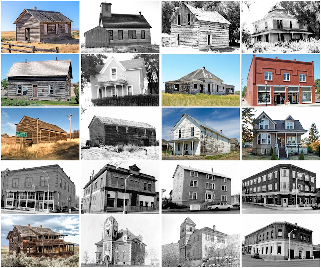
Image
Founding:  1885 Parent counties:  Umatilla and Wasco Namesake:  Cornelius Gilliam, Oregon pioneer Seat:  Arlington (1885–1890); Condon (1890–) Land area:  1,205 square miles Population (2020):  1,995 Population (historic):  3,600 (1890); 3,701 (1910); 3,467 (1930) Periods of population growth:  pre-1890; 1900–1920; 1950s; 1990s; 2010s Subdivisions:  Three cities Pre-1940 residences (estimated):  373 (33%) Pre-1940 housing survival rate:  36.5% Farm housing in disrepair (1950): 19.4% Nonfarm housing in disrepair (1950): 11.1% Average farmhouse value (1930):  $1,487 Average outbuilding value (1930):  $1,828 Average farmhouse size (1940):  5.1 rooms Number of farms (1920):  454 Average farm size (1920):  570.5 acres _________________________________________________________________________________   Condon   Namesake:  Harvey Condon, surveyor Founding:  1883 (platting); 1884 (post office); ...

Curry County, Oregon

Image
Founding:  1855 Parent counties:  Coos and Jackson Namesake:  George Curry, Oregon territorial governor Seat:  Port Orford (1855–1858); Gold Beach (1858–) Land area:  1,627 square miles Population (2020):  23,446 Population (historic):  393 (1860); 1,208 (1880); 1,868 (1900); 3,257 (1930) Periods of population growth:  pre-1860–1960; 1970–2020 Subdivisions:  Three cities; four CDPs Pre-1940 residences (estimated):  587 (4.5%) Pre-1940 housing survival rate:  26.7% Pre-1860 housing survival rate (1940):  2.4% Farm housing in disrepair (1950): 11.2% Nonfarm housing in disrepair (1950): 9.8% Average farmhouse value (1930):  $1,010 Average outbuilding value (1930):  $962 Average farmhouse size (1940):  4.7 rooms Number of farms (1920):  339 Average farm size (1920):  49.1 acres _________________________________________________________________________________   Gold Beach   Namesake:  Seasid...

Sherman County, Oregon

Image
Founding:  1889 Parent county:  Wasco Namesake:  William Tecumseh Sherman, U.S. army general Seat:  Wasco (1889–1892); Moro (1892–) Land area:  824 square miles Population (2020):  1,870 Population (historic):  1,792 (1890); 3,477 (1900); 4,242 (1910); 3,826 (1920); 2,978 (1930) Periods of population growth:  pre-1890–1910; 1950s; 2010s Subdivisions:  Four cities; one CDP Pre-1940 residences (estimated):  375 (40.8%) Pre-1940 housing survival rate:  37.8% Farm housing in disrepair (1950): 8% Nonfarm housing in disrepair (1950): 5.6% Average farmhouse value (1930):  $2,136 Average outbuilding value (1930):  $1,970 Average farmhouse size (1940):  5.7 rooms Number of farms (1920):  460 Average farm size (1920):  617.7 acres _________________________________________________________________________________   Moro   Namesake:  Unknown Founding:  1882 (platting); 1884 (post office); 1899 (inco...

Wheeler County, Oregon

Image
Founding:  1899 Parent counties:  Crook, Gilliam, and Grant Namesake:  Henry Wheeler, local resident Seat:  Fossil (1899–) Land area:  1,715 square miles Population (2020):  1,451 Population (historic):  2,443 (1900); 2,484 (1910); 2,791 (1920); 2,799 (1930) Periods of population growth:  pre-1900–1950; 1990s Subdivisions:  Three cities Pre-1940 residences (estimated):  259 (26.2%) Pre-1940 housing survival rate:  26.3% Farm housing in disrepair (1950): 35.8% Nonfarm housing in disrepair (1950): 26.9% Average farmhouse value (1930):  $1,241 Average outbuilding value (1930):  $1,097 Average farmhouse size (1940):  5.1 rooms Number of farms (1920):  359 Average farm size (1920):  111.7 acres Sources of settlement:  Missouri, Tennessee, California, Iowa, and Illinois _________________________________________________________________________________ Fossil Namesake:  Fo...