Posts

Showing posts with the label washington

Wahkiakum County, Washington
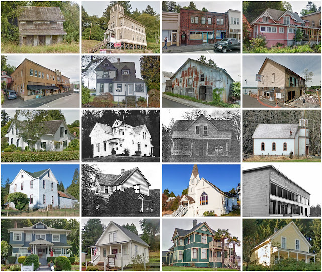
Image
Founding:  1854 Parent county:  Cowlitz Namesake:  Wahkiakum, Chinook chief Seat:  Cathlamet (1854–) Land area:  263 square miles Population (2020):  4,422 Population (historic):  270 (1870); 2,526 (1890); 3,285 (1910); 3,862 (1930) Periods of population growth:  1860–1940; 1960–1980; 1990–2020 Subdivisions:  One town; nine CDPs Pre-1940 residences (estimated):  323 (15%) Pre-1940 housing survival rate:  32.4% Farm housing in disrepair (1950):  21.1% Nonfarm housing in disrepair (1950):  12.7% Average farmhouse value (1930):  $1,356 Average outbuilding value (1930):  $1,069 Average farmhouse size (1940):  5.6 rooms Number of farms (1920):  373 Average farm size (1920):  23 acres Sources of settlement:  Oregon, Sweden, Finland, and Norway _________________________________________________________________________________ Cathlamet Namesake:  The Cathlamet peo...
Columbia County, Washington

Image
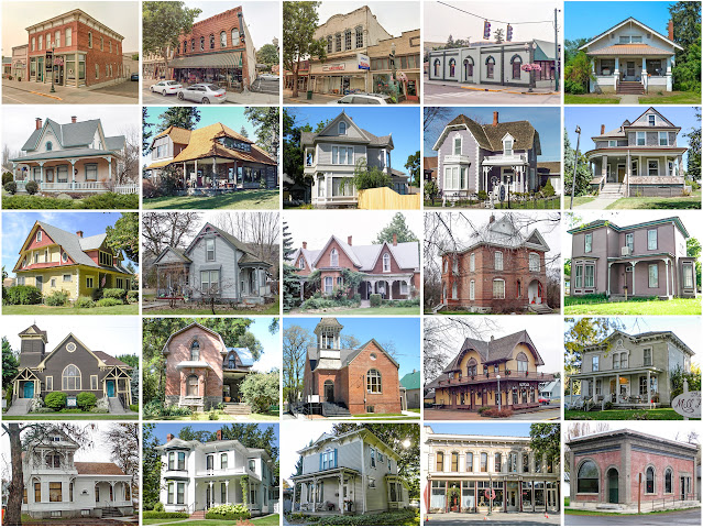
Founding:  1875 Parent county:  Walla Walla Namesake:  The Columbia River Seat:  Dayton (1875–) Land area:  869 square miles Population (2020):  3,952 Population (historic):  7,103 (1880); 7,128 (1900); 5,325 (1930) Periods of population growth:  pre-1880; 1890s; 1930s Subdivisions:  One city; one town Pre-1940 residences (estimated):  866 (40.1%) Pre-1940 housing survival rate:  46.3% Farm housing in disrepair (1950):  5.8% Nonfarm housing in disrepair (1950):  5.4% Average farmhouse value (1930):  $1,537 Average outbuilding value (1930):  $1,449 Average farmhouse size (1940):  5.9 rooms Number of farms (1920):  622 Average farm size (1920):  309.7 acres _________________________________________________________________________________ Dayton Namesake:  Jesse Day, owner of the city site Founding:  1871 (platting); 1872 (post office); 1876 (incorporation) ...

Asotin County, Washington

Image
Founding:  1883 Parent county:  Garfield Namesake:  Asotin Creek Seat:  Asotin (1883–) Land area:  636 square miles Population (2020):  22,285 Population (historic):  1,580 (1890); 5,831 (1910); 8,136 (1930) Periods of population growth:  pre-1890–2020 Subdivisions:  Two cities; two CDPs Pre-1940 residences (estimated):  1,288 (12.9%) Pre-1940 housing survival rate:  55.8% Farm housing in disrepair (1950):  7.5% Nonfarm housing in disrepair (1950):  3.9% Average farmhouse value (1930):  $1,287 Average outbuilding value (1930):  $942 Average farmhouse size (1940):  5.2 rooms Number of farms (1920):  578 Average farm size (1920):  166.8 acres Sources of settlement:  Washington, Missouri, Idaho, Iowa, Minnesota, and Germany _________________________________________________________________________________ Asotin Namesake:  Asotin Creek Founding:  1878 (p...

Garfield County, Washington

Image
Founding:  1881 Parent county:  Columbia Namesake:  James Garfield, U.S. president Seat:  Pomeroy (1882–) Land area:  711 square miles Population (2020):  2,286 Population (historic):  3,897 (1890); 4,199 (1910); 3,662 (1930) Periods of population growth:  pre-1890–1910; 1990s; 2010s Subdivisions:  One city Pre-1940 residences (estimated):  484 (38.6%) Pre-1940 housing survival rate:  41.8% Farm housing in disrepair (1950):  4.7% Nonfarm housing in disrepair (1950):  6.2% Average farmhouse value (1930):  $2,011 Average outbuilding value (1930):  $1,864 Average farmhouse size (1940):  5.9 rooms Number of farms (1920):  413 Average farm size (1920):  385.6 acres Sources of settlement:  Missouri, Oregon, Illinois, Kansas, and Germany _________________________________________________________________________________ Pomeroy Namesake:  Joseph Pomeroy, platter F...