Posts

Showing posts with the label iowa

Woodbury County, Iowa
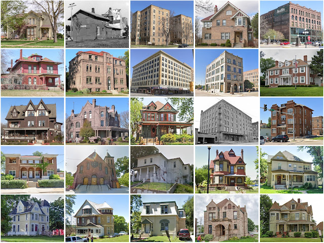
Image
Founding:  1853 (declared in 1851) Parent county:  Unorganized territory Namesake:  Levi Woodbury, New Hampshire politician Seat:   Thompsonville (1853–1856); Sioux City (1856–) Land area:  873 square miles Population (2020):  105,941 Population (historic):  1,119 (1860); 14,996 (1880); 54,610 (1900); 101,669 (1930) Periods of population growth:  pre-1860–1890; 1900–1960; 1990s; 2010s Subdivisions:  16 cities; one CDP; 24 townships Pre-1940 residences (estimated):  13,365 (31.6%) Pre-1940 housing survival rate:  49.5% Farm housing in disrepair (1950):  6.9% Nonfarm housing in disrepair (1950):  5.3% Average farmhouse value (1930):  $2,062 Average outbuilding value (1930):  $2,317 Average farmhouse size (1940):  6.2 rooms Number of farms (1920):  2,969 Average farm size (1920):  155.1 acres Sources of settlement:  Illinois, Germany, Wisconsin, New York, Ohio, Sweden, and Norway ________________...

Pottawattamie County, Iowa

Image
Founding:  1848 (declared in 1847) Parent county:  Unorganized territory Namesake:  The Potawatomi people Seat:  Council Bluffs (1848–) Land area:  950 square miles Population (2020):  93,667 Population (historic):  7,828 (1850); 16,893 (1870); 47,430 (1890); 55,832 (1910); 69,888 (1930) Periods of population growth:  pre-1850–1930; 1940–1970; 1990–2020 Subdivisions:  14 cities; three CDPs; 29 townships Pre-1940 residences (estimated):  11,325 (28.4%) Pre-1940 housing survival rate:  56.8% Farm housing in disrepair (1950):  4.1% Nonfarm housing in disrepair (1950):  8.2% Average farmhouse value (1930):  $2,318 Average outbuilding value (1930):  $2,594 Average farmhouse size (1940):  6.2 rooms Number of farms (1920):  3,781 Average farm size (1920):  139.5 acres Sources of settlement:  Illinois, Ohio, New York, Pennsylvania, Germany, Indiana, Ireland, and England __________________________...

Webster County, Iowa

Image
Founding:  1853 Parent counties:  Risley and Yell Namesake:  Daniel Webster, Massachusetts politician Seat:   Homer (1853–1856); Fort Dodge (1856–) Land area:  716 square miles Population (2020):  36,999 Population (historic):  2,504 (1860); 15,951 (1880); 31,757 (1900); 40,425 (1930) Periods of population growth:  pre-1860–1970 Subdivisions:  15 cities; one CDP; 24 townships Pre-1940 residences (estimated):  5,686 (33.4%) Pre-1940 housing survival rate:  54.9% Pre-1860 housing survival rate (1940):  3.2% Farm housing in disrepair (1950):  6.7% Nonfarm housing in disrepair (1950):  4.9% Average farmhouse value (1930):  $2,351 Average outbuilding value (1930):  $2,639 Average farmhouse size (1940):  6.6 rooms Number of farms (1920):  2,566 Average farm size (1920):  146.5 acres Sources of settlement:  Sweden, Norway, Illinois, Germany, Ireland, New York, and Wisconsin ____________________...

Plymouth County, Iowa

Image
Founding:  1858 (declared in 1851) Parent county:  Unorganized territory Namesake:  Plymouth, Massachusetts Seat:   Melbourne (1859–1872); LeMars (1872–) Land area:  863 square miles Population (2020):  25,698 Population (historic):  148 (1860); 8,566 (1880); 22,209 (1900); 24,159 (1930) Periods of population growth:  1860–1930; 1950–1980; 1990–2020 Subdivisions:  11 cities; 24 townships Pre-1940 residences (estimated):  3,200 (29.5%) Pre-1940 housing survival rate:  55.3% Farm housing in disrepair (1950):  2.5% Nonfarm housing in disrepair (1950):  2.9% Average farmhouse value (1930):  $2,256 Average outbuilding value (1930):  $3,210 Average farmhouse size (1940):  6.7 rooms Number of farms (1920):  2,699 Average farm size (1920):  174.6 acres Sources of settlement:  Iowa, Germany, Illinois, Wisconsin, New York, and England _____________________________________________________________________...

Crawford County, Iowa

Image
Founding:  1855 (declared in 1851) Parent counties:  Pottawattamie and unorganized territory Namesake:  William Crawford, Georgia politician Seat:  Denison (1856–) Land area:  714 square miles Population (2020):  16,525 Population (historic):  383 (1860); 12,413 (1880); 21,685 (1900); 21,028 (1930) Periods of population growth:  1860–1900; 1910 –1930; 1960s; 1990 –2010 Subdivisions:  13 cities; 20 townships Pre-1940 residences (estimated):  2,434 (34.5%) Pre-1940 housing survival rate:  52.4% Farm housing in disrepair (1950):  5.3% Nonfarm housing in disrepair (1950):  6.6% Average farmhouse value (1930):  $2,467 Average outbuilding value (1930):  $3,489 Average farmhouse size (1940):  6.8 rooms Number of farms (1920):  2,444 Average farm size (1920):  166.5 acres Sources of settlement:  Iowa, Germany, Illinois, Ireland, and Sweden ______________________________________________________________...

Kossuth County, Iowa

Image
Founding:  1856 (declared in 1851) Parent county:  Unorganized territory Namesake:  Lajos Kossuth, Hungarian politician Seat:  Algona (1856–) Land area:  973 square miles Population (2020):  14,828 Population (historic):  416 (1860); 6,178 (1880); 22,720 (1900); 25,452 (1930) Periods of population growth:  1860–1900; 1910 –1940 Subdivisions:  3 cities; four CDPs; 28 townships Pre-1940 residences (estimated):  2,601 (34.6%) Pre-1940 housing survival rate:  45.6% Farm housing in disrepair (1950):  4.4% Nonfarm housing in disrepair (1950):  5.2% Average farmhouse value (1930):  $2,376 Average outbuilding value (1930):  $3,081 Average farmhouse size (1940):  6.6 rooms Number of farms (1920):  2,928 Average farm size (1920):  172.7 acres Sources of settlement:  Iowa, Germany, Illinois, Wisconsin, and Sweden _________________________________________________________________________________   Alg...

Cherokee County, Iowa

Image
Founding:  1858 (declared in 1851) Parent county:  Unorganized territory Namesake:  The Cherokee people Seat:  Cherokee (1858–) Land area:  577 square miles Population (2020):  11,658 Population (historic):  58 (1860); 8,240 (1880); 16,570 (1900); 18,737 (1930) Periods of population growth:  1860–1940 Subdivisions:  Eight cities; 16 townships Pre-1940 residences (estimated):  2,311 (40.1%) Pre-1940 housing survival rate:  56.2% Farm housing in disrepair (1950):  3% Nonfarm housing in disrepair (1950):  0.7% Average farmhouse value (1930):  $2,187 Average outbuilding value (1930):  $3,734 Average farmhouse size (1940):  7 rooms Number of farms (1920):  1,844 Average farm size (1920):  166.4 acres Sources of settlement:  Iowa, Illinois, Germany, Wisconsin, and Sweden _________________________________________________________________________________   Cherokee   Namesake:  The Chero...

Buena Vista County, Iowa

Image
Founding:  1858 (declared in 1851) Parent county:  Unorganized territory Namesake:  The Battle of Buena Vista, fought during the Mexican–American War Seat:  Sioux Rapids (1868–1877); Storm Lake (1877–) Land area:  575 square miles Population (2020):  20,823 Population (historic):  57 (1860); 7,537 (1880); 16,975 (1900); 18,667 (1930) Periods of population growth:  1860–1900; 1910 –1960; 1990s; 2010s Subdivisions:  Ten cities; 16 townships Pre-1940 residences (estimated):  2,360 (28.5%) Pre-1940 housing survival rate:  53.3% Farm housing in disrepair (1950):  2% Nonfarm housing in disrepair (1950):  5.2% Average farmhouse value (1930):  $2,562 Average outbuilding value (1930):  $3,369 Average farmhouse size (1940):  6.9 rooms Number of farms (1920):  2,055 Average farm size (1920):  158.7 acres Sources of settlement:  Iowa, Illinois, Sweden, Germany, Denmark, and Norway ________________________...

Pocahontas County, Iowa

Image
Founding:  1859 (declared in 1851) Parent county:  Unorganized territory Namesake:  Pocahontas, daughter of Powhatan Seat:  Rolfe (1859–1875); Pocahontas (1875–) Land area:  577 square miles Population (2020):  7,078 Population (historic):  103 (1860); 3,713 (1880); 15,339 (1900); 15,687 (1930) Periods of population growth:  1860–1900; 1910–1940 Subdivisions:  Nine cities; 17 townships Pre-1940 residences (estimated):  1,412 (37.9%) Pre-1940 housing survival rate:  44.6% Farm housing in disrepair (1950):  6.4% Nonfarm housing in disrepair (1950):  11.5% Average farmhouse value (1930):  $2,477 Average outbuilding value (1930):  $2,861 Average farmhouse size (1940):  6.8 rooms Number of farms (1920):  1,992 Average farm size (1920):  163.8 acres Sources of settlement:  Iowa, Illinois, Germany, Sweden, Wisconsin, New York, and Norway _______________________________________________________________...

Wright County, Iowa

Image
Founding:  1855 (declared in 1851) Parent county:  Unorganized territory Namesake:  Uncertain—perhaps Silas Wright, New York governor Seat:   Eagleville (1855–1858); Goldfield (1858–1866); Clarion (1866–) Land area:  580 square miles Population (2020):  12,943 Population (historic):  2,392 (1870); 12,057 (1890); 17,951 (1910); 20,216 (1930) Periods of population growth:  pre-1870–1900; 1910s; 1990s Subdivisions:  Eight cities; 16 townships Pre-1940 residences (estimated):  2,554 (39.2%) Pre-1940 housing survival rate:  45.8% Farm housing in disrepair (1950):  2.3% Nonfarm housing in disrepair (1950):  4.7% Average farmhouse value (1930):  $2,132 Average outbuilding value (1930):  $2,934 Average farmhouse size (1940):  6.8 rooms Number of farms (1920):  1,927 Average farm size (1920):  160.7 acres Sources of settlement:  Iowa, Illinois, Germany, New York, Wisconsin, Norway, and Ohio ___________...