Posts

Showing posts with the label montana

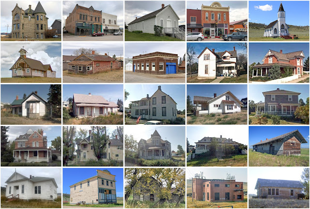
Lake County, Montana

Image
Founding:  1923 Parent counties:  Flathead and Missoula Namesake:  Flathead Lake Seat:  Polson (1923–) Land area:  1,490 square miles Population (2020):  31,134 Population (historic):  9,541 (1930); 13,490 (1940) Periods of population growth:  pre-1930–1950; 1960–2020 Subdivisions:  Two cities; one town; 21 CDPs Pre-1940 residences (estimated):  1,175 (9.8%) Pre-1940 housing survival rate:  38.4% Farm housing in disrepair (1950):  13% Nonfarm housing in disrepair (1950):  9.7% Average farmhouse value (1930):  $754 Average outbuilding value (1930):  $590 Average farmhouse size (1940):  3.8 rooms Number of farms (1930):  1,197 Sources of settlement:  Montana, Minnesota, Iowa, Wisconsin, Illinois, and Missouri _________________________________________________________________________________   Polson   Namesake:  David Polson, local rancher Founding:  1898 (post office); 1...
Pondera County, Montana

Image
Founding:  1919 Parent counties:  Chouteau and Teton Namesake:  The Pend d'Oreilles people Seat:  Conrad (1919–) Land area:  1,623 square miles Population (2020):  5,898 Population (historic):  5,741 (1920); 6,964 (1930) Periods of population growth:  pre-1920–1930; 1950s; 1970s Subdivisions:  One city; one town; eight CDPs Pre-1940 residences (estimated):  434 (20.2%) Pre-1940 housing survival rate:  29.8% Farm housing in disrepair (1950):  7.5% Nonfarm housing in disrepair (1950):  4.6% Average farmhouse value (1930):  $866 Average outbuilding value (1930):  $839 Average farmhouse size (1940):  3.9 rooms Number of farms (1920):  1,060 Average farm size (1920):  251.1 acres Sources of settlement:  Minnesota, Missouri, Wisconsin, Iowa, Washington, and Canada _________________________________________________________________________________   Conrad   Namesake:  William Conrad, Mo...

Meagher County, Montana

Image
Founding:  1867 Parent counties:  Chouteau and Gallatin Namesake:  Thomas Meagher, Montana territorial governor Seat:   Diamond City (1867–1879); White Sulphur Springs (1879–) Land area:  2,392 square miles Population (2020):  1,927 Population (historic):  1,387 (1870); 4,749 (1890); 4,190 (1910); 2,272 (1930) Periods of population growth:  pre-1870–1890; 1900s; 1950s; 1970s; 1990s; 2010s Subdivisions:  One city; two CDPs Pre-1940 residences (estimated):  382 (26.9%) Pre-1940 housing survival rate:  52.8% Farm housing in disrepair (1950):  4.1% Nonfarm housing in disrepair (1950):  5.7% Average farmhouse value (1930):  $1,011 Average outbuilding value (1930):  $1,695 Average farmhouse size (1940):  4.6 rooms Number of farms (1920):  447 Average farm size (1920):  306.1 acres _________________________________________________________________________________   White Sulphur Springs ...

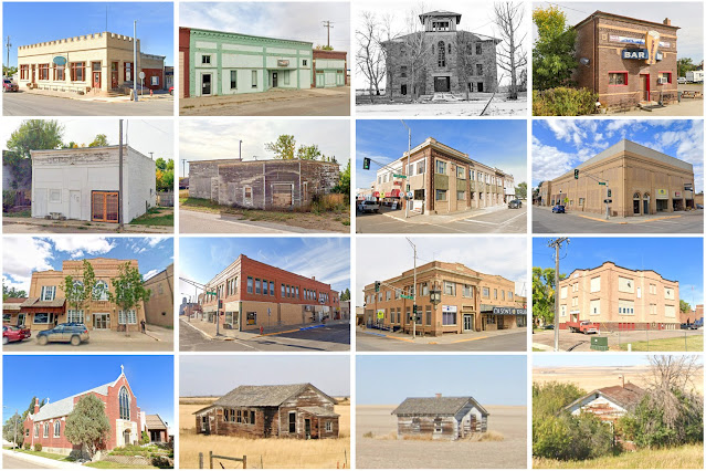
Toole County, Montana

Image
Founding:  1914 Parent counties:  Hill and Teton Namesake:  Joseph Toole, Montana governor Seat:  Shelby (1914–) Land area:  1,916 square miles Population (2020):  4,971 Population (historic):  3,724 (1920); 6,714 (1930); 6,769 (1940) Periods of population growth:  pre-1920–1960; 1990–2010 Subdivisions:  One city; two towns; four CDPs Pre-1940 residences (estimated):  469 (20.1%) Pre-1940 housing survival rate:  24.3% Farm housing in disrepair (1950):  11.9% Nonfarm housing in disrepair (1950):  7.3% Average farmhouse value (1930):  $666 Average outbuilding value (1930):  $713 Average farmhouse size (1940):  3.9 rooms Number of farms (1920):  933 Average farm size (1920):  164.9 acres Sources of settlement:  Montana, Minnesota, Canada, North Dakota, and Norway _________________________________________________________________________________   Shelby   Namesake:  Peter Shelby, ra...

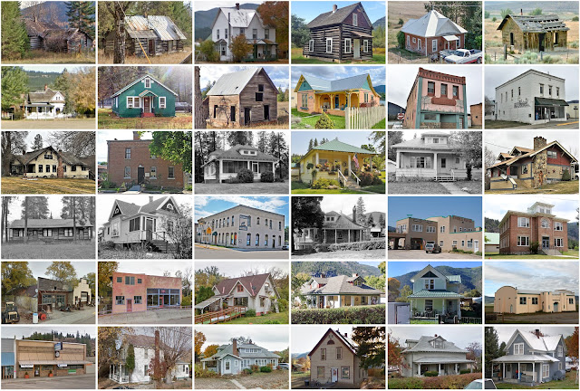
Sanders County, Montana

Image
Founding:  1905 Parent county:  Missoula Namesake:  Wilbur Sanders, Montana senator Seat:  Thompson Falls (1905–) Land area:  2,761 square miles Population (2020):  12,400 Population (historic):  3,713 (1910); 4,903 (1920); 5,692 (1930) Periods of population growth:  pre-1910–1940; 1960–1980; 1990–2020 Subdivisions:  Two cities; one town; 10 CDPs Pre-1940 residences (estimated):  720 (10.6%) Pre-1940 housing survival rate:  30.6% Farm housing in disrepair (1950):  16.7% Nonfarm housing in disrepair (1950):  15% Average farmhouse value (1930):  $779 Average outbuilding value (1930):  $636 Average farmhouse size (1940):  3.8 rooms Number of farms (1920):  667 Average farm size (1920):  63.6 acres _________________________________________________________________________________   Thompson Falls   Namesake:  David Thompson, British fur trader Founding:  1882 (post office); 1885 (pla...

Deer Lodge County, Montana

Image
Founding:  1865 Parent county:  Unorganized territory Namesake:  The Deer Lodge Valley Seat:   Silver Bow (1865–1867); Deer Lodge (1867–1896); Anaconda (1896–) Land area:  737 square miles Population (2020):  9,421 Population (historic):  4,367 (1870); 15,155 (1890); 12,988 (1910); 16,293 (1930) Periods of population growth:  pre-1870–1900; 1910–1930; 1940–1960; 2010s Subdivisions:  One city Pre-1940 residences (estimated):  1,795 (34.4%) Pre-1940 housing survival rate:  43% Farm housing in disrepair (1950):  11.5% Nonfarm housing in disrepair (1950):  6% Average farmhouse value (1930):  $1,591 Average outbuilding value (1930):  $1,707 Average farmhouse size (1940):  4.1 rooms Number of farms (1920):  202 Average farm size (1920):  119.9 acres _________________________________________________________________________________   Anaconda   Namesake:  Unknown Founding:  1883 (...

Wheatland County, Montana

Image
Founding:  1917 Parent counties:  Meagher and Sweet Grass Namesake:  Wheat farms within the county Seat:  Harlowton (1917–) Land area:  1,423 square miles Population (2020):  2,069 Population (historic):  5,619 (1920); 3,751 (1930); 3,286 (1940) Periods of population growth:  pre-1920 Subdivisions:  Two cities; five CDPs Pre-1940 residences (estimated):  429 (34.7%) Pre-1940 housing survival rate:  45.5% Farm housing in disrepair (1950):  8.8% Nonfarm housing in disrepair (1950):  4% Average farmhouse value (1930):  $1,018 Average outbuilding value (1930):  $1,543 Average farmhouse size (1940):  4.9 rooms Number of farms (1920):  688 Average farm size (1920):  298.1 acres Sources of settlement:  Minnesota, Wisconsin, Iowa, South Dakota, and Canada _________________________________________________________________________________   Harlowton   Namesake:  Richard Harlow, railroad p...

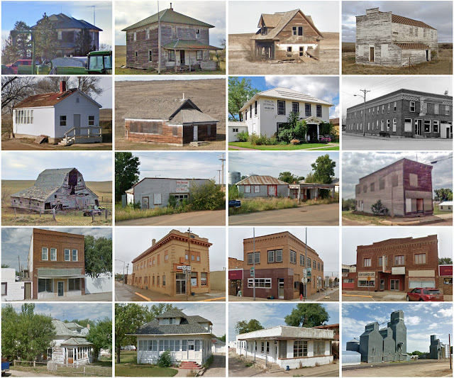
McCone County, Montana

Image
Founding:  1919 Parent counties:  Dawson and Richland Namesake:  George McCone, Montana senator Seat:  Circle (1919–) Land area:  2,643 square miles Population (2020):  1,729 Population (historic):  4,747 (1920); 4,790 (1930); 3,744 (1940) Periods of population growth:  pre-1920 Subdivisions:  One town; three CDPs Pre-1940 residences (estimated):  263 (23.2%) Pre-1940 housing survival rate:  20.6% Farm housing in disrepair (1950):  11% Nonfarm housing in disrepair (1950):  11.4% Average farmhouse value (1930):  $619 Average outbuilding value (1930):  $573 Average farmhouse size (1940):  3.5 rooms Number of farms (1920):  1,284 Average farm size (1920):  178.8 acres Sources of settlement:  Minnesota, Wisconsin, North Dakota, Illinois, Norway, and South Dakota _________________________________________________________________________________   Circle   Namesake:  The nearby Circle ...

Liberty County, Montana

Image
Founding:  1920 Parent counties:  Chouteau and Hill Namesake:  The American ideal of liberty Seat:  Chester (1920–) Land area:  1,430 square miles Population (2020):  1,959 Population (historic):  2,416 (1920); 2,198 (1930); 2,209 (1940) Periods of population growth:  pre-1920; 1950s; 2000s Subdivisions:  One town; five CDPs Pre-1940 residences (estimated):  278 (24.1%) Pre-1940 housing survival rate:  38.3% Farm housing in disrepair (1950):  4.3% Nonfarm housing in disrepair (1950):  4.1% Average farmhouse value (1930):  $748 Average outbuilding value (1930):  $677 Average farmhouse size (1940):  4 rooms Number of farms (1920):  515 Average farm size (1920):  192.7 acres _________________________________________________________________________________   Chester   Namesake:  Chester, Pennsylvania Founding:  circa 1891 (founding); 1895 (post office); 1910 (incorporation...

Fallon County, Montana

Image
Founding:  1913 Parent county:  Custer Namesake:  Benjamin O'Fallon, Indian agent Seat:  Baker (1913–) Land area:  1,621 square miles Population (2020):  3,049 Population (historic):  4,548 (1920); 4,568 (1930) Periods of population growth:  pre-1920; 1950–1970; 2000–2020 Subdivisions:  One city; one town Pre-1940 residences (estimated):  339 (21.2%) Pre-1940 housing survival rate:  25.1% Farm housing in disrepair (1950):  9.6% Nonfarm housing in disrepair (1950):  10% Average farmhouse value (1930):  $792 Average outbuilding value (1930):  $797 Average farmhouse size (1940):  4.3 rooms Number of farms (1920):  758 Average farm size (1920):  226.7 acres Sources of settlement:  Minnesota, Wisconsin, Iowa, South Dakota, and Russia _________________________________________________________________________________   Baker   Namesake:  A.G. Baker, railroad engineer Founding: ...

Powder River County, Montana

Image
Founding:  1919 Parent county:  Custer Namesake:  The Powder River Seat:  Broadus (1920–) Land area:  3,297 square miles Population (2020):  1,694 Population (historic):  3,357 (1920); 3,909 (1930); 3,159 (1940) Periods of population growth:  pre-1920–1930; 1960s Subdivisions:  One town; one CDP Pre-1940 residences (estimated):  117 (11.3%) Pre-1940 housing survival rate:  14.3% Farm housing in disrepair (1950):  17.8% Nonfarm housing in disrepair (1950):  14.6% Average farmhouse value (1930):  $620 Average outbuilding value (1930):  $522 Average farmhouse size (1940):  3.1 rooms Number of farms (1920):  833 Average farm size (1920):  90.3 acres _________________________________________________________________________________   Broadus   ...