Posts

Showing posts with the label sullivan county

Sullivan County, New York
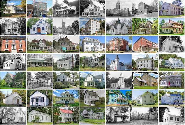
Image
Founding:  1809 Parent county:  Ulster Namesake:  John Sullivan, Continental Army general Seat:  Monticello (1809–) Land area:  968 square miles Population (2020):  78,624 Population (historic):  6,108 (1810); 15,629 (1840); 34,550 (1870); 32,306 (1900); 35,272 (1930) Periods of population growth:  pre-1810–1870; 1890 –1910;  1920 –2020 Subdivisions:  Six villages; 25 CDPs; 15 towns Pre-1940 residences (estimated):  11,314 (22.3%) Pre-1940 housing survival rate:  42.8% Pre-1860 housing survival rate (1940):  15% Farm housing in disrepair (1950):  5.6% Nonfarm housing in disrepair (1950):  3.4% Average farmhouse value (1930):  $4,321 Average outbuilding value (1930):  $3,128 Average farmhouse size (1940):  6.5 rooms Number of farms (1920):  3,543 Average farm size (1920):  43.6 acres _________________________________________________________________________________   Monticello   ...

Sullivan County, Missouri

Image
Founding:  1845 (declared in 1843) Parent county:  Unorganized territory Namesake:  John Sullivan, Continental Army general Seat:  Milan (1845–) Land area:  648 square miles Population (2020):  5,999 Population (historic):  2,983 (1850); 11,907 (1870); 19,000 (1890); 18,598 (1910); 15,212 (1930) Periods of population growth:  pre-1850–1900; 1990s Subdivisions:  Six cities; three villages; one CDP; 12 townships Pre-1940 residences (estimated):  936 (27.9%) Pre-1940 housing survival rate:  31.9% Pre-1860 housing survival rate (1940):  2.8% Farm housing in disrepair (1950):  12.6% Nonfarm housing in disrepair (1950):  17.4% Average farmhouse value (1930):  $1,060 Average outbuilding value (1930):  $728 Average farmhouse size (1940):  5.3 rooms Number of farms (1920):  2,660 Average farm size (1920):  128 acres Sources of settlement:  Ohio, Indiana, Illinois, Kentuck...

Sullivan County, Pennsylvania

Image
Founding:  1847 Parent county:  Lycoming Namesake:  Uncertain—possibly John Sullivan, Continental Army general Seat:  LaPorte (1847–) Land area:  450 square miles Population (2020):  5,840 Population (historic):  3,694 (1850); 6,191 (1870); 12,134 (1900); 7,499 (1930) Periods of population growth:  pre-1850–1900; 1970s; 1990s Subdivisions:  Four boroughs; nine townships Pre-1940 residences (estimated):  1,821 (28.6%) Pre-1940 housing survival rate:  83.9% Pre-1860 housing survival rate (1940):  13.5% Farm housing in disrepair (1950):  13.4% Nonfarm housing in disrepair (1950):  11.9% Average farmhouse value (1930):  $1,040 Average outbuilding value (1930):  $958 Average farmhouse size (1940):  7.2 rooms Number of farms (1920):  836 Average farm size (1920):  42.7 acres _________________________________________________________________________________ LaPor...

Sullivan County, Indiana

Image
Founding:  1817 Parent county:  Knox Namesake:  Daniel Sullivan, Indiana militiaman Seat:  Merom (1819–1842); Sullivan (1842–) Land area:  447 square miles Population (2020):  20,817 Population (historic):  3,498 (1820); 10,141 (1850); 18,453 (1870); 26,005 (1900); 28,133 (1930) Periods of population growth:  pre-1820–1910; 1970s; 1990s Subdivisions:  One city; six towns; nine townships Pre-1940 residences (estimated):  2,318 (26%) Pre-1940 housing survival rate:  37.7% Pre-1860 housing survival rate (1940):  7.6% Farm housing in disrepair (1950):  10.9% Nonfarm housing in disrepair (1950):  10.5% Average farmhouse value (1930):  $927 Average outbuilding value (1930):  $524 Average farmhouse size (1940):  4.9 rooms Number of farms (1920):  2,837 Average farm size (1920):  74.3 acres Sources of settlement:  Kentucky, Ohio, and Illinois ____________________________...