Posts

Showing posts from November, 2023

Waukesha County, Wisconsin
Image
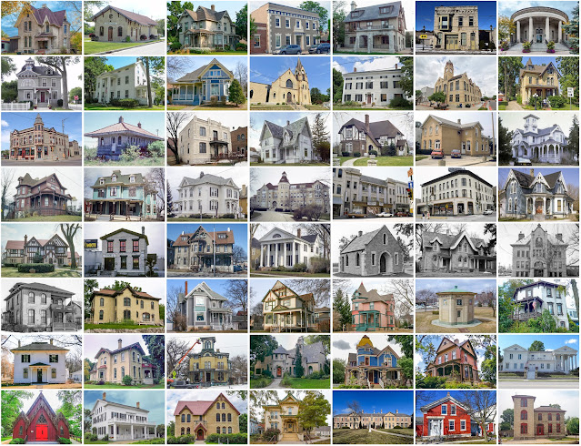
Founding:  1846 Parent county:  Milwaukee Namesake:  Uncertain—perhaps a Pottawatomi word describing the Fox River Seat:  Waukesha (1846–) Land area:  550 square miles Population (2020):  406,978 Population (historic):  19,258 (1850); 28,274 (1870); 33,270 (1890); 37,100 (1910); 52,358 (1930) Periods of population growth:  pre-1850–2020 Subdivisions:  Seven cities; 22 villages; two CDPs; eight towns Pre-1940 residences (estimated):  11,911 (6.8%) Pre-1940 housing survival rate:  68.5% Pre-1860 housing survival rate (1940):  14.1% Farm housing in disrepair (1950):  5.8% Nonfarm housing in disrepair (1950):  3.3% Average farmhouse value (1930):  $3,178 Average outbuilding value (1930):  $3,338 Average farmhouse size (1940):  7 rooms Number of farms (1920):  3,406 Average farm size (1920):  66.7 acres Sources of settlement:  Germany, New York, England, Wales, and Ireland ____________________...

Adams County, Idaho

Image
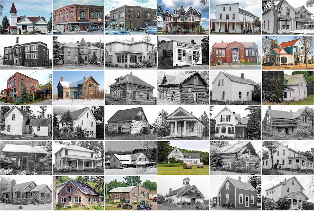
Founding:  1911 Parent county:  Washington Namesake:  John Adams, U.S. president Seat:  Council (1911–) Land area:  1,363 square miles Population (2020):  4,379 Population (historic):  2,966 (1920); 2,867 (1930); 3,407 (1940) Periods of population growth:  pre-1920; 1930s; 1970s; 1990–2020 Subdivisions:  Two cities Pre-1940 residences (estimated):  173 (6.5%) Pre-1940 housing survival rate:  27.3% Farm housing in disrepair (1950):  12.7% Nonfarm housing in disrepair (1950):  14.7% Average farmhouse value (1930):  $818 Average outbuilding value (1930):  $770 Average farmhouse size (1940):  4.4 rooms Number of farms (1920):  484 Average farm size (1920):  111.5 acres _________________________________________________________________________________   Council   Namesake:  The Council Valley Founding:  1878 (post office); 1903 (incorporation) Population (2020):  867 Population (...

Douglas County, Wisconsin

Image
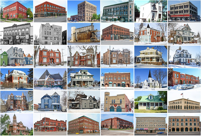
Founding:  1854 Parent county:  La Pointe Namesake:  Stephen Douglas, Illinois senator Seat:  Superior (1854–) Land area:  1,304 square miles Population (2020):  44,295 Population (historic):  812 (1860); 655 (1880); 36,335 (1900); 46,583 (1930) Periods of population growth:  pre-1860–1870; 1880–1920; 1930s; 1990–2020 Subdivisions:  One city; five villages; two CDPs; 16 towns Pre-1940 residences (estimated):  5,967 (26.1%) Pre-1940 housing survival rate:  50.9% Farm housing in disrepair (1950):  16.6% Nonfarm housing in disrepair (1950):  9.2% Average farmhouse value (1930):  $1,039 Average outbuilding value (1930):  $856 Average farmhouse size (1940):  4.2 rooms Number of farms (1920):  1,557 Average farm size (1920):  26 acres Sources of settlement:  Wisconsin, Minnesota, Sweden, Michigan, Canada, Norway, France, and Germany ___________________________________________________________________...

Sawyer County, Wisconsin

Image
Founding:  1885 (declared in 1883) Parent counties:  Ashland and Chippewa Namesake:  Philetus Sawyer, Wisconsin senator Seat:  Hayward (1885–) Land area:  1,257 square miles Population (2020):  18,074 Population (historic):  1,977 (1890); 6,227 (1910); 8,878 (1930) Periods of population growth:  pre-1890–1940; 1960–2020 Subdivisions:  One city; four villages; five CDPs; 16 towns Pre-1940 residences (estimated):  1,307 (8.2%) Pre-1940 housing survival rate:  38% Farm housing in disrepair (1950):  10.2% Average farmhouse value (1930):  $807 Average outbuilding value (1930):  $809 Average farmhouse size (1940):  4.1 rooms Number of farms (1920):  823 Average farm size (1920):  24.9 acres Sources of settlement:  Wisconsin, Norway, Minnesota, Canada, Sweden, and Germany _________________________________________________________________________________   Hayward   Namesake:  ...

Oneida County, Wisconsin

Image
Founding:  1887 Parent county:  Lincoln Namesake:  The Oneida people Seat:  Rhinelander (1887–) Land area:  1,113 square miles Population (2020):  37,845 Population (historic):  5,010 (1890); 11,433 (1910); 15,899 (1930) Periods of population growth:  pre-1890–2000; 2010s Subdivisions:  One city; four CDPs; 20 towns Pre-1940 residences (estimated):  2,515 (8.2%) Pre-1940 housing survival rate:  49.5% Farm housing in disrepair (1950):  21.8% Average farmhouse value (1930):  $1,306 Average outbuilding value (1930):  $1,273 Average farmhouse size (1940):  4.7 rooms Number of farms (1920):  724 Average farm size (1920):  38.9 acres Sources of settlement:  Wisconsin, Germany, Michigan, Canada, Sweden, Norway, and Russia _________________________________________________________________________________   Rhinelander   Namesake:  Frederic Rhinelander, railroad president Founding:  1880 ...

Sheridan County, Kansas

Image
Founding:  1880 (declared in 1873) Parent county:  Unorganized territory Namesake:  Philip Sheridan, Union general Seat:   Kenneth (1880–1886); Hoxie (1886–) Land area:  896 square miles Population (2020):  2,447 Population (historic):  1,567 (1880); 3,819 (1900); 6,038 (1930) Periods of population growth:  pre-1880–1910; 1920s Subdivisions:  Two cities; 14 townships Pre-1940 residences (estimated):  269 (23.1%) Pre-1940 housing survival rate:  31.8% Farm housing in disrepair (1950):  8.4% Nonfarm housing in disrepair (1950):  5.2% Average farmhouse value (1930):  $1,019 Average outbuilding value (1930):  $984 Average farmhouse size (1940):  5.3 rooms Number of farms (1920):  932 Average farm size (1920):  448.4 acres Sources of settlement:  Kansas, Iowa, Missouri, Illinois, and Nebraska _________________________________________________________________________________   Hoxie   Names...

Rawlins County, Kansas

Image
Founding:  1881 (declared in 1873) Parent county:  Unorganized territory Namesake:  John Rawlins, Union officer Seat:  Atwood (1881–) Land area:  1,069 square miles Population (2020):  2,561 Population (historic):  1,623 (1880); 5,241 (1900); 7,362 (1930) Periods of population growth:  1870–1890; 1900–1930; 2010s Subdivisions:  Three cities; ten townships Pre-1940 residences (estimated):  514 (37.5%) Pre-1940 housing survival rate:  41.3% Farm housing in disrepair (1950):  7.6% Nonfarm housing in disrepair (1950):  3.8% Average farmhouse value (1930):  $1,184 Average outbuilding value (1930):  $1,204 Average farmhouse size (1940):  5.5 rooms Number of farms (1920):  1,048 Average farm size (1920):  350.2 acres Sources of settlement:  Kansas, Nebraska, Iowa, Illinois, Czechoslovakia, and Germany _________________________________________________________________________________   Atwood ...

Rice County, Kansas

Image
Founding:  1871 (declared in 1867) Parent county:  Unorganized territory Namesake:  Samuel Rice, Union soldier Seat:   Atlanta (1871–1876); Lyons (1876–) Land area:  726 square miles Population (2020):  9,427 Population (historic):  9,292 (1880); 14,745 (1900); 13,800 (1930) Periods of population growth:  1870–1910; 1930s; 1990s Subdivisions:  Nine cities; 20 townships Pre-1940 residences (estimated):  1,345 (30.6%) Pre-1940 housing survival rate:  35.5% Farm housing in disrepair (1950):  8.4% Nonfarm housing in disrepair (1950):  7% Average farmhouse value (1930):  $1,416 Average outbuilding value (1930):  $1,287 Average farmhouse size (1940):  6 rooms Number of farms (1920):  1,660 Average farm size (1920):  224.8 acres Sources of settlement:  Ohio, Illinois, Indiana, Iowa, and Pennsylvania _________________________________________________________________________________   Lyons  ...