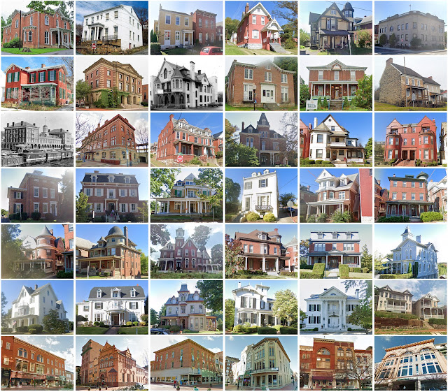
Allegany County, Maryland
Founding: 1789
Parent county: Washington
Namesake: The Allegheny Mountains
Seat: Cumberland (1789–)
Seat: Cumberland (1789–)
Land area: 424 square miles
Population (2020): 68,106
Population (historic): 4,809 (1790); 10,609 (1830); 28,348 (1860); 41,571 (1890); 79,098 (1930)
Periods of population growth: pre-1790–1870; 1880–1950; 2010s
Subdivisions: Two cities; five towns; 30 CDPs
Pre-1940 residences (estimated): 10,606 (32.1%)
Pre-1940 housing survival rate: 56.9%
Pre-1860 housing survival rate (1940): 24.8%
Pre-1940 housing survival rate: 56.9%
Pre-1860 housing survival rate (1940): 24.8%
Farm housing in disrepair (1950): 16%
Nonfarm housing in disrepair (1950): 7.2%
Average farmhouse value (1930): $1,289Average outbuilding value (1930): $825
Average farmhouse size (1940): 5.6 rooms
Number of farms (1920): 999
Average farm size (1920): 64.1 acres
_________________________________________________________________________________
Cumberland
Namesake: Prince William, Duke of Cumberland
Founding: 1787 (platting); 1795 (post office)
Population (2020): 19,076
Population (historic): 2,428 (1840); 4,078 (1860); 10,693 (1880); 17,128 (1900); 37,747 (1930)
Periods of population growth: pre-1840–1850; 1860–1940
Pre-1940 residences (estimated): 4,891 (46.8%)
_________________________________________________________________________________
Pre-1940 residences (estimated): 4,891 (46.8%)
_________________________________________________________________________________
_________________________________________________________________________________


Comments
Post a Comment