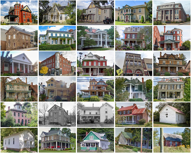
Monongalia County, West Virginia
Founding: 1776
Parent counties: Hampshire and the District of West Augusta
Namesake: Unclear—perhaps the Monongahela River
Seat: Phillips' Choice Plantation (1776–1779); Mifflintown (1779–1783); Morgantown (1783–)
Seat: Phillips' Choice Plantation (1776–1779); Mifflintown (1779–1783); Morgantown (1783–)
Land area: 360 square miles
Population (2020): 105,822
Population (historic): 4,768 (1790); 14,056 (1830); 13,048 (1860); 15,705 (1890); 50,083 (1930)
Periods of population growth: pre-1790–1810; 1820–1840; 1850–1950; 1960–2020
Subdivisions: Two cities; three towns; four CDPs
Pre-1940 residences (estimated): 6,110 (13.6%)
Pre-1940 housing survival rate: 46.8%
Pre-1860 housing survival rate (1940): 16.6%
Pre-1940 housing survival rate: 46.8%
Pre-1860 housing survival rate (1940): 16.6%
Farm housing in disrepair (1950): 14.4%
Nonfarm housing in disrepair (1950): 13.7%
Average farmhouse value (1930): $1,451Average outbuilding value (1930): $626
Average farmhouse size (1940): 5.3 rooms
Number of farms (1920): 1,805
Average farm size (1920): 68.7 acres
_________________________________________________________________________________
Morgantown
Namesake: Zackquill Morgan, platter
Founding: 1783 (platting); 1795 (post office); 1838 (incorporation)
Population (2020): 30,347
Population (historic): 741 (1860); 745 (1880); 1,895 (1900); 16,186 (1930)
Periods of population growth: pre-1860–1870; 1880–1950; 1960s; 1990–2020
Pre-1940 residences (estimated): 3,223 (26%)
_________________________________________________________________________________
Pre-1940 residences (estimated): 3,223 (26%)
_________________________________________________________________________________
_________________________________________________________________________________


Comments
Post a Comment