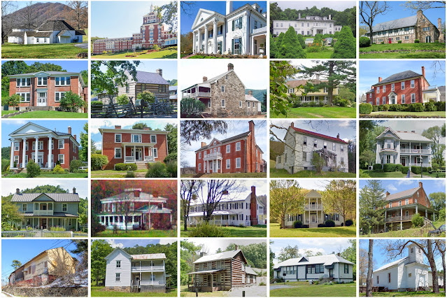
Bath County, Virginia
Founding: 1791
Parent counties: Augusta, Botetourt, and Greenbrier
Namesake: Bath, England
Seat: Warm Springs (1791–)
Seat: Warm Springs (1791–)
Land area: 529 square miles
Population (2020): 4,209
Population (historic): 5,508 (1800); 4,300 (1840); 3,795 (1870); 5,595 (1900); 8,137 (1930)
Periods of population growth: pre-1800; 1810s; 1830s; 1850–1910; 1920s; 1970s; 1990s
Subdivisions: Two CDPs
Pre-1940 residences (estimated): 821 (24.5%)
Pre-1940 housing survival rate: 48.7%
Pre-1860 housing survival rate (1940): 15%
Pre-1940 housing survival rate: 48.7%
Pre-1860 housing survival rate (1940): 15%
Farm housing in disrepair (1950): 14.1%
Nonfarm housing in disrepair (1950): 21%
Average farmhouse value (1930): $2,237Average outbuilding value (1930): $1,125
Average farmhouse size (1940): 6.2 rooms
Number of farms (1920): 639
Average farm size (1920): 65.3 acres
_________________________________________________________________________________
Warm Springs
Namesake: Mineral springs within the village
Founding: 1794 (post office)
Population (2020): 121
Pre-1940 residences (estimated): 65 (100%)
_________________________________________________________________________________
View and filter the data. Or see a map.
_________________________________________________________________________________
_________________________________________________________________________________
View and filter the data. Or see a map.
_________________________________________________________________________________

Comments
Post a Comment