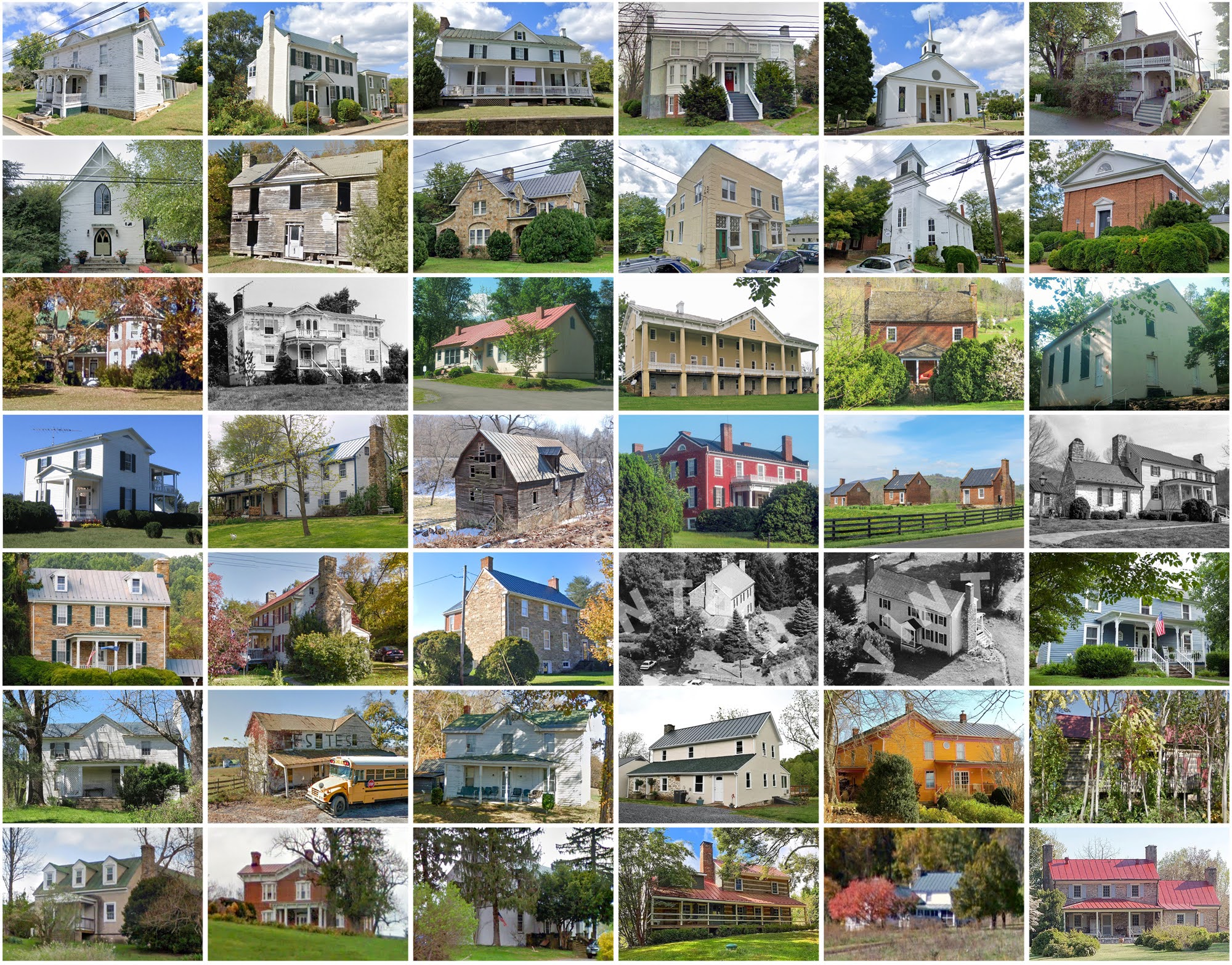
Rappahannock County, Virginia
Founding: 1833
Parent county: Culpeper
Namesake: The Rappahannock River
Seat: Washington (1833–)
Seat: Washington (1833–)
Land area: 266 square miles
Population (2020): 7,348
Population (historic): 9,257 (1840); 8,850 (1860); 9,291 (1880); 8,843 (1900); 7,717 (1930)
Periods of population growth: pre-1840–1850; 1870s; 1890s; 1970–2010
Subdivisions: One town; three CDPs
Pre-1940 residences (estimated): 1,072 (27.2%)
Pre-1940 housing survival rate: 51.4%
Pre-1860 housing survival rate (1940): 26%
Pre-1940 housing survival rate: 51.4%
Pre-1860 housing survival rate (1940): 26%
Farm housing in disrepair (1950): 35.7%
Nonfarm housing in disrepair (1950): 24.4%
Average farmhouse value (1930): $1,500Average outbuilding value (1930): $942
Average farmhouse size (1940): 5.5 rooms
Number of farms (1920): 949
Average farm size (1920): 107.9 acres
_________________________________________________________________________________
Washington
Namesake: George Washington, U.S. president
Founding: 1749 (platting); 1795 (incorporation); 1803 (post office)
Population (2020): 86
Population (historic): 254 (1880); 300 (1900); 250 (1930)
Periods of population growth: pre-1880; 1890s; 1970s
Pre-1940 residences (estimated): 48 (60.8%)
_________________________________________________________________________________
View and filter the data. Or see a map.
_________________________________________________________________________________

Pre-1940 residences (estimated): 48 (60.8%)
_________________________________________________________________________________
View and filter the data. Or see a map.
_________________________________________________________________________________
Comments
Post a Comment