Cooper County, Missouri
Founding: 1819
Parent county: Howard
Namesake: Sarshell Cooper, local settler
Seat: Boonville (1818–)
Seat: Boonville (1818–)
Land area: 565 square miles
Population (2020): 17,103
Population (historic): 6,959 (1820); 12,950 (1850); 20,692 (1870); 22,532 (1900); 19,522 (1930)
Periods of population growth: pre-1820; 1830–1890; 1920s; 1980–2010
Subdivisions: Six cities; two villages; 14 townships
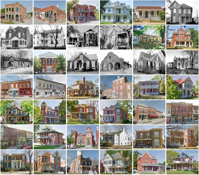
Pre-1940 residences (estimated): 1,329 (17.7%)
Pre-1940 housing survival rate: 38%
Pre-1860 housing survival rate (1940): 12.3%
Pre-1940 housing survival rate: 38%
Pre-1860 housing survival rate (1940): 12.3%
Farm housing in disrepair (1950): 13.6%
Nonfarm housing in disrepair (1950): 13%
Average farmhouse value (1930): $1,676Average outbuilding value (1930): $1,267
Average farmhouse size (1940): 5 rooms
Number of farms (1920): 2,419
Average farm size (1920): 112.8 acres
Sources of settlement: Kentucky, Virginia, Germany, and Ohio
Number of farms (1920): 2,419
Average farm size (1920): 112.8 acres
Sources of settlement: Kentucky, Virginia, Germany, and Ohio
______________________________________________________________________________
Boonville
Namesake: Daniel and Nathan Boone, local salt traders
Founding: 1817 (platting); 1825 (post office); 1839 (incorporation)
Population (2020): 7,964
Population (historic): 2,326 (1850); 3,506 (1870); 4,141 (1890); 4,252 (1910); 6,435 (1930)
Periods of population growth: pre-1850–1900; 1910–1930; 1940–1970; 1980–2010
Pre-1940 residences (estimated): 635 (17.9%)
Pre-1940 residences (estimated): 635 (17.9%)
______________________________________________________________________________
View and filter the data. Or see a map.
View and filter the data. Or see a map.
______________________________________________________________________________


Comments
Post a Comment