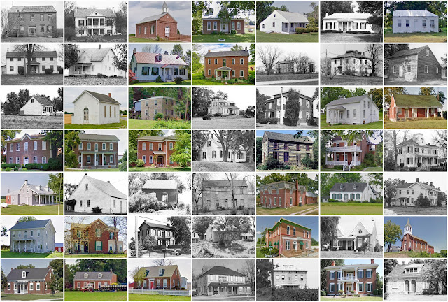
St. Clair County, Illinois
Founding: 1790
Parent county: Unorganized territory
Namesake: Arthur St. Clair, governor of the Northwest Territory
Seat: Cahokia (1790–1814); Belleville (1814–)
Seat: Cahokia (1790–1814); Belleville (1814–)
Land area: 658 square miles
Population (2020): 257,400
Population (historic): 5,253 (1820); 20,180 (1850); 51,068 (1870); 86,685 (1900); 157,775 (1930)
Periods of population growth: pre-1820–1970; 2000s
Subdivisions: 11 cities; 21 villages; five CDPs; 21 townships
Pre-1940 residences (estimated): 16,778 (14.1%)
Pre-1940 housing survival rate: 33.7%
Pre-1860 housing survival rate (1940): 31.2%
Pre-1940 housing survival rate: 33.7%
Pre-1860 housing survival rate (1940): 31.2%
Farm housing in disrepair (1950): 6.9%
Nonfarm housing in disrepair (1950): 12.4%
Average farmhouse value (1930): $1,579Average outbuilding value (1930): $1,230
Average farmhouse size (1940): 5.3 rooms
Number of farms (1920): 3,112
Average farm size (1920): 97.8 acres
Sources of settlement: Germany, Missouri, Ireland, England, France, Indiana, and Kentucky
_________________________________________________________________________________
Number of farms (1920): 3,112
Average farm size (1920): 97.8 acres
Sources of settlement: Germany, Missouri, Ireland, England, France, Indiana, and Kentucky
_________________________________________________________________________________
Belleville
Namesake: A French term meaning "beautiful city"
Founding: 1814 (platting); 1816 (post office); 1819 (incorporation)
Population (2020): 42,404
Population (historic): 2,941 (1850); 8,146 (1870); 15,361 (1890); 21,122 (1910); 28,425 (1930)
Periods of population growth: pre-1850–1930; 1940–1990; 2000s
Pre-1940 residences (estimated): 5,431 (25.8%)
_________________________________________________________________________________
View and filter the data. Or see a map.
_________________________________________________________________________________
Pre-1940 residences (estimated): 5,431 (25.8%)
_________________________________________________________________________________
View and filter the data. Or see a map.
_________________________________________________________________________________


Comments
Post a Comment