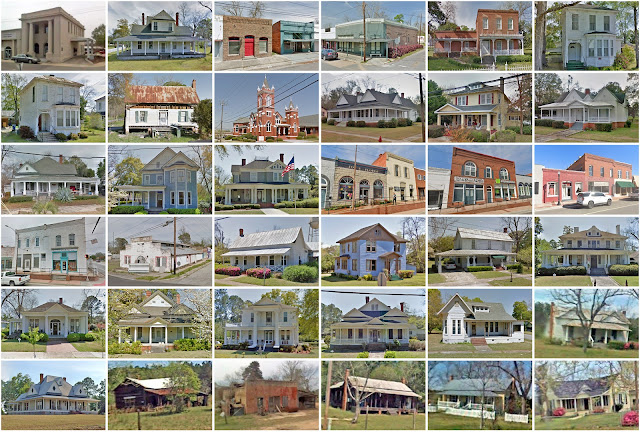
Telfair County, Georgia
Founding: 1807
Parent county: Wilkinson
Namesake: Edward Telfair, Georgia governor
Seat: Jacksonville (1807–1871); McRae (1871–)
Seat: Jacksonville (1807–1871); McRae (1871–)
Land area: 437 square miles
Population (2020): 12,477
Population (historic): 744 (1810); 2,763 (1840); 3,245 (1870); 10,083 (1900); 14,997 (1930)
Periods of population growth: pre-1810–1850; 1860–1920; 1930s; 1990–2010
Subdivisions: Four cities; one town
Pre-1940 residences (estimated): 631 (8.7%)
Pre-1940 housing survival rate: 13.4%
Pre-1860 housing survival rate (1940): 4.5%
Pre-1940 housing survival rate: 13.4%
Pre-1860 housing survival rate (1940): 4.5%
Farm housing in disrepair (1950): 38%
Nonfarm housing in disrepair (1950): 28.1%
Average farmhouse value (1930): $401Average outbuilding value (1930): $189
Average farmhouse size (1940): 4.1 rooms
Number of farms (1920): 1,897
Average farm size (1920): 45.9 acres
_________________________________________________________________________________
McRae
Namesake: Daniel McRae, owner of the city site
Founding: 1870 (platting); 1871 (post office); 1874 (incorporation)
Population (2000): 2,682
Population (historic): 1,020 (1900); 1,160 (1910); 1,273 (1920); 1,314 (1930)
Periods of population growth: pre-1900; 1930–1970
Pre-1940 residences (estimated): 376 (13.9%)
_________________________________________________________________________________
View and filter the data. Or see a map.
Pre-1940 residences (estimated): 376 (13.9%)
_________________________________________________________________________________
View and filter the data. Or see a map.
_________________________________________________________________________________

Comments
Post a Comment