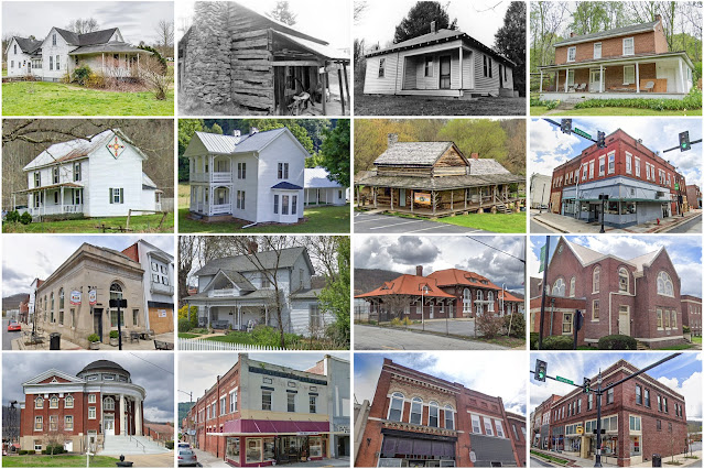
Unicoi County, Tennessee
Founding: 1875
Parent counties: Carter and Washington
Namesake: A Cherokee word referencing the area's fogs
Seat: Erwin (1875–)
Seat: Erwin (1875–)
Land area: 186 square miles
Population (2020): 17,928
Population (historic): 3,645 (1880); 5,851 (1900); 12,678 (1930)
Periods of population growth: pre-1880–1950; 1960–2010
Subdivisions: Two towns; one CDP
Pre-1940 residences (estimated): 1,231 (13.8%)
Pre-1940 housing survival rate: 43.3%
Pre-1940 housing survival rate: 43.3%
Farm housing in disrepair (1950): 19.8%
Nonfarm housing in disrepair (1950): 11.2%
Average farmhouse value (1930): $595Average outbuilding value (1930): $251
Average farmhouse size (1940): 4.3 rooms
Number of farms (1920): 811
Average farm size (1920): 26.9 acres
_________________________________________________________________________________
Erwin
Namesake: David Ervin, owner of the city site
Founding: 1879 (post office); 1903 (incorporation)
Population (2020): 6,083
Population (historic): 1,149 (1910); 2,965 (1920); 3,623 (1930)
Periods of population growth: pre-1910–1930; 1940s; 1960–2010
Pre-1940 residences (estimated): 752 (26.1%)
_________________________________________________________________________________
View and filter the data. Or see a map.
Pre-1940 residences (estimated): 752 (26.1%)
_________________________________________________________________________________
View and filter the data. Or see a map.
_________________________________________________________________________________

Comments
Post a Comment