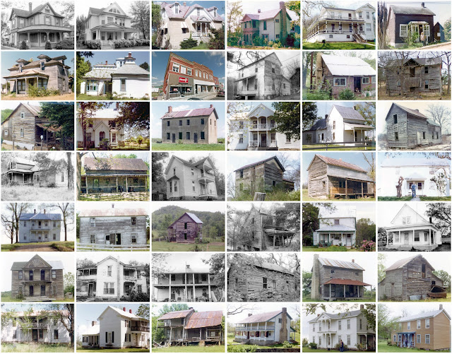
Miller County, Missouri
Founding: 1837
Parent counties: Cole, Pulaski, and unorganized territory
Namesake: John Miller, Missouri governor
Seat: Tuscumbia (1837–)
Seat: Tuscumbia (1837–)
Land area: 593 square miles
Population (2020): 24,722Population (historic): 2,282 (1840); 6,812 (1860); 9,805 (1880); 15,187 (1900); 16,728 (1930)
Periods of population growth: pre-1840–1860; 1870–1910; 1920s; 1950–2010
Subdivisions: Four cities; four villages; seven townships
Pre-1940 residences (estimated): 1,243 (9.6%)
Pre-1940 housing survival rate: 29.2%
Pre-1860 housing survival rate (1940): 1.7%
Pre-1940 housing survival rate: 29.2%
Pre-1860 housing survival rate (1940): 1.7%
Farm housing in disrepair (1950): 14.6%
Nonfarm housing in disrepair (1950): 9.5%
Average farmhouse value (1930): $780Average outbuilding value (1930): $541
Average farmhouse size (1940): 4.2 rooms
Number of farms (1920): 2,194
Average farm size (1920): 74.9 acres
Sources of settlement: Missouri, Kentucky, Ohio, Illinois, Virginia, Tennessee, Indiana, and Germany
_________________________________________________________________________________
Tuscumbia
Namesake: Perhaps Tuscumbia, Alabama
Founding: 1837 (founding); 1837 (post office); 1857 (incorporation)
Population (2020): 188
Population (historic): 77 (1860); 157 (1880); 225 (1900); 282 (1930)
Periods of population growth: pre-1860–1890; 1900s; 1920s; 1960s; 1990s
Pre-1940 residences (estimated): 19 (35.2%)
_________________________________________________________________________________
View and filter the data. Or see a map.
Pre-1940 residences (estimated): 19 (35.2%)
_________________________________________________________________________________
View and filter the data. Or see a map.
_________________________________________________________________________________

Comments
Post a Comment