Ray County, Missouri
Founding: 1821
Parent county: Howard
Namesake: John Ray, Missouri politician
Seat: Bluffton (1820–1828); Richmond (1828–)
Seat: Bluffton (1820–1828); Richmond (1828–)
Land area: 569 square miles
Population (2020): 23,158Population (historic): 2,657 (1830); 10,373 (1850); 18,700 (1870); 24,805 (1900); 19,846 (1930)
Periods of population growth: pre-1830–1900; 1950–2010
Subdivisions: Eight cities; three villages; one CDP; eight townships
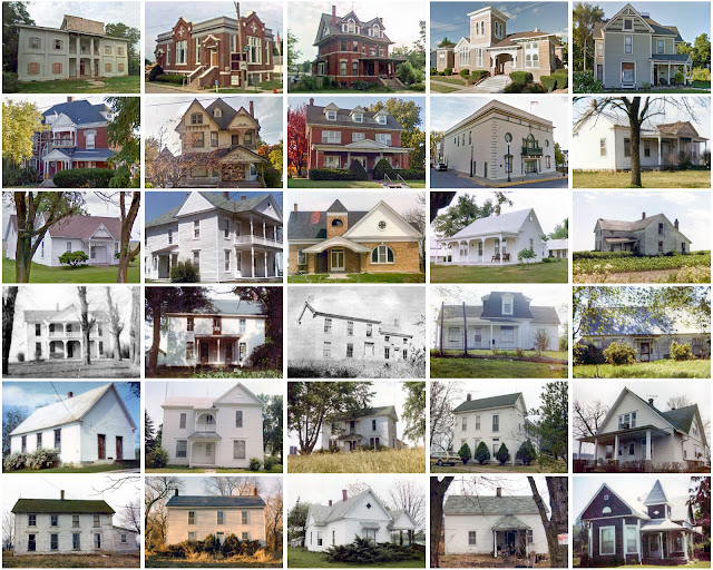
Pre-1940 residences (estimated): 1,319 (13.1%)
Pre-1940 housing survival rate: 31.8%
Pre-1860 housing survival rate (1940): 6.3%
Pre-1940 housing survival rate: 31.8%
Pre-1860 housing survival rate (1940): 6.3%
Farm housing in disrepair (1950): 12.2%
Nonfarm housing in disrepair (1950): 12.6%
Average farmhouse value (1930): $1,251Average outbuilding value (1930): $844
Average farmhouse size (1940): 4.7 rooms
Number of farms (1920): 2,541
Average farm size (1920): 104 acres
Sources of settlement: Virginia, Kentucky, and Tennessee
_________________________________________________________________________________
Richmond
Namesake: Richmond, Virginia
Founding: 1827 (platting); 1828 (post office)
Population (2020): 6,013
Population (historic): 615 (1860); 1,424 (1880); 3,478 (1900); 4,129 (1930)
Periods of population growth: pre-1860–1920; 1930–2000; 2010s
Pre-1940 residences (estimated): 334 (11.8%)
_________________________________________________________________________________
View and filter the data. Or see a map.

Pre-1940 residences (estimated): 334 (11.8%)
_________________________________________________________________________________
View and filter the data. Or see a map.
_________________________________________________________________________________


Comments
Post a Comment