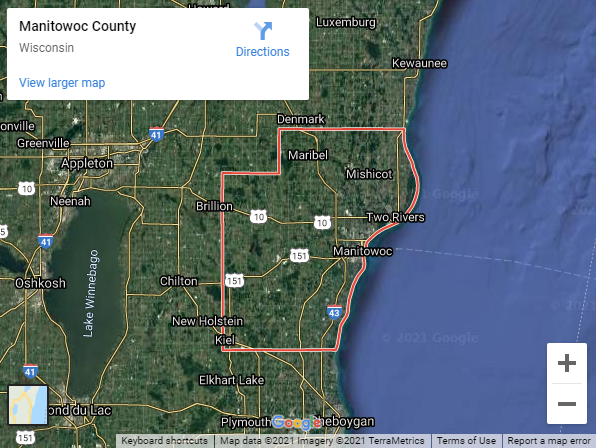
Manitowoc County, Wisconsin
Founding: 1848 (declared in 1836)
Parent county: Brown
Namesake: The Manitowoc River
Seat: Manitowoc (1848–)
Land area: 589 square miles
Population (historic): 3,702 (1850); 33,364 (1870); 37,831 (1890); 44,978 (1910); 58,674 (1930)
Pre-1940 housing survival rate: 70.4%
Pre-1860 housing survival rate (1940): 10.3%
Parent county: Brown
Namesake: The Manitowoc River
Seat: Manitowoc (1848–)
Land area: 589 square miles
Population (historic): 3,702 (1850); 33,364 (1870); 37,831 (1890); 44,978 (1910); 58,674 (1930)
Pre-1940 housing survival rate: 70.4%
Pre-1860 housing survival rate (1940): 10.3%
Farm housing in disrepair (1950): 3.9%
Average farmhouse value (1930): $2,563Average outbuilding value (1930): $3,011
Housing in poor condition (1940): 16.3%
Average farmhouse size (1940): 7.4 rooms
Number of farms (1920): 3,904
Average farm size (1920): 64.3 acres
Sources of settlement: Germany, Czechoslovakia, Sweden, and Ireland
_________________________________________________________________________________
Namesake: The Manitowoc River
Pre-1940 residences (estimated): 5,097 (31.7%)
_________________________________________________________________________________
Average farmhouse size (1940): 7.4 rooms
Number of farms (1920): 3,904
Average farm size (1920): 64.3 acres
Sources of settlement: Germany, Czechoslovakia, Sweden, and Ireland
_________________________________________________________________________________
Manitowoc
Pre-1940 residences (estimated): 5,097 (31.7%)
_________________________________________________________________________________


Comments
Post a Comment