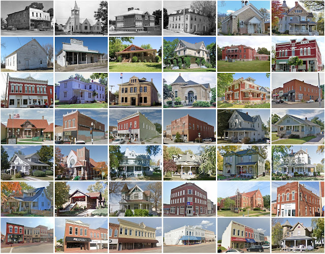
Miami County, Kansas
Founding: 1857 (declared in 1855)
Parent county: Unorganized territory
Namesake: The Miami people
Seat: Paola (1857–)
Land area: 576 square miles
Population (historic): 4,980 (1860); 17,802 (1880); 21,641 (1900); 21,243 (1930)
Pre-1940 housing survival rate: 42.3%
Pre-1860 housing survival rate (1940): 3.4%
Farm housing in disrepair (1950): 10.4%
Nonfarm housing in disrepair (1950): 7.4%
Average farmhouse value (1930): $1,169Average outbuilding value (1930): $1,036
Average farmhouse size (1940): 5.6 rooms
Number of farms (1920): 2,303
Average farm size (1920): 124.6 acres
Sources of settlement: Illinois, Ohio, Missouri, Indiana, Pennsylvania, and Kentucky
_________________________________________________________________________________
Namesake: Paola, Italy
Pre-1940 residences (estimated): 553 (21.9%)
_________________________________________________________________________________
Average farm size (1920): 124.6 acres
Sources of settlement: Illinois, Ohio, Missouri, Indiana, Pennsylvania, and Kentucky
_________________________________________________________________________________
Paola
Pre-1940 residences (estimated): 553 (21.9%)
_________________________________________________________________________________


Comments
Post a Comment