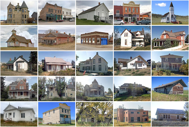
Meagher County, Montana
Founding: 1867
Parent counties: Chouteau and Gallatin
Namesake: Thomas Meagher, Montana territorial governor
Seat: Diamond City (1867–1879); White Sulphur Springs (1879–)
Land area: 2,392 square miles
Population (historic): 1,387 (1870); 4,749 (1890); 4,190 (1910); 2,272 (1930)
Pre-1940 housing survival rate: 52.8%
Farm housing in disrepair (1950): 4.1%
Nonfarm housing in disrepair (1950): 5.7%
Average farmhouse value (1930): $1,011Average outbuilding value (1930): $1,695
Average farmhouse size (1940): 4.6 rooms
Number of farms (1920): 447
Average farm size (1920): 306.1 acres
_________________________________________________________________________________
Namesake: Medicinal springs at the city site
Pre-1940 residences (estimated): 166 (29.9%)
_________________________________________________________________________________
Average farm size (1920): 306.1 acres
_________________________________________________________________________________
White Sulphur Springs
Pre-1940 residences (estimated): 166 (29.9%)
_________________________________________________________________________________

Comments
Post a Comment