Posts

Showing posts from August, 2023

Mitchell County, Kansas

Image
Founding:  1870 (declared in 1867) Parent county:  Unorganized territory Namesake:  William Mitchell, Kansas soldier Seat:  Beloit (1870–) Land area:  702 square miles Population (2020):  5,796 Population (historic):  485 (1870); 15,037 (1890); 14,089 (1910); 12,774 (1930) Periods of population growth:  1870–1890; 1970s Subdivisions:  Seven cities; 20 townships Pre-1940 residences (estimated):  1,168 (37.1%) Pre-1940 housing survival rate:  42.7% Farm housing in disrepair (1950):  12.1% Nonfarm housing in disrepair (1950):  7.9% Average farmhouse value (1930):  $1,186 Average outbuilding value (1930):  $986 Average farmhouse size (1940):  6.2 rooms Number of farms (1920):  1,822 Average farm size (1920):  191.5 acres Sources of settlement:  Iowa, Illinois, Ohio, Indiana, Pennsylvania, New York, Missouri, and Wisconsin ____________________________________________________________________________...

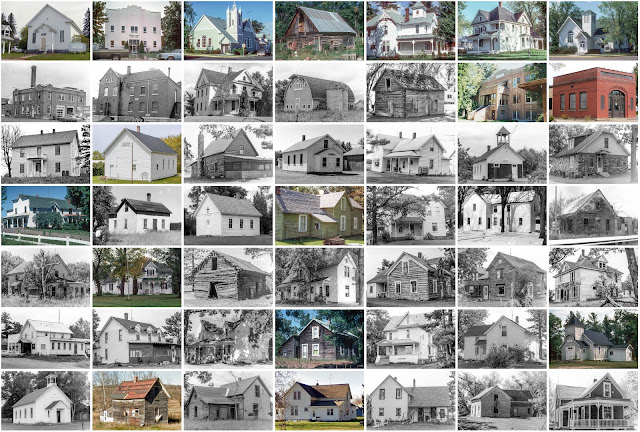
Osborne County, Kansas

Image
Founding:  1871 (declared in 1867) Parent county:  Unorganized territory Namesake:  Vincent Osborne, Kansas soldier Seat:  Osborne (1872–) Land area:  893 square miles Population (2020):  3,500 Population (historic):  12,517 (1880); 11,844 (1900); 11,568 (1930) Periods of population growth:  1870s; 1900s Subdivisions:  Five cities; 23 townships Pre-1940 residences (estimated):  38.9% Pre-1940 housing survival rate:  840 (40.7%) Farm housing in disrepair (1950):  11.6% Nonfarm housing in disrepair (1950):  1.9% Average farmhouse value (1930):  $1,157 Average outbuilding value (1930):  $955 Average farmhouse size (1940):  6.1 rooms Number of farms (1920):  1,781 Average farm size (1920):  206.2 acres Sources of settlement:  Iowa, Pennsylvania, Ohio, Illinois, Indiana, and Missouri _________________________________________________________________________________   Osborne   Namesake: ...

Burnett County, Wisconsin

Image
Founding:  1871 (declared in 1856) Parent counties:  Douglas and Polk Namesake:  Thomas Burnett, Wisconsin politician Seat:  Grantsburg (1871–1985); Meenon (1985–) Land area:  822 square miles Population (2020):  16,526 Population (historic):  706 (1870); 4,393 (1890); 9,026 (1910); 10,233 (1930) Periods of population growth:  1860–1920; 1930s; 1960–2000; 2010s Subdivisions:  Three villages; one CDP; 21 towns Pre-1940 residences (estimated):  1,505 (9.9%) Pre-1940 housing survival rate:  36.9% Farm housing in disrepair (1950):  14.6% Nonfarm housing in disrepair (1950):  9% Average farmhouse value (1930):  $1,078 Average outbuilding value (1930):  $1,034 Average farmhouse size (1940):  4.7 rooms Number of farms (1920):  1,872 Average farm size (1920):  42.5 acres Sources of settlement:  Sweden, Wisconsin, Minnesota, Norway, and Germany __________________________________________________________...

Sauk County, Wisconsin

Image
Founding:  1844 (declared in 1840) Parent counties:  Crawford, Dane, and Portage Namesake:  The Sauk people Seat:  Baraboo (1846–) Land area:  831 square miles Population (2020):  65,763 Population (historic):  4,371 (1850); 23,860 (1870); 30,575 (1890); 32,869 (1910); 32,030 (1930) Periods of population growth:  1840–1900; 1930–1950; 1960–2020 Subdivisions:  Three cities; 13 villages; one CDP; 22 towns Pre-1940 residences (estimated):  7,550 (24.3%) Pre-1940 housing survival rate:  66.7% Pre-1860 housing survival rate (1940):  8.8% Farm housing in disrepair (1950):  6.8% Average farmhouse value (1930):  $1,975 Average outbuilding value (1930):  $2,549 Average farmhouse size (1940):  7.2 rooms Number of farms (1920):  3,697 Average farm size (1920):  75.7 acres Sources of settlement:  Germany, New York, Switzerland, Ohio, Ireland, and England _______________________________...

Eau Claire County, Wisconsin

Image
Founding:  1856 Parent county:  Chippewa Namesake:  The Eau Claire River Seat:  Eau Claire (1856–) Land area:  638 square miles Population (2020):  105,710 Population (historic):  3,162 (1860); 19,993 (1880); 31,692 (1900); 41,087 (1930) Periods of population growth:  pre-1860–2020 Subdivisions:  Three cities; two villages; one CDP; 13 towns Pre-1940 residences (estimated):  6,485 (14.2%) Pre-1940 housing survival rate:  61.9% Pre-1860 housing survival rate (1940):  3.8% Farm housing in disrepair (1950):  10.1% Nonfarm housing in disrepair (1950):  4.6% Average farmhouse value (1930):  $1,619 Average outbuilding value (1930):  $1,794 Average farmhouse size (1940):  6.6 rooms Number of farms (1920):  2,368 Average farm size (1920):  82.1 acres Sources of settlement:  New York, Norway, Germany, and Canada __________________________________________________________________...
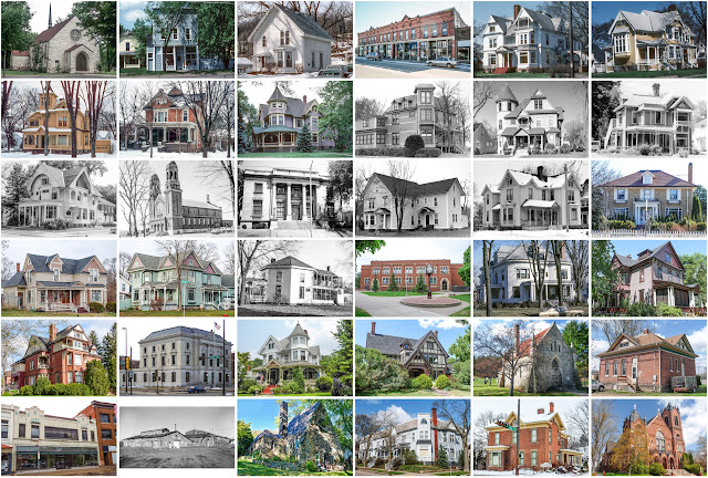
Teton County, Idaho

Image
Founding:  1915 Parent county:  Madison Namesake:  The Teton Range Seat:  Driggs (1915–) Land area:  449 square miles Population (2020):  11,630 Population (historic):  3,921 (1920); 3,573 (1930); 3,601 (1940) Periods of population growth:  pre-1920; 1930s; 1970–2020 Subdivisions:  Three cities Pre-1940 residences (estimated):  119 (2.1%) Pre-1940 housing survival rate:  35.7% Farm housing in disrepair (1950):  15.9% Nonfarm housing in disrepair (1950):  11.3% Average farmhouse value (1930):  $797 Average outbuilding value (1930):  $630 Average farmhouse size (1940):   Number of farms (1920):  541 Average farm size (1920):  155.9 acres _________________________________________________________________________________   Driggs   Namesake:  Benjamin and Don Driggs, founders of the city Founding:  1888 (platting); 1894 (post office); 1910 (incorporation) Population (2020):...

Custer County, Idaho

Image
Founding:  1881 Parent counties:  Alturas, Idaho, and Lemhi Namesake:  The General Custer Mine, which operated within the county Seat:  Challis (1881–) Land area:  4,921 square miles Population (2020):  4,275 Population (historic):  1,870 (1890); 3,001 (1910); 3,162 (1930) Periods of population growth:  pre-1890–1920; 1930s; 1970–2010 Subdivisions:  Five cities Pre-1940 residences (estimated):  230 (7.5%) Pre-1940 housing survival rate:  36.4% Farm housing in disrepair (1950):  17.3% Nonfarm housing in disrepair (1950):  20.1% Average farmhouse value (1930):  $1,152 Average outbuilding value (1930):  $746 Average farmhouse size (1940):  4.2 rooms Number of farms (1920):  379 Average farm size (1920):  130.5 acres _________________________________________________________________________________   Challis   Namesake:  Alvah Challis, platter Founding:  1876 (platting); 1878 (p...

Fond du Lac County, Wisconsin

Image
Founding:  1844 (declared in 1836) Parent county:  Brown Namesake:  The city of Fond du Lac Seat:  Fond du Lac (1844–) Land area:  720 square miles Population (2020):  104,154 Population (historic):  14,510 (1850); 46,273 (1870); 44,088 (1890); 51,610 (1910); 59,883 (1930) Periods of population growth:  1840–1880; 1890–2020 Subdivisions:  Two cities; nine villages; three CDPs; 21 towns Pre-1940 residences (estimated):  10,958 (23.9%) Pre-1940 housing survival rate:  68.7% Pre-1860 housing survival rate (1940):  9.2% Farm housing in disrepair (1950):  6.7% Nonfarm housing in disrepair (1950):  4.1% Average farmhouse value (1930):  $2,597 Average outbuilding value (1930):  $3,099 Average farmhouse size (1940):  7.7 rooms Number of farms (1920):  4,190 Average farm size (1920):  76.7 acres Sources of settlement:  Germany, New York, Ireland, Canada, and Holland ___________...